Both sides of Stone Maps Argument

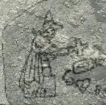
I was waiting for This reply. U can't see what's in front of u. The horse head is there from the eye down. The h/p map was made to see through it literally. The priest and horse are of one spot. I know u have seen me write about it before. Guess u don't retain what has been given as a gift. Listen more, u will learn more.
Hahaha! You are funny indeed!
 

I lost my 3D glasses.
Can lead a horse to water , can't make them drink.
Maybe one day U will see others have the real answers. U keep trying to manipulate them maps all u want..
It's simple. Just have to know what they wanted to show.

Good luck.
 

Can lead a horse to water , can't make them drink.
Maybe one day U will see others have the real answers. U keep trying to manipulate them maps all u want..
It's simple. Just have to know what they wanted to show.

Good luck.
It's Ok. Good luck to you too.
 

For those who are realy interested to learn how Spanish/Mexicans and Jesuits made their 2D maps.
First, what you see to looks like a canyon or a ravine in their maps, are just lines which follow a consecutive line of rocks and sometimes follow a round shape of a larger boulder. These lines run sometimes parallel with the canyons/ravines but not for a long distance and in the most cases can cross on the other side of the canyon/ravine. What shapes you will see in their maps , are shapes on the ground by following consecutive rocks or rocks formations, and in no any instance would be something which could be seen as a 3D formation.
Just to make something clear, the Horse landmark which I have posted in other threads, have nothing to do with the 2D Horse map from the stone tablet. Are close in the field but not the same. Anything which is depicted on all the stone maps, lines or figures, should be interpreted in a 2D view, and not in a 3D view.
An example is the Priest map which I will post below. Like you can see, every detail of the figure or of the other clues, follows a shape on the ground or a row of consecutive rocks. Even the contours of the tablet use the same concept. There is nothing wrong in the details on the ground which could malformate the original shape of the figure or of the other clues.

Just my two cents. Enjoy.
 

Attachments

  • Priest.png
    Priest.png
    317.1 KB · Views: 81
Last edited:
For those who are realy interested to learn how Spanish/Mexicans and Jesuits made their 2D maps.
First, what you see to looks like a canyon or a ravine in their maps, are just lines which follow a consecutive line of rocks and sometimes follow a round shape of a larger boulder. These lines run sometimes parallel with the canyons/ravines but not for a long distance and in the most cases can cross on the other side of the canyon/ravine. What shapes you will see in their maps , are shapes on the ground by following consecutive rocks or rocks formations, and in no any instance would be something which could be seen as a 3D formation.
Just to make something clear, the Horse landmark which I have posted in other threads, have nothing to do with the 2D Horse map from the stone tablet. Are close in the field but not the same. Anything which is depicted on all the stone maps, lines or figures, should be interpreted in a 2D view, and not in a 3D view.
An example is the Priest map which I will post below. Like you can see, every detail of the figure or of the other clues, follows a shape on the ground or a row of consecutive rocks. Even the contours of the tablet use the same concept. There is nothing wrong in the details on the ground which could malformate the original shape of the figure or of the other clues.

Just my two cents. Enjoy.
Smh. U will never learn.. Can't say I didn't try..
 

Sorry, just hate seeing people strayed away from the truth. Just cuz I won't share it all yet. Don't mean it wont come. One more trip.
I'm not staying away from the truth because I'm part of the truth.
 

Last edited:

Top Member Reactions

Users who are viewing this thread

Back
Top