Washington Chinese caches

Tuberale

Gold Member
May 12, 2010
5,775
3,447
Portland, Oregon
Detector(s) used
White's Coinmaster Pro
I haven't seen anything posted on this, so a word to the wise.

The book "Straw Hats, Sandals and Steel: The Chinese in Washington State", by Lorraine Barker Hildebrand, c. 1977, is a wealth of information on the Chinese experience in Washington. Included are several potential and probable caches.

I think I can quote a paragraph from the book without invoking copyright infringement. The following is from page 16, regarding an extensive Chinese camp near Peach, Washington, which was said to have 400-500 Chinese:

"A small party of Chinese camped across the river and when only two of the Chinese remained a group of whites outfitted themselves with cow's heads, rushed the camp, and when the Chinese fled in fright, they helped themselves to the proceeds of the miners. Another tale is told of the Chinese in Colville, suspected of arson, who was given a trial at a kangaroo court and sentenced to be hanged. While the rabble searched for a rope to accomplish the deed, a sympathetic justice of the peace sized up the situation and allowed the terrified Chinese to escape."

I could find no reference to a Peach, Washington. I did find a Peach Cemetery in Chelan County, Washington, which may be near the same community, but would like to hear more if someone knows.
 

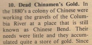
I Found this
for

STEVENS COUNTY

LastScande.jpg
 

Attachments

  • LastScan5t5.jpg
    LastScan5t5.jpg
    236.9 KB · Views: 637
Peach was located in the sandy bottom of the Columbia River at its confluence with Hawk Creek before Lake Roosevelt was filled. The Peach Post Office was established on February 11, 1898. Fruit production started around 1899 and in 1900 about 40 families, each with their own few acres, lived in the settlement. By 1917 about 300 people lived in the town, not an insignificant population by Lincoln County standards. Peach had a school, located on the banks of Hawk Creek, and orchards of peach, plum, apricot, pear, apple, and cherry trees.
Fruit grown in Peach was harvested by local residents and by residents of the nearby Spokane Indian Reservation. The fruit was packed in wooden crates made from lumber milled at the Emerson and Lantzy mills located about six miles upriver. The crates of fruit were then transported to Creston and from there shipped by rail to North Dakota, Nebraska, and Illinois. In years with good growing conditions, Peach growers shipped as many as 100 carloads of their products.
Peach businesses included a hotel, a grocery, and a feed store, along with a Methodist Pentecostal church and eventually a gas station.
The End of Peach
Crews of Work Projects Administration (WPA) and Civilian Conservation Crew (CCC) workers began the massive task of clearing what would become the giant bed of the reservoir, Franklin D. Roosevelt Lake. Clearing the Columbia basin for the reservoir was the nation's largest single WPA project, employing more than 2,000 people. Workers established temporary camps near the areas they were clearing, moving camp when the nearby area had been stripped of buildings and other construction, trees, stumps, and anything else that might float to the surface of the future lake.
The workers who cleared Peach were stationed at Camp Lincoln, the first of an eventual six WPA camps established. Peach was the lowest town to be displaced and the first cleared. By October 1938 this work was well underway.
The United States government paid Peach settlers $5,000 for each 20 acres of land they owned. Since managing orchards was highly labor intensive and since these were family farms, many residents owned far fewer than 20 acres. Once these settlements were made, Peach residents were instructed to vacate the area by January 1, 1939.
As in other towns preparing for inundation, some homes from Peach were likely moved to higher ground. Most were left standing, and were later burned down, as were the orchards. Bureau of Reclamation policy was to burn fruit trees as soon as residents had vacated an area, fearing that untended trees would become infested with insects and these infestations would spread to orchards outside the inundation footprint. Stumps from the burned orchards were blasted out with dynamite.
By July 1939, the town of Peach was no more. Perhaps your Chinese camp is also now under water.


Don.........
 

Seems likely Peach has been underwater for some time, as well as the Chinese camps nearby. Would still like to know sources, though.

Don, did your information come from one of the WPA books on Washington? I'm surprised you were able to find when Peach was begun and that it had a post office. Where did that information come from, though? The source might be an important resource for searching other sites in Washington as well.

In Oregon, one of the most important sources for researching ghost towns (places which had a post office and later lost them) is Lewis McArthur's "Oregon Geographical Names." Does Washington have a similar resource?

I especially enjoyed the newspaper clipping from Jeff. Similar to some of the data from Lucille Bowen's writings. Still need citation though. For newspapers older than 50 years, copyright is in the public domain, and anyone can cite them. Photos of clippings, especially from scrapbooks, are an interesting newer addition to research options. Helpful to have a citation still. Even when found in a scrapbook. Helps relocate those difficult to find sources later as well.

Oregon almost lost its historical society this last year because the state failed to provide funding for it. Another reason why citations are so important to preserving appropriate data.
 

Here is a website that pin points historic locations on Lake Roosevelt - that is, the Columbia River backed up behind Grand Coulee Dam.

Among many submerged Native villages, it also show the placement of Peach (Loc: P) and Chinese placer camps circa 1864 at the confluence of the Sanpoil and Columbia rivers (Loc F.)

http://www.bentler.us/eastern-washington/history/lake-roosevelt.aspx#!latitude=47.90161354142077&longitude=-118.51295471191406&zoom=11
 

Top Member Reactions

Users who are viewing this thread

Back
Top