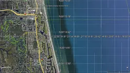
want a sea chart of the area of 31 degrees to 29 degrees and 12 / 16 miles out

Attachments

  • GE_map-ponte_vedra.jpg
    GE_map-ponte_vedra.jpg
    371.5 KB · Views: 53
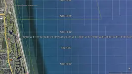
  • GE_map-ponte_vedra-B.jpg
    GE_map-ponte_vedra-B.jpg
    250.7 KB · Views: 64
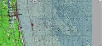
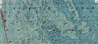
Topo pin in the water is more than 2 miles but less than 3 miles out.
 

Attachments

  • Topo_map-ponte_vedra_0.jpg
    Topo_map-ponte_vedra_0.jpg
    2 MB · Views: 58
Is this a great place or what? Where else can you pose a question like that and immediately get an answer?Good luck to all you treasure hunters,may you find your quest.
 

  • Like
Reactions: RTR
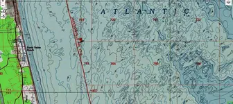
Same map centered a little better.
 

Attachments

  • Topo_map-ponte_vedra_1.jpg
    Topo_map-ponte_vedra_1.jpg
    1.7 MB · Views: 49
Putting pin right on left edge, moving beyond 3 miles from left to right.
 

Attachments

  • Topo_map-ponte_vedra_1B.jpg
    Topo_map-ponte_vedra_1B.jpg
    2 MB · Views: 60
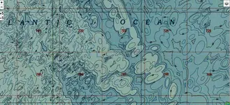
Moving east from map above, bottom right shows an underwater structure, top only 10 feet deep.
 

Attachments

  • Topo_map-ponte_vedra_1C.jpg
    Topo_map-ponte_vedra_1C.jpg
    1.9 MB · Views: 59
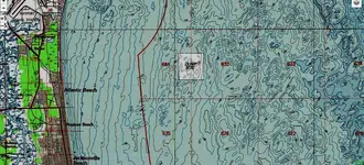
I found a dump site, just north a little on topo. Wonder what could have been dumped at the underwater site?
 

Dump site on topo.
 

Attachments

  • Topo_map-North-ponte_vedra_1dump-site.jpg
    Topo_map-North-ponte_vedra_1dump-site.jpg
    2 MB · Views: 58
Took time to calculate actual distance on topo pin, to be exact, 4 miles even off shore.
 

Took time to calculate actual distance on topo pin, to be exact, 4 miles even off shore.

I found a dump site, just north a little on topo. Wonder what could have been dumped at the underwater site?
Usually designated 'dump sites' are areas that have been used for dredge spoils (sand or mud) to clear inlets or channels. There are numerous areas off the various ports on the West Coast. Usually a distance offshore to not effect fisheries. Believe it or not the recently discovered containers of DDT off L.A. and in the past the radioactive containers off S.F. were dumped decades ago and not marked on charts as 'dump sites' even now.
 

Last edited:
'dump sites' are areas that have been used for dredge spoils (sand or mud) to clear inlets or channels.

In Florida, if from the right location, should translate to treasure.
 

Salvor6 do you still have a boat? Ivan Salis is right about the galleons.
 

Ya I have a boat. I' thinking about going there but it will have to wait until next spring.
 

Ya I have a boat. I' thinking about going there but it will have to wait until next spring.
Ok sounds good! Reason I asked, another shipwreck hunter asked me just the other day. I told them you probably still do have the boat.
 

I found a dump site, just north a little on topo. Wonder what could have been dumped at the underwater site?
Its everyplace...Alum.
I hear that, think it was Mo (?} testing the new Fisher pulse back in the good old days, "we could be in the aluminum recycling business."
 

Whay year of Spanish fleet are the wrecks of? Can't seem to find searching. One printed reference said 1714, probably was a miss-print.
 

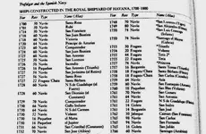
Spanish Royal Navy shipyard built new ships in 1714. I see, maybe was only 1 ship.
 

Attachments

  • Spanish-Navy_1.jpg
    Spanish-Navy_1.jpg
    598.9 KB · Views: 46

Top Member Reactions

Users who are viewing this thread

Back
Top