heavenly_light
Greenie
- Aug 24, 2007
- 15
- 0
- Detector(s) used
- None at this time. Looking to buy!
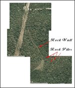
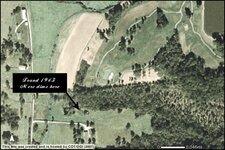
Using BuckleBoy's Advice, Tell me what you think..Images included in post.
Ok, Taking the following exerpt from BuckleBoy's advice:
"1. Research a Captain/General/etc. that had troops in your area. Read as many books as you can about him and his campaigns. If there are any books about the Civil War in your area, you should have already read those. Now...how to read them... When I read any book like this, it always takes me twice as long, because I take tons of notes. Now most books like this will not have much information about campsites, but you'll learn information about what they were doing in your area, and what they were there to guard or destroy".
History search from yesterday:
I found the following: Falmouth was HQ to the 18th Regiment which was tasked with guarding the L&N railroad from Coving to Lexington. A Skermish in Falmouth on 16 June 1863 left 5 dead and one prisoner. We also hosted site to the 40th Regiment infantery July 30 1863 under Colonel Clinton J. True This was a scouting unit and seen combat at Mt. Sterling. Also, the harrison county Home Guard was sent to Falmouth to protect it. Lastly in 1798 the french and indians attacked two stations (one less than a mile or two from my land) and then was forced to retreat in June 1780 know as Birds war road in Falmouth, Historical marker 937.
I wish to explore more in the history I wish to fine a map in the 1700's or 1800's which will show the Boone Trace, Skagg's Trace, and the Warriors Path or something with early trails and roads through the wilderness of south eastern kentucky.
Personal history we bought our land 100 acres in 1971. The land was used for cattle farming only due to most of it is on a slant from the hill / hills. Farmers which farm only cattle do not create rock piles. My search today to revisit old sites I visited and played at as a child, but with new visions in my eyes lead the following discoveries.
1. http://rockpiles.blogspot.com/2006_06_11_archive.html
"Rock piles would be used for the following"
-Field clearing
- Staging areas for selling rock
- Memorials (to the dead or to events)
- Burial mounds
- Trail markers
- Vision quests locations
- Blessing of water (at a spring)
- Archeo-astronomy position markers
- Shadow making piles (like "light daggers")
- Effigies
- Piles which seem to be designed to channel "energy"
"In the Northeast, as I mentioned earlier, farmers simply dumped unwanted stone at the edges of fields and didn't bother to carefully stack them. This was the usual practice, but there may be the occasional exception.Farmers simply had too much to do to bother with careful stacking, which took time away from more important work.
If one studies the context of the site, farmer piles are never found on top of the ridge but low on the hillside".
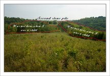
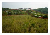
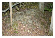
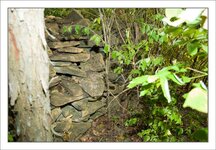
All of these piles are on the ridge and on the hill side not at the bottome or lower part of the hill.
"Historic rock fence" means any drylaid stone fence or wall at least fifty (50) years old that was originally constructed from natural stones and without mortar".
"Meridian: Established February 14, 1855, with Heber Shoemaker as postmaster. This station was about one mile south of Butler, and at the heel of the “Horse shoe Bend” of the Main Licking River. On March 24, 1860, the name was changed to Boston Station, and the office was moved about one mile further south, to the present site of the village of Boston Station, on Harris Creek and the Main Licking. It’s also the location of one of Pendleton County’s largest manufacturing industries, the Licking River Lumber and mining Company, owned by residents of Boston, Massachuset"
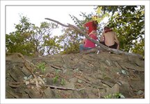
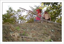
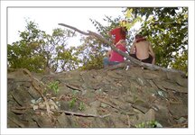
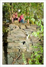
This station is about a mile or so away from my land. From the advantage point when standing on the rock piles when I was a child I could see for miles in all directions. If you notice in the images most of the trees are small, hence new and would not be present during the time of the civil war or later.
Lastly, this is going very quickly and may seem like rambeling but, I have come to the following facts.
1. My luck, these are nothing but, a rogue farmer who spend thousands of hours moving rocks, etc... Area is void of anything.
2. Could be something but, will be void of anything.
3. Best wish, This is a scout post, sentry area, marker, or a traveled area and will have items of historical value to be found.
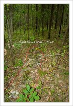
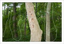
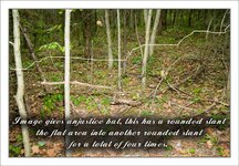
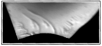
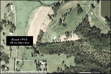
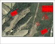
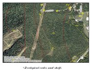
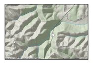
Here are the images I took. This is spread over about a mile from the north side to ridge and ridge to the east side of our hill.
Let me know if you think I could continue or am I just waisting my time due to your personal experiences and encounters with things like these.
Amazon Forum Fav 👍
Attachments
-
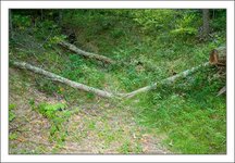 earth-depression.jpg78.8 KB · Views: 339
 -
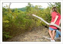 Rock-Pile-view-point.jpg67.1 KB · Views: 343
 -
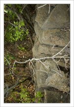 rock-wall-vertical-face.jpg59.1 KB · Views: 330
 -
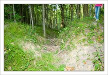 Earth-v-cutout.jpg77.5 KB · Views: 345
 -
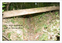 V-shape-earth-depression-back-side-view.jpg71.5 KB · Views: 341
 -
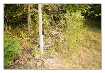 Stone-wall.jpg78.6 KB · Views: 347
 -
 Rock-Pile-1.jpg72.1 KB · Views: 334
 -
 Rock-pile-3.jpg67.1 KB · Views: 342
 -
 Rock-Pile-rear-view.jpg65.6 KB · Views: 343
 -
 Rock-Pile-size.jpg73.2 KB · Views: 339
 -
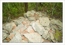 Third-Rock-Pile.jpg65.1 KB · Views: 333
 -
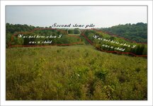 second-stone-pile-facing-south-on-ridge.jpg51.8 KB · Views: 338


