Treasure Marks/Signs - Diagnosed Here

Thank you for your input. I have researched, and yes he was in the area around when this item was placed. As far as your speculation that it came from a barn or something, 1. They did not, even back then, build structures in the flood plains of the Connecticut river, 2. Thirteen inch spikes were not used as fasteners to make barns or any other building for that matter 300+ years ago, 3. The spike is bent exactly the way they were used in shipbuilding at the time... Banged in, bent at a 90 degree angle, then the tip bent in.. embedding it in the timber, 4. There was no settlement or shipbuilding ventures in that particular area at the time, 5. This area was accessible from the river only
at the time which is a proven/given fact, and with very adequate room to beach boats and hide out for an extended amount of time, as in a vigil waiting for directions.

Anyways, there are remains so I have a separate issue to contend with.
 

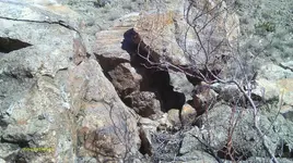
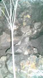
IMAG1076 (2).JPGIMAG0266.JPG
THIS DEATH TRAP SYMBOL USED RESEMBLES THE SHAPE OF THE BASE BALANCE STONE USED TO SUPPORT A DOWNFALL BOULDER DEATH-TRAP, USED BY THE SPANIARD'S.

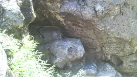
SPEAKING HYPOTHETICALLY: IMAG1076, CARVED ON THE ROCK FACE, ON THE LEFT-SIDE OF PHOTO, IS A ''DEATH TRAP WARNING SYMBOL''. -- IMAG0266, ACTUAL DEATH TRAP, DOWNFALL BOULDERS, SUPPORTED ON A CUT BALANCE STONE, IT HAS A WIDENED ''V'' SHAPE WHICH REPRESENTS THE TIP OF A HEART CUT OFF. {THE SPANIARD'S USE THIS SHAPE ON CUT MARKER STONES AND CARVINGS TO DENOTE A DEATH-TRAP WARNING}. --- YOUR PHOTO IMAG166 WITH THE MONUMENT BOULDERS. THE TOP OF THE SHADOWED TRIANGLE SHAPED BOULDER HAS THE SAME SHAPE AS THE DEATH-TRAP SYMBOL USED BY THE SPANISH. THE BOULDER IN FRONT HAS A MOUNTAIN LION FACE-PROFILE POINTING RIGHT WITH IT'S EAR'S MISSING TO DISGUISE IT.

THERE IS A SMALL ROCK MARKER ON IT'S HEAD. THESE MONUMENTS MAYBE, '' DEATH-TRAP WARNING MONUMENTS? -- THE STONE ON THE MOUNTAIN LION'S HEAD MAY REPRESENT, '' LOOK FOR A DEATH-TRAP BOULDER FROM ABOVE? --- THESE MONUMENTS MAYBE NEAR AN EXPOSED MINE/TUNNEL ENTRANCE AND VERY DANGEROUS IF BOOBY-TRAPPED. -- LOOK FOR THE HIDDEN COVERED ENTRANCE. THE MINES USUALLY HAD MANY ENTRANCES. THEY WOULD FOLLOW A VEIN AND TUNNEL OUT ALONG IT WITH ENTRANCE OUTLETS. THESE ENTRANCE OUTLETS WOULD HELP CIRCULATE AIR VENTILATION IN THE MINE. THESE EXTRA OUTLET MINE ENTRANCES, ALSO ALLOWED A MEANS OF ESCAPE, IN CASE OF A '' CAVE-IN ''.

THE KING'S FILES ---------- THE TRUTH IS OUT THERE
 

Last edited:
Trailrider:
Where did you find info that says a sloped stone with 30 degree angled sides is a sign for a death trap. I've read you posts concerning spread "V"s and these stones with 30 degree angles being the sign for DTs and did some review of my files and have not found any mention of this. Where did you find the researched info that establishes this as fact?
HEY Shortstack, hope things are going well for you. About the widened '' V '', I call a death-trap symbol. When I am speaking hypothetically, it means that everything I write about is a supposition, relating to an hypothesis. A theory assumed to account for which is not understood. I never claim anything to be fact. Any theories I claim can only be proven or not proven out there on the old Spanish trail. -- I first read about this 'death-trap' symbol here in treasurenet and took notes. This death-trap sign was described as a pointer with sloped shoulders is typical of this sign. The back in most cases is straight, but in one of these it has been shaped to be a heart as well.

When I state that the sloped shoulders are 30 degrees, it is an observation, using a general description of the approximate angle, not exact. This symbol may mean ''the bottom tip of a heart cut off''.
 

Last edited:
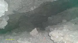
IMAG1409.JPG IMAG0233.JPG SNAKE-HEAD, DEATH-TRAP WARNING BOULDER {IMAGE0233}. ALSO FOUND MANY OTHER DEATH-TRAP SYMBOLS AT THIS SITE. -- IMAG1409, THE POINTED BOULDER ITSELF {CENTER OF PICTURE} IS THE DEATH-TRAP SYMBOL, WITH SLOPED SHOULDERS {THE POINT OF A HEART CUT OFF} IT'S A CUT AND SHAPED BOULDER. --- THE CUT LIGHTNING BOLT ON THE LEFT SLOPED SHOULDER OF THIS POINTED BOULDER IS A CONFORMATION THAT THIS INDEED IS A DEATH-TRAP WARNING. -- FOLLOW THE DIRECTION THE POINTER ON THE BOULDER IS POINTING TO ON THE CEILING, AND NOTICE { A CUT 90 DEGREE NOTCH }. IF ANY 90 DEGREE NOTCHES ARE FOUND BY THE DIFFERENT DEATH-TRAP SYMBOLS IN A MINE/TUNNEL; MEANS LOOK FOR DEATH-TRAP NEAR-BY. -- [PRAY THAT GOD WILL GIVE YOU AWARENESS OF ANY DEATH-TRAPS THAT YOU MAY ENCOUNTER] THE MINES ARE VERY DANGEROUS, ONE ENTERS AT THERE OWN RISK

THE KING'S FILES ---------- THE TRUTH IS OUT THERE
 

Last edited:
Trailrider:
The Spanish were working with very specific rules and directives from the King and would not deviate from them. Three dimensional pyramids were used sometimes to give distance and direction info. A pointed support stone for a "crusher" boulder was a way to insure that the killer rock could easily come down when the trigger mechanisms were tripped.

"V" shaped notches were used as verification marks that some very close markings / symbols were, in fact, man made and not entirely natural. Those notches could be done on the bottom faces of a table rock, at it's edge or on the top edge of a standing flat rock. They are also carved on the face of rocks and boulders; especially on a carved face monument. When carved on a face monument, the "V" would point to the most dominant indicator of which direction to go for finding the next trail marker / monument. Example: If there's a carved dog's head facing a particular direction with some part of the carving pointing to a slightly DIFFERENT direction, a "V" would be used to tell whether to follow the direction the dog is facing ( it's eye or snout) or the part that pointed in a slightly different heading. If the eyes were carved true to form in relation to the snout, and one of the eyes was looking in the true direction, a "V" would be put on that eye and usually pointed slightly upward to avoid confusion as to what it meant.

The DT signs that Kenworth showed in his book were the only ones approved by the King. He wrote that the later Mexican expeditions use the same codes, generally speaking, but did have some of their own codes incorporated. Each Mexican group represented some cartel or hascenda(sp) and closed guarded their own codes and code modifications. Did some of those groups use a pyramid as a DT warning sign?? It is possible, but not probable since that type monument was for distance and direction.

These are just my observations and I'm certainly NO authority on the matter. I just take good notes on proven findings. LOL
 

Would someone Please give the meaning of an " H " found at a site.

Carved Symbols, The Capital Letter "H"

The more you hunt for treasure caches the more carvings you are bound to run into. The more carvings you run into the more you will find different interpretations for the same symbol. This article is about a symbol I have run across on several occasions and each time it has meant something a little different. This is because different individuals/groups were responsible for making the carvings and each used the carving as they interpreted it. They didn’t have a book they carried around that said, “this symbol means this”.

The symbol I am referring to is the capital letter H. Take notice that I said the CAPITAL letter H. The capital letter H and the lower case h can, and generally do, mean something different. In the case of the capital H, I have found it to mean a “tunnel”, a “hill”, the “hole”(and not because of the H, I will explain this later), to look up or “high” and it has been used as a reference for a starting point with no actual meaning other than find the H and start there.

One capital H I came across was used twice in the same trail and had two different meanings. This particular H is carved on a large boulder and the boulder sits in the bottom of a small valley directly below a sandstone bluff about 40 feet above the boulder. In the first use of the H it told me “high” or look up. When I did I saw the bluff and in climbing up to the bluff (a real pain in the butt) I found a carved map. This was a fairly simple interpretation but it was a correct interpretation.

The second time this H was used was in the map itself. About half way through the carved map a capital H showed up and had I been just a little smarter at the time I may have skipped the first half of the map and gone directly to the H because the first half of the map took me all over the valley floor just to bring me back to the H carved on the boulder where I started. You can imagine that at this point I was really cussing the outlaw that made this map! So the second time the H was used was as a marker in the map itself. In the second instance the H didn’t mean anything other than “at the H”.

I have also found that the capital H can mean “hole”, but only in certain instances. In the one situation where I found the H to mean a hole the H wasn’t really an H but intended give you the impression it was an H. Are you confused yet? Yea, me too! This H, I have included a photo for you to see, looks like it had been weathered enough to change part of the letter. At least that was my first thought but I later realized this was a mistake. If you look at this carving closely you will see that the top half of the H looks like a squared off U. This squared off U is a sign I have seen several times and means “hole”. This is simply a picture of a hole in the ground. In this case, the carver was trying to camouflage the symbol by making it look like an H.
.
 

Tree Blaze???

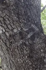
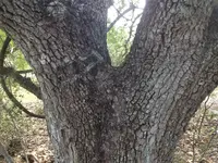
Found this mark on a large oak tree. Looks old and man made... Any ideas what it means. There is also an arrow formation of large rocks on the property, about 1000 yards away, pointing towards the tree, but too over grown to get a picture. Ranch owner says legend of gold cache buried between two trees...

tree marks 2.PNGTree Marks 1.JPG
 

Can you point me to the reference material you used to come to this conclusion please? Honestly curious.


There have been several posts on this subject in the past on this forum. You'll need to search the threads / posts of this section. I could take a while for you to do that, since you are not a Charter Member (neither am I) with the ability to use the forum's search engine.

Another source I have is a book titled, The Spanish Code to Treasure, by L.J. Layton.

Basically, you measure all 6 sides of a pyramid and add those values. That figure will give you the number of varas to travel. The direction is given by the angle on the base that points to a cardinal point on a compass. Only one of the corners will do that.......the other 2 will lnot. Just like decoding a triangle except with triangles, the distance may be in varas OR feet......depending on how the triangle is located. Also, that would be SPANISH feet. When using feet or inches; you must convert to SPANISH feet or inches NOT western.
 

Hello all. Hey SS I done an amazon search for the book you mentioned by L.J. layton. It turned up no known book. could you tell a little bit more about the book and where I might get a copy. Thank you very much Pinwheel.
 

Hello all. Hey SS I done an amazon search for the book you mentioned by L.J. layton. It turned up no known book. could you tell a little bit more about the book and where I might get a copy. Thank you very much Pinwheel.

I have PMed you the info. Good luck in your searches.
 

Again thank you for the replys and for (saving my ass). Here is an example of a double death tap for everyone. There are about four traps (that i can see) surrounding the mine this is where the alpha map has lead me. it looks like there there s only one way to safely get into the mine. I have also noticed that there s a path marked by shadows and one by the sun {Blaze} The shadow path you can see with google earth. and the blaze you see through out the day. but t is not a constant trail. it jumps all over the place. I have one picture that was taken on the solstice and that one is constant, but hardly any of my pictures are clear enough to read the trail i only have bits and pieces. my camera was getting over exposure it almost looks like i was standing in the middle of an aurora borealous. its seems like there are three treasure room sites in this one area of about 300 square yards, two mines are right next to each other and the third is across the stream. Have you guys heard of such a thing and why would they do three. ive been able to find the covered mines and how they sealed them. I assume that the winter solstice would give me the next constant trail. Also the shadow trail shows you where all the death traps are. has anyone seen them mark DT like that. its actually quit amusing to see.
 

Sancho.
You wonder about the diggings on both sides of the river / creek. A major vein running more or less perpendicular to the run of the waterway. If the Spanish (or anyother group) found this spot they would mint in both directions. The second mine on one side would most likely be a branch vein. That is a very good example of how gold dust and nuggets get into flowing water ways and is spread down stream. Spot prospecting along the waterway or canyon is the way prospectors search for the "mother" vein. If you were to find a pocket of nuggets / dust down stream from this location, it could put some very good coin into your search fund. It would be a good way to finance the equipment you might need for entering any mines and / or cache rooms in that area.

Just a thought. Best of luck to you. :icon_thumleft: You have a project site that would be the envy of all THers on the trails. Be frugal with the information you post on the web and speak of in public. Go into some form of "security mode".
 

Last edited:

Top Member Reactions

Users who are viewing this thread

Latest Discussions

Back
Top