Treasure Marks/Signs - Diagnosed Here

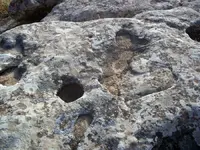
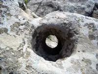
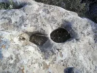
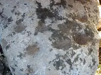
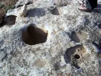
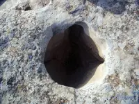
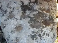
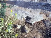
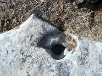
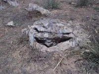
Welcome Abdullah, Good drill hole and thank you for sharing it with us post # 642 seems to be 10 CM across-- 10 CM deep = 2 ( if it is 20 CM deep then the multiplier is 3 CM if its 20 CM wide and 10 CM deep then its 2 X if theres a shoulder 1/2 way down then its 2.5 ) X circumference of the hole which is 35.5 CM and the answer is 69 vara ( 1 vara = 32 inches ) or approx 189 feet. The direction of travel should be indicated by the horzional V that has the small stone in its mouth. The 1 inch across drill hole looks to be a mooring hole, it could mean measure by the foot also it depends on how deep its drilled, I sure would be interested in seeing what a clean bottom would reveal. The busted out ( 1/2 drill hole ) could mean 1/2 , distance, measure very careful and use a probe to see if something is concealed under the ground, if used with a full drill hole it may be 1-1/2 distance, not science just common sense. Most always the V = 22X10 or 220 CM deep and all that I have seen also will indicate the direction of travel
 

rangler wrote
something about elephants :tongue3:
 

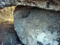
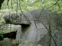
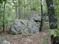
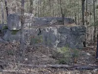
some more pics from this place...

Abdullah
 

Attachments

  • 100_1370new.jpg
    100_1370new.jpg
    159.1 KB · Views: 702
  • 100_1353new.jpg
    100_1353new.jpg
    127.8 KB · Views: 856
  • 100_1358new.jpg
    100_1358new.jpg
    144.3 KB · Views: 501
  • 100_1361new.jpg
    100_1361new.jpg
    156 KB · Views: 474
dsty,
wow, that really sounds like science to me. How did you learn that ?
Did you see the huge holes ? Do I have to measure them the same way, or do they have another meaning ?
I think I need to print out everything you all wrote here in this forum before I go there again. Can´t keep everything in my mind.... :D

That´s a great forum !

Abdullah
 

Attachments

  • 100_1358new.jpg
    100_1358new.jpg
    144.3 KB · Views: 505
  • 100_1358new.jpg
    100_1358new.jpg
    144.3 KB · Views: 488
  • 100_1357new.jpg
    100_1357new.jpg
    120.1 KB · Views: 487
  • 100_1378new.jpg
    100_1378new.jpg
    153.4 KB · Views: 509
  • 100_1377new.jpg
    100_1377new.jpg
    136 KB · Views: 579
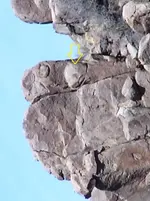
That one looks like an eye. Does anyone know what that means ?

Abdullah
 

Attachments

  • 100_1383eye.jpg
    100_1383eye.jpg
    153.3 KB · Views: 567
  • 100_1381.jpg
    100_1381.jpg
    146.6 KB · Views: 512
depends on what kind of eye I guess
 

Kanabite:
Those last two photos are very interesting. There is some stuff that is naturally formed, but there are a couple of things that HAVE to be man made..........or man ADJUSTED. LOL That huge figure you emphasised could be natural BUT I don't believe those sharp pointed feather tips are natural. They look like they might be the leavings of some Ancient group.

Edit: For the record, I wrote this comment BEFORE you posted the pics again with your mark ups. Hey, be careful; there's a lurker around who doesn't like other peoples' markups.
 

Here are a few pictures I took earlier. The bird looking rock looks lsimilar to the one borderland posted earlier.
-Weekender
 

Attachments

  • PICT1853.JPG
    PICT1853.JPG
    101.7 KB · Views: 471
  • PICT2549.JPG
    PICT2549.JPG
    159.1 KB · Views: 485
  • PICT24911024x768.jpg
    PICT24911024x768.jpg
    137.5 KB · Views: 476
  • pict24751024x768.jpg
    pict24751024x768.jpg
    233.2 KB · Views: 563
there also looks like the letter a by the eye a close up shot would help to
see if there is more there the shadow of the beak looks like maybe a 5
 

Hello Abdullah, the larger drill holes are just longer distances 16" wide X 4" deep or for the answer it should be 4 X 189 feet = 776 feet, there may be other meanings because of the possible other carvings that would change the meaning, the two that I have seen that's drilled thru the rock have the same meaning measure to the bottom of the holes and those that are on an angle seem to indicate mooring holes, they can be 1/4 inch to 8 inches or possibly more. The drill holes in my estimation are from the Viking influence, there are trails across hundreds of in miles in America, and they left information in some of the spots as indicated
 

Ground0 said:
Abdullah said:
That one looks like an eye. Does anyone know what that means ?

Abdullah

Did you notice the little arrow above the "eye" pointing at it ?


Yes, I noticed it. Thanks for your attention :thumbsup:


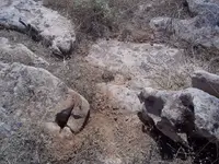
Went there today and searched for other interesting marks on the other side of the dry river. I´ll try to make a map, because there are really too much marks at that small place. It looks like an unsolvable puzzle ! ...
 

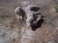
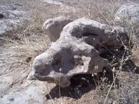
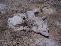
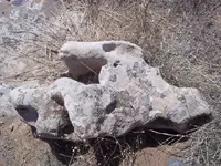
...I found some "strange" looking stones today. For me the first one looks like a dog lying on the side. The second reminds me of a frog with his tongue out :D


dsty:
Thank you for the explanation.


Abdullah
 

Attachments

  • resized_resized_100_1430.jpg
    resized_resized_100_1430.jpg
    120 KB · Views: 440
  • resized_resized_100_1431.jpg
    resized_resized_100_1431.jpg
    128.3 KB · Views: 424
  • resized_resized_100_1429.jpg
    resized_resized_100_1429.jpg
    120.1 KB · Views: 416
  • resized_resized_100_1432.jpg
    resized_resized_100_1432.jpg
    142.4 KB · Views: 410
  • resized_resized_100_1433.jpg
    resized_resized_100_1433.jpg
    138.6 KB · Views: 422
  • resized_resized_100_1409.jpg
    resized_resized_100_1409.jpg
    136.2 KB · Views: 440
What in the world is THIS guy looking at??

P1010323.JPG
 

Shortstack said:
What in the world is THIS guy looking at??

I can´t say what he´s looking at, but "the guy" looks like this :o ;D

Abdullah
 

dog said:
.....i also found a old tobacco tin hidden in the rocks at the triangle marker,i couldnt belive it.i was wondering what was inside,i was hoping gold.it felt heavy when i lifted it.but when i opended it i found a foled up piece of paper the started to fall apart so i left it foled for now,....

dog, what you've found is a mining claim location monument with a copy of the location certificate in a Prince Albert (or another brand) tobacco tin. This method (tobacco tin) was a common method used from about the 1920's to about 1960's, more or less. More modern prospectors use other containers - pill bottles, etc, to hold the papers. In NM, the location monument is frequently found at an 'end-center', that is, at the midpoint of a 600 foot line with corner monuments on the end points. From there, you will find the other two corners 1500 feet from the two corners - this makes a mining claim 600' x 1500'. The four corners may be stone monuments, or they may be 4'-high posts - wooden 4x4's were often used during the tobacco tin days. If you're real diligent, or if you care, you could probably track down the claim at the county courthouse. Too bad the papers disintegrated - they would have told you everything you wanted to know about the claim. Good find.
 

dog said:
thanks for the info springfield, and your time. iam going to put it back where i found it when i head back to the area.maybe with a new note with the date i found it.iam not going to try and unfold the paper now.i have only been out west now for four months.i haved lived all my life back east in pa. and wv.these is all new to me.i use to coin shoot old foundations back east.but dont see many here.so my new hobby is to look for spanish and indian signs.not that i even know what the look like.lol. but iam trying to learn.green as can be.thanks agian for the info. good luck all in your seaches. dog.

Keep your eyes open dog - there's lots to find out there. Look's like you've got a good start.
 

Top Member Reactions

Users who are viewing this thread

Back
Top