gjb
Sr. Member
- Apr 21, 2016
- 281
- 333
- Detector(s) used
- Garrett Ace 300i
Garrett EuroAce
- Primary Interest:
- All Treasure Hunting
I’m obviously going out on a limb here, as there will be some people who just ‘know’ what I’m suggesting isn’t so, but it could be that the roadway is not only original to the undertaking but also a clue to the overall intent.
I suggest that the roadway runs at 30 degrees south of the magnetic compass east-west bearing operating at the time, that is, it bears at az. 107 degrees. The angle of magnetic variation would be that angle represented by two-fifths the tangent of 30 degrees - that is, 13 degrees. The clue to this was left in the form of the tilt of the Welling Triangle (one-fifth the tangent) and in the angle of the Pirate Stones Triangle (three-fifths the tangent).
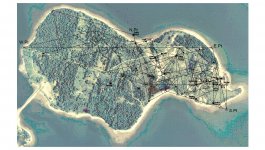
Taking the nature and the placing of all the ground markers as clues enables a potential original ground plan to be revealed, and the Money Pit is clearly not the focal point of the operation.

In this reconstruction, the unit of measure throughout is the British rod of 16.5 feet (each of 25 links). The line following the roadway is 250 rods, and the distance between the Money Pit and the Sump Hole at Smith’s Cove is 30 rods. All the angles bear on 30 degrees.
Go ahead, trash it or ignore it - that’s what Dan Blankenship and David Tobias did, Fred Nolan simply refused to look, and it’s one reason why Rick and Marty are off chasing Templars! Solving the mystery depends much on the frame of mind of the owners, and the brothers seem to be losing their way.
The originator went to a great deal of trouble to leave clues for someone to follow and thereby expose the intent of the enterprise. Instead of using these clues and aids to discovery, the owners tend to move and destroy them, or choose to ignore them.
It just goes to show that if we don’t like the look of a potential truth then we simply blank it out. We certainly wouldn't want to test it!
I suggest that the roadway runs at 30 degrees south of the magnetic compass east-west bearing operating at the time, that is, it bears at az. 107 degrees. The angle of magnetic variation would be that angle represented by two-fifths the tangent of 30 degrees - that is, 13 degrees. The clue to this was left in the form of the tilt of the Welling Triangle (one-fifth the tangent) and in the angle of the Pirate Stones Triangle (three-fifths the tangent).
Taking the nature and the placing of all the ground markers as clues enables a potential original ground plan to be revealed, and the Money Pit is clearly not the focal point of the operation.

In this reconstruction, the unit of measure throughout is the British rod of 16.5 feet (each of 25 links). The line following the roadway is 250 rods, and the distance between the Money Pit and the Sump Hole at Smith’s Cove is 30 rods. All the angles bear on 30 degrees.
Go ahead, trash it or ignore it - that’s what Dan Blankenship and David Tobias did, Fred Nolan simply refused to look, and it’s one reason why Rick and Marty are off chasing Templars! Solving the mystery depends much on the frame of mind of the owners, and the brothers seem to be losing their way.
The originator went to a great deal of trouble to leave clues for someone to follow and thereby expose the intent of the enterprise. Instead of using these clues and aids to discovery, the owners tend to move and destroy them, or choose to ignore them.
It just goes to show that if we don’t like the look of a potential truth then we simply blank it out. We certainly wouldn't want to test it!


