Swift Silver??

The Indians captured Jenny Wiley in Walkers Gap and traveled along the Tug ,so they used a Indian /buffalo trail to travel. In my thinking it would have possibly been a route Swift could have used on his travels into the Big Sandy area. Or he could have used a better known trail like Route 60 which would have been a closer route from Alexandria .
 

No connection between Swift and Jenny Wiley, she was taken in 1789 ( 20 years later than Swifts last travel to the mines) and there is no mention by her of any white people while with those Indians.
 

No connection between Swift and Jenny Wiley, she was taken in 1789 ( 20 years later than Swifts last travel to the mines) and there is no mention by her of any white people while with those Indians.

No mention BUT there must have been an Indian/ buffalo trail through the areas for the Indians to have been able to find their way through the area. There are places in this country you can go around a high knob till you wear a well worn path , and all you're doing is going around in circles.
 

The Indians captured Jenny Wiley in Walkers Gap and traveled along the Tug ,so they used a Indian /buffalo trail to travel. In my thinking it would have possibly been a route Swift could have used on his travels into the Big Sandy area. Or he could have used a better known trail like Route 60 which would have been a closer route from Alexandria .
Around here in Virginia (Amherst County), Rt. 60 is known as BUFFALO ROAD!
 

The Indians captured Jenny Wiley in Walkers Gap and traveled along the Tug ,so they used a Indian /buffalo trail to travel. In my thinking it would have possibly been a route Swift could have used on his travels into the Big Sandy area. Or he could have used a better known trail like Route 60 which would have been a closer route from Alexandria .

I have walked all over those trails. I know where most of them run. At one time I was going to map them but the four wheeler's made trails before I could map them. They are just about all gone now. I do remember where they ran though. Most ran along the top of the mountain ridges and would come off at gaps to cross streams and rivers then go back up to the top of another mountain ridge. I have been on the trail near Walker's Gap near Burke's Garden near Richlands and Tazewell Virginia. From there it ran along the Appalachian Mtns. onto the headwaters of the Big Sandy River. Went within a mile of a two room log house where I was born. I have walked those trails all day long from before sunrise until way after sunset. All along State Line Ridge between Virginia and West Virginia. Got lost there lots of times. Great country and I have covered over 50 mile radius or about 15,000 square miles of those woods. I have all of the area covered shaded in on a topomap. I have an Indian Arrowhead made from White Quartz and sharp as a needle. I found it at one of the ten or twelve creek crossings at the head of Little Slate Creek that empties into the Tug River. I have also been all over several areas of the Tug Fork River.
 

Last edited:
There is bound to be some Indian pointer trees still along those traces.

There is many of the old trail markers still around and much more if ya think outside the box. All kinds of stuff off the beaten path . There is more out there than will ever be discovered or found. Ya just have to keep looking and learning. No one knows how much stuff there is out there to be found, for that reason it will all never be found. There are markers covered by water, weather and stripe mining that will never be seen by human eyes again. I know for a fact there is a crane and Indian carving much like the one in one of Boomers post that is covered by water not far from where I live.
 

Last edited:
I think a lot of people got tunnel vision when it comes to the Swift legend. They see one map/waybill and try to make it fit the area they are searching. When in reality if they would take all of them into consideration and get out off the beaten path and actually do some exploring like some of the guys on here does ,they would find a lot more things of interest. I know where there was once a J S carving, but that opens up a keg of nails it could have been John Swift, Smith ,Sparks or Spears that carved on that rock. I haven't been back to inspect it in 45 years and didn't take a pic when I saw it. It may not even be there now sense there has been a road project very near where it was .
 

Last edited:
I was out in the middle of nowhere once 45-50 yrs ago and saw a depression running along close to a creek and ask an old man what caused it . He said son that is an old buffalo trail that ran up by the creek and through into the next county and god only knows how fur be on that. The depression was 3' deep and 10-12' wide. I thought maybe the creek had changed its coarse, but I like the old mans answer better now that I think back on it.
 

Last edited:
Was just doing some research on historical aerial map.com . To my surprise in a 1917 topo there is a creek south of Paintsville that had the name of Kentucky River . Now this being the case what might this do to the swift legend ??? How long had this creek had that name before 1917 ?? Could it have had that name since say the 1600/1700 ?? Who knows or will we ever know?? WOW the questions research can raise.
 

It was probably mislabeled on the map, why would a creek be named a river...? As to its affects to the Swift Legend, doubtful it would...did the old maps/first maps have the creek name correct? Nothing from 1917 much less 1817 would affect the Swift legend.
 

It was probably mislabeled on the map, why would a creek be named a river...? As to its affects to the Swift Legend, doubtful it would...did the old maps/first maps have the creek name correct? Nothing from 1917 much less 1817 would affect the Swift legend.

I like your thinking Hiker !! I can't imagine Paintsville being flooded with treasure hunters. lol I' was looking at it and started going forward in years and it was changed in 55 so I figure mislabeled was the case as well. Or I might not have been looking at the big picture some how. Who knows.
 

I will say one thing about the Paintsville Creek Area. I homed in on that area years ago. I talked with a lot of locals in the area before the gas companies and others moved in. There were several caches of old silver coins found at the mouth of Paintsville Creek. There are stories of Indians coming there and going up Paintsville Creek came back with their pack animals jingling with the rattle of metal coins. Some were killed and/or disappeared along with their pack animals and their cargo.

What got me interested in that particular area was the old map of Imlay's of Kentucky dated 1793

https://screenshots.firefox.com/B9W2rQE1uKFo769Q/collections.leventhalmap.org

I have several other stories about people that stayed at Harman's Station and I know they found silver before the Battle of King's Mountain.
 

Last edited:
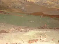
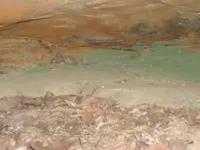
Yep I've heard some of them stories as well franklin. There is some here I'm sure just got to look in the right places. I was in a place yesterday that had some strange green looking what appeared to be tarnish on some stone back in a crack/ ledge , not sure what it is and didn't have anything to get samples of it. I'll be making another trip back in a few days I'm sure.
 

Last edited:
I do believe the silver mines are within one half days journey of the mouth of Paintsville Creek. The old Indian Trail went through a couple branches of Blaine Creek. I did a lot of searching in that area also. And Jenny Wiley was held prisoner at the head of Mudlick Creek.
 

Here is a couple of pics DSC00536.JPGDSC00537.JPG
 

I do believe the silver mines are within one half days journey of the mouth of Paintsville Creek. The old Indian Trail went through a couple branches of Blaine Creek. I did a lot of searching in that area also. And Jenny Wiley was held prisoner at the head of Mudlick Creek.

I think you are real close on your thinking. There is something in the area of Paint Creek I'm pretty sure . I saw carvings up through Paint while fishing before the lake was made that suggests there is. Some of the carvings were very similar to ones boomer has posted in relation to the Grayson find.
 

Jenny Wiley was actually held captive on what is Little Mud Lick today. Probably a 2 hour walk from Paintsville. At least that is the way the story goes around here. I think when she got sick Black Wolf nursed her back to health probably in the head of Little Sandy or Sandy Hook area. Most of this is from a story as told by one of her sons years later. She and her husband moved back to this area some years after she was captured from Walkers Gap. They have marked out the trail she was supposed to have taken to get to Harmons Station in Block House Bottom on her escape.
 

I will say one thing about the Paintsville Creek Area. I homed in on that area years ago. I talked with a lot of locals in the area before the gas companies and others moved in. There were several caches of old silver coins found at the mouth of Paintsville Creek. There are stories of Indians coming there and going up Paintsville Creek came back with their pack animals jingling with the rattle of metal coins. Some were killed and/or disappeared along with their pack animals and their cargo.

What got me interested in that particular area was the old map of Imlay's of Kentucky dated 1793

https://screenshots.firefox.com/B9W2rQE1uKFo769Q/collections.leventhalmap.org

I have several other stories about people that stayed at Harman's Station and I know they found silver before the Battle of King's Mountain.

'Reputed Silver Mines' basically in the head waters of the North and Middle forks of the KY river and Eastward toward Paintsville and Prestonsburg.
I always saw this map as a rendering of the text in the Swift Journal that one group went West and the other Southwest along the great ridge (Pine Mt) from the forks of the Sandy.
Its farther East than the common thought of one of the mines being at or around the forks of the KY River. Its a broad area of the state if you use deductive reasoning based on the journal entry mentioned above and the stated amount of time traveled in days. If the journal is accurate the mines should be West of the Sandy Rvr...South of the Ohio Rvr...and along or North of the Ky Rvr. Although in the back of my mind I tend to discount anything along the KY River as there is no mention of another large river after the forks of the Sandy. Only a clifty area with a smart stream. This could be the KY headwaters or the Eastern sections of the Red River...or
 

Last edited:
Hey Ken, I have never heard of Jenny being in the Sandy Hook area; do you have any more information on this? THanks for the posts! Enjoy reading your information.
 

Top Member Reactions

Users who are viewing this thread

Back
Top