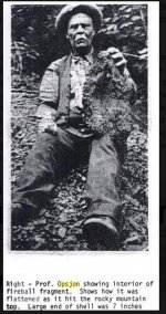
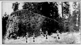
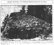
Supposed Battle Between Indians & Norse Vikings in 1010 A.D. Spokane, Washington

jeff of pa

Super Moderator
Staff member
Dec 19, 2003
88,058
62,371
🥇 Banner finds
1
🏆 Honorable Mentions:
1
Primary Interest:
All Treasure Hunting
000ddd.jpg
000eee.jpg

000fff.jpg

000ggg.jpg


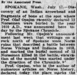
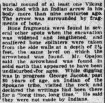
Evening star. [volume]
(Washington, D.C.), 18 July 1926.

000aaa.jpg
000bbb.jpg
000ccc.jpg

https://chroniclingamerica.loc.gov/...&proxValue=&dateFilterType=yearRange&page=330
 

Last edited:
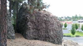
I would like to locate the rock in the photo which does seem real.

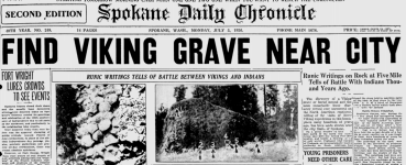
Viking article from Spokane Washington
I contacted Peter Sjolander on Facebook to ask about the location since he went there in 1995.

https://books.google.com/books?id=3...SIQ6AEwCXoECC4QAQ#v=onepage&q=spokane&f=false

There is an area on the north side of town that has rocks like that one in the picture but I couldn't find the exact one when I went out to look at them. The area is called Five Mile and this is right off of it.

nJ6c2rs.png

20180910_185329.jpg
 

What is This off North Dorset ?

Looks Flat on Top & Worked.

north.jpg


But also appears to Be a Large Boulder

dorset.jpg

could the "powers that be", have destroyed it ?
 

Last edited:
Ill look into that Jeff. It does look a little bit like its just someone digging out for a basement for a house.

I do think its still out there, this area doesn't have any real prime real estate so all of these really large rock out outcroppings are still here, to give you an idea, the one I posted a photo of above was about 20ft tall.

The one were looking for was maybe 4 or 5 times the hight of a man based on the photos.
 

Last edited:
Yes Hard to say what that is. The Dirt Road in,
seems to have disappeared or
more then Likely , didn't exist yet when Street View drove by.

It's also Flat ground (Prairie) so it's not in the correct place by their Description.

The view of it looking like a Gigantic Boulder
With others surrounding it, May be just a Bad Google Image,
and Visual distortion.

Unfortunately Google, due to policy changes has put Gmap4 out of Business.
their Ariel Views were like Night & day :(. Gmap4 was much more Advanced in Quality views then Google.
 

again I'm a bit more open Minded then most.
instead of saying Prove it is.
I say once someone says it is, Prove it's Not !


Calling it a Hoax doesn't Necessarily Prove something is a Hoax.
The Hoax may be The person saying "it's just a Rock"
so Archies & Historians can Save Face.
they are the ones with Fancy Degrees & Govt. Handouts to protect.
 

Last edited:
This rock is off Southwest Boulevard, at about 17th across the street from Liberty Park. It doesn't appear as massive today, mainly because of the soils and debris pushed over, and around it from the home construction above, and below.
This landmark would have been designated as a rally point for the Norsemen who had recently observed the busy 'falls' of Spokane, and designated it as a fall back point should their interaction go sideways with the natives collecting winter stores.
 

Attachments

  • 1910 E Southeast Blvd - Google Maps.pdf
    4.3 MB · Views: 49
Last edited:

Top Member Reactions

Users who are viewing this thread

Back
Top