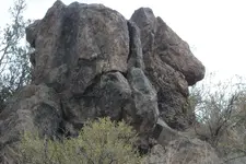
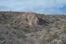
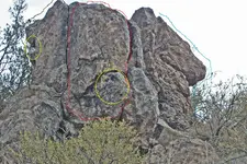
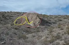
Mdog, I believe the trail north is a web work of smaller trails that kick off towards water holes, safe areas, and minerals. But right now it appears there is a very clearly marked trail. Between treasure hunters and archys, there is a difference of ideas of actually how to read the trail, and what is happening. So the kings trail as marked is most likely pretty close. Now I get offers for Mexico, but feel I would end up in a ransom box or my head wrapped in duct tape.
Springfield has mentioned a few trails as there are others. There is only a few hundred years of trade and search for mineral that apply to the Spanish. That is also a debate, how long was the Spanish here. A lot can happen in a few hundred years, declination of a compass, the use of the back staff to quadrant, or the setting of the Vera for land ownership purposes. Also it is believed the Spanish was chased out at one point so the areas we search was occupied twice by them. Lastly, the laws that applied to the Spanish also changed and some may have not followed them.
I focus on some of the larger monument types of sign. Anyone who has walked the trail will tell you there is several markers looking down the same trail. There was other players so there is other markers that are the same and makes for a confusing day. I think there is even a lil bit of truth in a lie. But everyone hunts the trail different. As people loose things all the time, I believe there is probably treasure just about everywhere you look. My pictures are my treasure. Without some very expensive equipment I don't own right now, I will never know if I have found any caches or hidden mines. But the trail is marked. I learn something every time I go out.
Oh, before I forget. The north and south trail seems to be oriented with Sante Fe, and Mexico City. I believe that orientation lays a big part in some monuments.


