You are using an out of date browser. It may not display this or other websites correctly.
You should upgrade or use an alternative browser.
You should upgrade or use an alternative browser.
Spanish/Jesuit/MexicanMINE SHRINES
- Thread starter ghostdog
- Start date
dog the treasure hunter
Gold Member
- Joined
- Jan 16, 2011
- Messages
- 5,010
- Reaction score
- 5,039
- Golden Thread
- 0
- Location
- By, By Have fun.
- Detector(s) used
- Time to move on. Good luck everyone .
- Primary Interest:
- All Treasure Hunting
i like hearing about the smaller stuff you found. its belived by some of the experts, if you can move it with your foot it not a sign. but i dont buy that. i have found smaller items that i know have been done by man.thanks for the info.
John_Arizona
Hero Member
i like hearing about the smaller stuff you found. its belived by some of the experts, if you can move it with your foot it not a sign. but i dont buy that. i have found smaller items that i know have been done by man.thanks for the info.
the experts can be wrong at times and sometimes they don't have all the answers to everything. I know where some things are but won't go into that, but there are some markers that can be picked up by hand.
I found a corner marker made out of marble, so what is really interesting is that why way out here in this damned desert is there a 5" x 5" square and 7" tall block of marble in an area surround in sand, cacti and dried magma?
I have a photo of it, just need to look for it
Last edited:
dog the treasure hunter
Gold Member
- Joined
- Jan 16, 2011
- Messages
- 5,010
- Reaction score
- 5,039
- Golden Thread
- 0
- Location
- By, By Have fun.
- Detector(s) used
- Time to move on. Good luck everyone .
- Primary Interest:
- All Treasure Hunting
very interesting john az., i have also found small square cut stones that i call tablets, propped up against other rocks to catch your attention.your the first i have heard on here to mention that. thanks for the info. watch what you say,youll piss people off,and they will put you on the black list,lol.
dog the treasure hunter
Gold Member
- Joined
- Jan 16, 2011
- Messages
- 5,010
- Reaction score
- 5,039
- Golden Thread
- 0
- Location
- By, By Have fun.
- Detector(s) used
- Time to move on. Good luck everyone .
- Primary Interest:
- All Treasure Hunting
very interesting john az. i see the skull. have you done any work with a i.r. lens? i want to do some more work with differant lens and such. iam very interested in doing some things also with black and white, also i want to try some time frame stuff,both high speed and low speed. very interesting. super cool. man your giving me the push i need to get on with that type of work. as paris hilton would say, thats hot! lol.
John_Arizona
Hero Member
i will have 2 of what u r smoking!
You kinda let me down, hadji
Last edited:
John_Arizona
Hero Member
very interesting john az. i see the skull. have you done any work with a i.r. lens? i want to do some more work with differant lens and such. iam very interested in doing some things also with black and white, also i want to try some time frame stuff,both high speed and low speed. very interesting. super cool. man your giving me the push i need to get on with that type of work. as paris hilton would say, thats hot! lol.
I was using a small 8 meg camera that I can jam into my pocket, I don't want to be luggin a big camera around. I put the image in photoshop, and dropped the width to .03 and boosted the dpi up to 1 million, I color corrected the image and sharpened it a little... because I can do some seriously close zooming in that way to see the treasure signs, faces, etc on the ground.
I have found countless skulls, but that was east of the south entrance to the Peralta Trailhead and east of the Quarter Circle U Ranch & Reavis Ranch.
There are some Old Ruins back in there from the Hohokams and did find that the Tonto Natl Park Service has a camera hidden on a hill looking down at the ruins... why you might ask... I found a Gold Sword, Chalices, a Wagon Wheel, and countless Skulls. I also think I found an Aztec/Hohokam/Pima Pyramid there http://library.thinkquest.org/12641/archaic/archaic1.html http://www.infoplease.com/encyclopedia/society/pima.html ... and some other stuff that made me wonder http://www.infoplease.com/encyclopedia/people/kino-eusebio-francisco.html
So then, the Park Service knows that is there... but really no one else does. Probably to keep it quiet and they don't want a lot of people going out there... but since now it's been exposed by me opening my mouth LOL!!
I have a photo of that and some other interesting things I have found as well. I use to hike and photograph the Supes all around where the LDM (Bluff Spring), Weavers & Miners Needle are and all the Glyphs found on Black Mesa. There are things back in those Canyons that would really blow your mind, but I got bored with that area and started fanning out to the east and north east from there.
When I did that, I began finding a lot more and large amounts of signs, symbols, letters and old diggings. I did find a few foundations to stone structures below Miners Needle and west of Reavis Ranch. I have rented a Horse from the Spur U Ranch that is south of the Quarter Circle U Ranch and ridden all over the place also.
So since I live here, I have scoured that damned area quite well. My Dad was a big Gold Miner and he had a mine out near Salome, AZ. I still own that mine today... I don't work it, but I will get out there one day and mess around. I'm more into the Spanish Mines and old symbols etc. So I know there are a lot of people on this site that are experts in the symbols, meaning etc. I hope they can help me and I can expose to the world my finds as well. I will post more photo's in the time to come.
Last edited:
John_Arizona
Hero Member
very interesting john az., i have also found small square cut stones that i call tablets, propped up against other rocks to catch your attention.your the first i have heard on here to mention that. thanks for the info. watch what you say,youll piss people off,and they will put you on the black list,lol.
These square stones in a triangle or a diamond shape is the marking corners to the treasure thats buried below and beneath them. It's a Jesuit trick, and if you use a metal detector... you will find items buried in the shape of a cross inside the diamond or triangle at a depth up to 18". I also ran across and old treasure magazine my father had and found where a guy found this on Jesuit Hill near Tucson. Jesuit Hill is now surrounded by an open - pit/gravel pit. The only thing they left was Jesuit Hill.
...but it doesn't stop or begin there either. That was a lucky find possibly or he knew what he was looking at. These are all over the place, and the sizes get bigger & smaller (depending on the space on the ground and the room they had to work with). When they bury a large cache. There are multiple diamond shapes within diamond shapes and up to 5 diamonds in one spot inside each other. One bigger, inside of that a smaller one about a foot inside the main lines, then a smaller one a foot inside those lines and so on and so forth.
I have found these way into Canada, but the diamond and triangle shapes are the eyes of animals, they use animals and they use the ground and hill sides as the shape of the animals and they will also rearrange the earth to make these shapes. I've found they use a Parrot (I found the Parrot 3 times in the Supes) One East of Reavis Ranch, One West of AZ-88 going towards Canyon Lake. One near the Stone Priest Head near Reavis Trailhead.
The Horse & Horse Head was and is found extensively throughout the Southwest, carved on sandstone, magma, and huge images on hillsides.
They use the Bison shape in Utah, the snake head in the southeast of Phoenix aka Snake Town ( Snaketown - Wikipedia, the free encyclopedia ) I have carved Snake Heads on my claim carved/etched on stone and made from monoliths of stone. There are a lot at the Hohokam Ruins east of the South Peralta Trailhead Entrance (east of Reavis Ranch)
These two links tell of the Hohokum in Arizona, but not at the Ruins east of Reavis & Quarter Circle U Ranch's Hohokam - Wikipedia, the free encyclopedia The Hohokam: Preshistoric People of the Desert Southwest - DesertUSA
View attachment 739575
*I apologize for adding all this information to your spanish-jesuit-mexicanmine-shrines page here*
Last edited:
usernotfound
Sr. Member
- Joined
- Sep 7, 2011
- Messages
- 495
- Reaction score
- 149
- Golden Thread
- 0
- Detector(s) used
- T-2
- Primary Interest:
- All Treasure Hunting
These square stones in a triangle or a diamond shape is the marking corners to the treasure thats buried below and beneath them. It's a Jesuit trick, and if you use a metal detector... you will find items buried in the shape of a cross inside the diamond or triangle at a depth up to 18". I also ran across and old treasure magazine
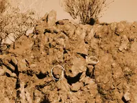
Diamonds, you say. I have a picture or two of which you speak.
Shortstack
Silver Member
- Joined
- Jan 22, 2007
- Messages
- 4,305
- Reaction score
- 419
- Golden Thread
- 0
- Detector(s) used
- Tesoro Bandido II and DeLeon. also a Detector Pro Headhunter Diver, and a Garrett BFO called The Hunter & a Garrett Ace 250.
- Primary Interest:
- All Treasure Hunting
John_Arizona:
If you will use "bing maps" and it's "birds eye view" app, you can get right down to about 200 feet above the ground in the Superstitions. Those sat photos are very detailed, too. Maybe you can use them to aid your searches and to investigate the rougher spots.
Bing Maps - Driving Directions, Traffic and Road Conditions
usernotfound
Sr. Member
- Joined
- Sep 7, 2011
- Messages
- 495
- Reaction score
- 149
- Golden Thread
- 0
- Detector(s) used
- T-2
- Primary Interest:
- All Treasure Hunting
John_Arizona:
If you will use "bing maps" and it's "birds eye view" app, you can get right down to about 200 feet above the ground in the Superstitions. Those sat photos are very detailed, too. Maybe you can use them to aid your searches and to investigate the rougher spots.
Bing Maps - Driving Directions, Traffic and Road Conditions
I've searched using being maps countless hours, in fact, I just finished anther couple of hours looking at Arivaca, Oro Blanco and the Tumacacori Mountains. Looking for the exact spot of "82 lbs." 12 miles from the border or so.
Shortstack
Silver Member
- Joined
- Jan 22, 2007
- Messages
- 4,305
- Reaction score
- 419
- Golden Thread
- 0
- Detector(s) used
- Tesoro Bandido II and DeLeon. also a Detector Pro Headhunter Diver, and a Garrett BFO called The Hunter & a Garrett Ace 250.
- Primary Interest:
- All Treasure Hunting
The only little drawback on bing maps is that the "birds eye view" is not available for all places. It IS for at least part of the Supers. I tried it, just on a whim, for the area starting with Apache Junction, and the detail was great. Another time, at a place that another member mentioned and it was available there, too, soooo I'm presuming the whole Supers are in that app bank.
John_Arizona
Hero Member
Diamonds, you say. I have a picture or two of which you speak.
Where did you photograph these and how big are they?
John_Arizona
Hero Member
You kinda let me down, hadji
it's ok hadji... I apologize. I will post some pics that are less toned down in color or make some black & white.
John_Arizona
Hero Member
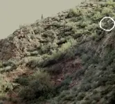
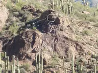
i see this cow with a V on cheek.View attachment 740103and a big#3 below it.the face is a man also bottom of V is his mouth?
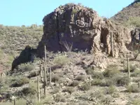
did discover in the pit, there is a tunnel (dark area in trees is the mouth) goes in here and it comes out on the left side of this hill. It's 1/8 of a mile long... it goes way in, turns left and goes up a hill inside and comes out in another canyon with an old spanish trail on it winding around to another mine.
usernotfound
Sr. Member
- Joined
- Sep 7, 2011
- Messages
- 495
- Reaction score
- 149
- Golden Thread
- 0
- Detector(s) used
- T-2
- Primary Interest:
- All Treasure Hunting
Where did you photograph these and how big are they?
Several different locations, vary in size, but the outer area...about three meters long.
Similar threads
- Replies
- 4
- Views
- 789
Users who are viewing this thread
Total: 1 (members: 0, guests: 1)
Latest Discussions
-
-
🔎 UNIDENTIFIED Unidentified rock found in Minnesota
- Latest: ConceptualizedNetherlandr
-
My Tennessee Stone Ax Head... found in 95'
- Latest: ConceptualizedNetherlandr
-
-


