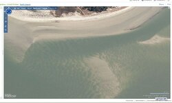
shipwreck from satallite

I satalite scan the shallows looking for dark objects in flat white sand beach areas here in florida --its really amazing what "pops up" on a white sand back ground on a smooth water sunny day . :wink: Ivan
 

It is absolutely possible to see shipwrecks using Google Earth. I prefer the MSN images because they now have the Birds Eye feature with better images. No shipwreck in this image, but great resolution. Actually there is a wreck, but its burried!

RGecy
 

Attachments

  • MSN-Maps.jpg
    MSN-Maps.jpg
    77.2 KB · Views: 3,536
I've been doing this for many years, since the jump jet was introduced to America as a reality , not just a wish list item...because 2 weeks before it came out i watched one crash in my back yard...the Barnegat bay in NJ. A good friend was 1st on the scene and snatched up the operation manual and some satellite images of our area. they following him around town day and night till he gave up the manual...but he kept the areal photos and hung them up in the garage where we would hang out and speculate on the possibilities, i was hooked and started looking for all and any thing satellite related that i could find, and let me tell you since then its gotten a lot better
 

LMAO...........in answere to your question....no.....however, that does look like a good imitation of what the pilot looked like when he ejected out of the real jump jet
 

LMAO! The "pilot" (and I use that term VERY loosely) could've used a set of wings and and large pair of dive fins to maneuver. He actually looks like a scared villager that was talked into the experiment! LOL! Nice to see some good-natured kind of old-fashioned joking on here.

But back to main topic about finding shipwrecks using Google, I'm in Egypt and have found that Google is absolutely useless for finding anything below 10 meters of depth due to the irregular updates and the resolution for this region. You guys off the coast of Florida have the best resolution available. In the meantime, we are looking for wrecks the "old-fashioned" way (i.e. talking to the local fishermen and good old research).

Narked1
 

Mike

Its not as convenient, but a lot more interesting way to carry out an investigtaion, plus there is much more info that way.

Regards

Mike Collins
 

0820082138.jpg


I was told by someone who has thousands of hours reading sidescan sonar that the shiny part of the top right pile should be gold reflecting back at satellite....as well as everything else in the picture that is shiny.......................................Limo Bob
 

these too photos above, have been confirmed to me by a friend who worked with the Fisher organization when Mel was still alive , to be just a small part of what appears to be at least three ships possibly more.....was waiting for proposal from them on what our arrangement would be if i disclose info on where this location is....but since this new Florida law Rule 1A-31 coming in on the 21st of this month will make me an outlaw, i guess that day will not ever come ...so this location....which has slowly covered itself up with sand over past 4 years ...will remain a mystery...to them...
 

Limo Bob wrote: but since this new Florida law Rule 1A-31 coming in on the 21st of this month will make me an outlaw....

No laws are changing on October 21st. That is just the date of a "workshop"

Please re-read the thread at: http://forum.treasurenet.com/index.php/topic,183886.0.html

It is not too late for us to act and make sure the proposed changes do not become law.
 

So true, our State legislature does not even reconvene until about 15 November.

Tom
 

Top Member Reactions

Users who are viewing this thread

Back
Top