Request dowsing of satellite picture.

Thanks Red_desert for cropping the pic,
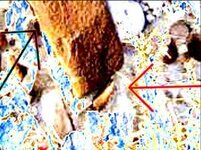
Well, I believe there is gold out there. The 10 picture says looking north at the other formation, which is 8?. But the number 8 on the satellite pic is SW of where Pala indicated 10? on the satellite pic, but he did say he was not sure of where some things were in relation to each other out there. I got the feeling that those conglomerates are covering up an entrance and/or gold is in the vicinity, particularly beneath.
Jon
 

teleprospector said:
Thanks Red_desert for cropping the pic,
Well, I believe there is gold out there. The 10 picture says looking north at the other formation, which is 8?. But the number 8 on the satellite pic is SW of where Pala indicated 10? on the satellite pic, but he did say he was not sure of where some things were in relation to each other out there. I got the feeling that those conglomerates are covering up an entrance and/or gold is in the vicinity, particularly beneath.
Jon
I don't think he was sure on the location, was why suggested getting GPS readings next trip. #8 & #10 we aren't sure, but could be the same treasure looking at it from different directions. Anyway, do need some good maps to dowse later.
 

One more thing, the heart is in a diamond shape, which could represent a distance. Reduced the size, should be able to see the diamond carving. It leans slightly to the right, diamond/heart shape is in the whole setup that leans left, is on the right side of mound, diamond could point to the right marker.
 

Attachments

  • 10. Looking northLGr2cropsml.jpg
    10. Looking northLGr2cropsml.jpg
    25.2 KB · Views: 477
Hello amigos ,

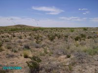
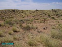
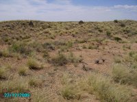
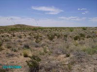
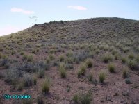
The first two pictures show turtle (#1) and cave (#4) location.


The third picture shows the two rock conglomorates (#8,#10).

Pala y Pico
 

Attachments

  • 14. NW looking at hill toward. cave..jpg
    14. NW looking at hill toward. cave..jpg
    124.5 KB · Views: 294
  • 7. Two formations NW of opening about 70 to 100 ft..jpg
    7. Two formations NW of opening about 70 to 100 ft..jpg
    140.8 KB · Views: 327
  • 7. Two formations NW of opening about 70 to 100 ft..jpg
    7. Two formations NW of opening about 70 to 100 ft..jpg
    140.8 KB · Views: 326
  • 14. NW looking at hill toward. cave..jpg
    14. NW looking at hill toward. cave..jpg
    124.5 KB · Views: 285
  • 15. End of hill At turte..jpg
    15. End of hill At turte..jpg
    120.6 KB · Views: 238
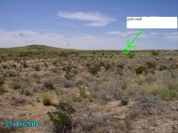
Pala Y Pico any of your treasure sign got a vault in area? this picture has got a gold vault in it.
 

Attachments

  • 14. NW looking at hill toward. cave..jpg
    14. NW looking at hill toward. cave..jpg
    126.2 KB · Views: 185
okiedowser said:
Pala Y Pico any of your treasure sign got a vault in area? this picture has got a gold vault in it.

My suspicion is that if these are Spanish mines, there must have been a storage area.

The storage area I think would be near the mines.

okiedowser, Do you mean a treasure room where gold was stored?

Thank you

Pala y Pico
 

Pala Y Pico said:
okiedowser said:
Pala Y Pico any of your treasure sign got a vault in area? this picture has got a gold vault in it.

My suspicion is that if these are Spanish mines, there must have been a storage area.

The storage area I think would be near the mines.

okiedowser, Do you mean a treasure room where gold was stored?

Thank you

Pala y Pico
Yes it a Storage room , most time's it be a hole in the ground with a flat rock on top,sometime a foot are so under the ground,will be a flat rock,,,,but there be sign leading to this spot.but if you like to locate this place we can do it with closer picture's tell we get to the spot's......are we can either do it here are you can pm me, what ever you care to do be ok.
 

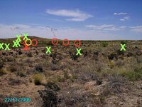
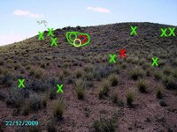
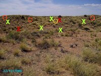
I got a couple gold signals, yellow circles for any type of gold. Red circles for any type of entrance/cave/tunnel or excavated opening. The green circle with line around it, not sure which side of the hill, but seems a cave like opening....maybe even concealed. Red Xs silver coins, green Xs for any archaeological signal or markers.
 

Attachments

  • 14. NW looking at hill toward. cave.-Pala Y Pico.jpg
    14. NW looking at hill toward. cave.-Pala Y Pico.jpg
    129 KB · Views: 290
  • 15. End of hill At turte.-Pala Y Pico.jpg
    15. End of hill At turte.-Pala Y Pico.jpg
    124.8 KB · Views: 295
  • 7. Two formations NW of opening about 70 to 100 ft.-Pala Y Pico.jpg
    7. Two formations NW of opening about 70 to 100 ft.-Pala Y Pico.jpg
    149.1 KB · Views: 291

Top Member Reactions

Users who are viewing this thread

Back
Top