BosnMate
Gold Member
- Sep 10, 2010
- 6,916
- 8,441
- Detector(s) used
- Whites MXT, Whites DFX, Whites 6000 Di Pro
- Primary Interest:
- Other
This rock shelter can be almost driven to, it's just a very short hike. The Forest Service has opened the site again to the public. Going to Google Earth and putting in "Medicne Creek Rock Shelter," google earth will take you right to it. Trouble is the paintings haven't stood up to time. Lichens have covered and ruined a lot of them. Anyhow, when the Forest Service re-opened the site, they put out a press release in 2008, which follows:
– The Umpqua National Forest is celebrating National Trails Day and the Forest’s 100th birthday with the re-opening of the Medicine Creek Rock Shelter Trail on Saturday, June 7, from 10 a.m. to 2 p.m. To reach the trail, take State Highway 138 East from Roseburg to milepost 55. Turn on to Forest Service Road (FSR) 4775, the Medicine Creek Road, and travel another 1.3 miles to the trailhead.Medicine Creek Pictograph is a protected heritage site known to the general public since the 1930s. The large rock overhang bears the drawings of American Indians from the mid-18th century or earlier. Previously, a narrow and somewhat steep footpath took visitors to this familiar shelter."Thanks to Title II funding from the Secure Rural Schools and Community Self-Determination Act, there is now a smooth 0.2 mile trail accessible to assisted wheelchairs with an easy grade and a small bridge over a draw leading to the awe-inspiring wall of pictographs," said Cliff Dils, Forest Supervisor. "A contractor constructed the trail and bridge improving access to the site and then volunteers helped in completing and spreading gravel on the trail."Over the years thousands of people have visited the site, some less than respectful toward this cultural heritage site. Nature itself has had its part in obscuring the images on the rock with lichens and moss. The recent improvements will help protect the site.
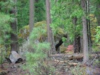
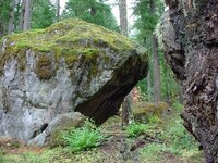
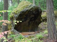
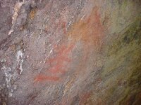
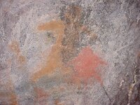
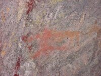
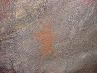
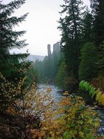
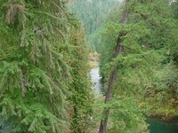 The first three photo's show the shelter, four pictures showing what's left of the paintings, the next to last picture is "Old Man rock" named by the Indians, seen from hiway 138 on the north Umpqua River. People climb that darn thing now. The last photo is the same river from the bridge on the way up to the shelter.


 The first three photo's show the shelter, four pictures showing what's left of the paintings, the next to last picture is "Old Man rock" named by the Indians, seen from hiway 138 on the north Umpqua River. People climb that darn thing now. The last photo is the same river from the bridge on the way up to the shelter.
Upvote
0


