CanadianTrout
Hero Member
Hi guys. Any one mind taking a stab at this image?
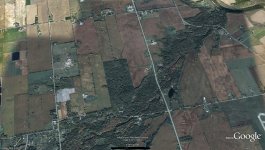
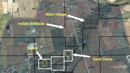
The pic below is of a creek that feeds a major river. The river historically was home and highway to natives for thousands of years. It was also travelled during the fur trade days and by early explorers/cartographers.
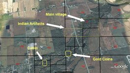
I have read a couple differing sources on this same tale. Somewhere between the late 1700's to the late 1800's a man owned or occupied some or all of the land pictured. He had his cabin/home along this creek somewhere. The map is aligned North at the top and the creek is in the forested region that connects to the river in the upper right. (I tilted the image a bit to get more of the creek in the picture). I can only fit about 2/3 of it in the pic but I figured this is the most likely location (being closer to the major river)
The tale:
"There was a settler who lived along the creek where it flowed into the ****** River. He was wealthy and had a untrustworthy daughter, who along with her husband were eager to acquire his money. The old man, aware of his daughter's greed, secretly buried his coins in a chest along the creek valley. Unfortunately after hiding the chest, he slipped while walking along the creek, striking his head on a rock. The unconscious man drowned, and with him went the location of his wealth. Thus named the creek... ***** Creek."
Another slightly different version has all the above details except the daughter had known where the cache was before being married. Later the manipulative daughter and her husband, who had been denied a dowry and/or had been turned away multiple times asking for a loan, returned to rob the old man. He either dies trying to run away or they kill him. The couple go to the cache location and try to dig it up only to find the father had moved it to another location after she had been married off.
FYI - there was a mill along here somwhere built at a later date. Also there is a proven Native settlement around the mouth of the creek on both sides of the river.
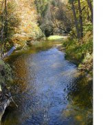
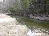
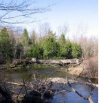
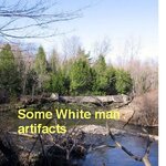
I also included 3 close-ups. Two of them are near the mouth and looking upstream and the other is located about halfway along on the large overall picture (some structure (remains of a mill) can be seen here.)
So, what do you think? Any idea where HIS cabin was or any other readings? If by a miracle I find something this summer while exploring the areas you suggest the provider of the correct information can expect to hear from me. You'll have to take me at my word.
The pic below is of a creek that feeds a major river. The river historically was home and highway to natives for thousands of years. It was also travelled during the fur trade days and by early explorers/cartographers.
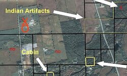
I have read a couple differing sources on this same tale. Somewhere between the late 1700's to the late 1800's a man owned or occupied some or all of the land pictured. He had his cabin/home along this creek somewhere. The map is aligned North at the top and the creek is in the forested region that connects to the river in the upper right. (I tilted the image a bit to get more of the creek in the picture). I can only fit about 2/3 of it in the pic but I figured this is the most likely location (being closer to the major river)
The tale:
"There was a settler who lived along the creek where it flowed into the ****** River. He was wealthy and had a untrustworthy daughter, who along with her husband were eager to acquire his money. The old man, aware of his daughter's greed, secretly buried his coins in a chest along the creek valley. Unfortunately after hiding the chest, he slipped while walking along the creek, striking his head on a rock. The unconscious man drowned, and with him went the location of his wealth. Thus named the creek... ***** Creek."
Another slightly different version has all the above details except the daughter had known where the cache was before being married. Later the manipulative daughter and her husband, who had been denied a dowry and/or had been turned away multiple times asking for a loan, returned to rob the old man. He either dies trying to run away or they kill him. The couple go to the cache location and try to dig it up only to find the father had moved it to another location after she had been married off.
FYI - there was a mill along here somwhere built at a later date. Also there is a proven Native settlement around the mouth of the creek on both sides of the river.
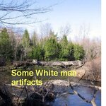
I also included 3 close-ups. Two of them are near the mouth and looking upstream and the other is located about halfway along on the large overall picture (some structure (remains of a mill) can be seen here.)
So, what do you think? Any idea where HIS cabin was or any other readings? If by a miracle I find something this summer while exploring the areas you suggest the provider of the correct information can expect to hear from me.
 You'll have to take me at my word.

