- Feb 3, 2009
- 39,899
- 151,502
- 🥇 Banner finds
- 1
- Detector(s) used
- Deus, Deus 2, Minelab 3030, E-Trac,
- Primary Interest:
- Relic Hunting
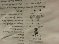
I'm having a  and can't seem to find out the meaning of this symbol in the picture which is from a 1870's historical map, which is a plus sign inside a circle.


")