LUE MAP THEORY, MAYBE SOME CONTEXT

Attachments

  • IMG_3788.jpeg
    IMG_3788.jpeg
    68.7 KB · Views: 33
  • IMG_3787.jpeg
    IMG_3787.jpeg
    62.8 KB · Views: 30
To All,

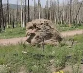
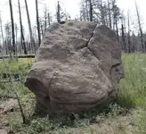
LUE Clues: The two are of the same rock and is west of the LUE location. You notice that one looks like and eagle head and the other side is a directional marker.

Regards

LUE-Hawn
Thank you for the pictures and the information.
I can see why you would interpret the large formations as Pope and King but I was wondering if there are any kind of confirmation carvings on them. Also, are they close enough to a trail to be seen from the trail or are they close to one of the large Hand of God monuments that you have posted about. Is the LUE marker in Colorado or New Mexico and is there some information that would make you believe that the rock is part of the LUE?
Thanks again LUE-Hawn.
 

Last edited:
To All,

LUE Clues: The two are of the same rock and is west of the LUE location. You notice that one looks like and eagle head and the other side is a directional marker.

Regards

LUE-Hawn
Wet Canyon ?
Forbes Park ?
 

Last edited:
Here we go again with another obelisk .. this one apparently more ancient than the ones in Ponil Park and St. James Hotel.
(Symbols are artificially enhanced in the photo, see blog for more pics)

Located somewhere near the Purgatoire River; potentially in LUE territory??
Note the 'M' symbol.

Peter Faris's blog is very interesting. You could say he is a "rock art" scholar of the Southwest USA.


IMG_0177.jpeg
 

Last edited:
On October 15,2023, Skyhawk1251 posted a story by author Leland Lovelace from her book Lost Mines and Hidden Treasure. She writes of Spaniards who came to southern Colorado, from Mexico, during the late 1700s. They discovered an immensely rich deposit of gold in the mountains west of Trinidad, Colorado. The Spaniards began mining operations but for some unexplained reason, they closed up the mine shaft and destroyed all evidence of their operation. Then they left the area, never to return.
In 1939, a man named Manuel Torres discovered evidence of a mining operation, high up on Culebra Peak. There was no record of what Torres found.

The author writes that those who search for the Spanish mine, concentrate their efforts west of Trinidad around Culebra Peak, in the south, and Walsenburg, in the northeast. She also mentioned East and West Spanish Peaks, as being in the search area. However, it seems that most of the search took place at Culebra Peak.

Something she mentioned, as she finished the story, was that there are other treasures to be found in the ground, such as Uranium.

The Spanish expedition into the mountains and their sudden departure, reminded me of the Treasure Mountain legend.
 

Here we go again with another obelisk .. this one apparently more ancient than the ones in Ponil Park and St. James Hotel.

Located somewhere near the Purgatoire River; potentially in LUE territory??
Note the 'M' symbol.

Peter Faris's blog is very interesting. You could say he is a "rock art" scholar of the Southwest USA.


View attachment 2145542
Thanks for the article, Ryano. It would be nice to know the exact location.
 

On October 15,2023, Skyhawk1251 posted a story by author Leland Lovelace from her book Lost Mines and Hidden Treasure. She writes of Spaniards who came to southern Colorado, from Mexico, during the late 1700s. They discovered an immensely rich deposit of gold in the mountains west of Trinidad, Colorado. The Spaniards began mining operations but for some unexplained reason, they closed up the mine shaft and destroyed all evidence of their operation. Then they left the area, never to return.
In 1939, a man named Manuel Torres discovered evidence of a mining operation, high up on Culebra Peak. There was no record of what Torres found.

The author writes that those who search for the Spanish mine, concentrate their efforts west of Trinidad around Culebra Peak, in the south, and Walsenburg, in the northeast. She also mentioned East and West Spanish Peaks, as being in the search area. However, it seems that most of the search took place at Culebra Peak.

Something she mentioned, as she finished the story, was that there are other treasures to be found in the ground, such as Uranium.

The Spanish expedition into the mountains and their sudden departure, reminded me of the Treasure Mountain legend.
MD,

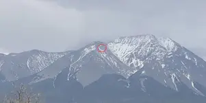
There is the Bullfrog mine Between East and West Spanish Peak. The Whale mine is on West Spanish Peak as pointed out by my 90 year old friend. He could see the Whale Mine from his house withIn the red circle. He also said that the two mines were connected somehow? I asked him if he ever went in them and he said a resounding “No”.

He also knew some of the Torres clan and did work for them.

Best in Treasure

LUE-Hawn
 

Attachments

  • IMG_6913.jpeg
    IMG_6913.jpeg
    104.3 KB · Views: 23
Here we go again with another obelisk .. this one apparently more ancient than the ones in Ponil Park and St. James Hotel.

Located somewhere near the Purgatoire River; potentially in LUE territory??
Note the 'M' symbol.

Peter Faris's blog is very interesting. You could say he is a "rock art" scholar of the Southwest USA.


View attachment 2145542
Nice carvings Ry - obviously a message of some sort. I wouldn't call that rock an obelisk, which is a monolith shaped as a tapered rectangle with a pyramid top. It's close enough, I guess, to look kinda similar. Those big rocks in the background are interesting. Any carvings on those?

I used to have a dog who led me to numerous Indian ruins, petroglyphs and old mines. He'd run ahead, find something good and then wait for me. Here's an obelisk he found.
Farley's obelisk.JPG
 

SDCFIA - Very cool! . Sounds like your dog was especially talented and a real partner in the field.

_____
(below is copy/pasted interesting text from the article.. also the bottom photos on that webpage are taken from different angle):

"In a tributary of the Purgatoire (Picketwire) river in southeastern Colorado there is a vertical stone column with petroglyphs carved into its face. It was erected in a crude circle of large boulders. My photographs make it look like it is leaning on the rock behind it but, in fact, it is free-standing and not touching that rock with an unknown length of the column buried in the ground. The obelisk now stands approximately four feet tall but the top has been obviously broken off so it once stood taller, and probably sported more petroglyphs as well. About 20 years ago a chunk of the broken-off portion could be found lying at the base of the remaining column but whether it is still there or has been taken I cannot say. When that portion was added to the standing column the broken faces did not match suggesting that there was once still more column that is no longer in place. Back then we estimated that if the missing portions were replaced it would have stood around six feet tall, but that was largely guesswork."
------

Mdog - I ordered a book (referenced in the blog article) that might have its location. I should have it soon and will update you.
 

Last edited:
MD,

There is the Bullfrog mine Between East and West Spanish Peak. The Whale mine is on West Spanish Peak as pointed out by my 90 year old friend. He could see the Whale Mine from his house withIn the red circle. He also said that the two mines were connected somehow? I asked him if he ever went in them and he said a resounding “No”.

He also knew some of the Torres clan and did work for them.

Best in Treasure

LUE-Hawn
Thank you, LUE-Hawn. Next time you see your friend could you ask him if Torres claimed a mine on Culebra Peak?

Here's an article that mentions the Whale Mine.


Thank you Mdog. That's some great work. Did you ever try look at major RXR railroad lines that run east west that cross your North/South Runestone lines? Might be some info. there in the form of number on switch electrical box maybe a stainless tag on a railroad tie or something along that line. It should be easy access at the closest rail road crossing. Should be a nice railroad access road along the tracks for a hike or bike ride to the spot. If a cross spot was close to me I would take a look to see if there is some info there. Thanks again, great work.
 

Thank you Mdog. That's some great work. Did you ever try look at major RXR railroad lines that run east west that cross your North/South Runestone lines? Might be some info. there in the form of number on switch electrical box maybe a stainless tag on a railroad tie or something along that line. It should be easy access at the closest rail road crossing. Should be a nice railroad access road along the tracks for a hike or bike ride to the spot. If a cross spot was close to me I would take a look to see if there is some info there. Thanks again, great work.
Thank you, Knights Templar.
 

SDCFIA - Very cool! . Sounds like your dog was especially talented and a real partner in the field.

_____
(below is copy/pasted interesting text from the article.. also the bottom photos on that webpage are taken from different angle):

"In a tributary of the Purgatoire (Picketwire) river in southeastern Colorado there is a vertical stone column with petroglyphs carved into its face. It was erected in a crude circle of large boulders. My photographs make it look like it is leaning on the rock behind it but, in fact, it is free-standing and not touching that rock with an unknown length of the column buried in the ground. The obelisk now stands approximately four feet tall but the top has been obviously broken off so it once stood taller, and probably sported more petroglyphs as well. About 20 years ago a chunk of the broken-off portion could be found lying at the base of the remaining column but whether it is still there or has been taken I cannot say. When that portion was added to the standing column the broken faces did not match suggesting that there was once still more column that is no longer in place. Back then we estimated that if the missing portions were replaced it would have stood around six feet tall, but that was largely guesswork."
------

Mdog - I ordered a book (referenced in the blog article) that might have its location. I should have it soon and will update you.

Ryano, this carved stone and rock circle is located in Salt Arroyo, about 21 miles upstream from the mouth of the Purgatoire River and very likely on or very close to mdogs great circle connecting Treasure Mountain and Villamont, VA. Interesting coincidence.
Screenshot 2024-04-26 at 2.28.50 PM.png


Probably not related to Salt Arroyo, it's also interesting that there is another Viking Runestone panel further downstream from the Salt Arroyo on the Arkansas River at Heavener, OK. It's cruder etching than the Kensington Runestone, and also claimed by experts to be fraudulent. However, it's claimed by others to be a land claim. Who knows?
Screenshot 2024-04-26 at 2.38.31 PM.png
 

Ryano, this carved stone and rock circle is located in Salt Arroyo, about 21 miles upstream from the mouth of the Purgatoire River and very likely on or very close to mdogs great circle connecting Treasure Mountain and Villamont, VA. Interesting coincidence.
View attachment 2145652

Probably not related to Salt Arroyo, it's also interesting that there is another Viking Runestone panel further downstream from the Salt Arroyo on the Arkansas River at Heavener, OK. It's cruder etching than the Kensington Runestone, and also claimed by experts to be fraudulent. However, it's claimed by others to be a land claim. Who knows?
View attachment 2145653
That's real interesting. Three fourths of a mile off the line.

That Purgatoire River is an interesting place. About 15 miles sw of Salt Arroyo, on the river, are petroglyphs that are similar to ancient Hebrew writing.


These mission ruins are right by the Hebrew petroglyphs.


The overlay that would give you locations MIGHT be in the upper left quadrant. The rays of the Sun (Capella) and the gaps in the rays might show you where to look on a map, or get you close, anyway.

I'll post three drawings of the LUE clue. The starting point, the midpoint of the Sun, is at 38deg 03' 10.84" N and 104deg 59' 33.43" W.

I figured out the scale on my copy of the LUE clue and it's 1/16 inch equals 1 mile, so the numbers will be in miles.

This first picture shows headings from the starting point.

LUE headings.jpg


This next picture shows the length of the ray lines.

LUE numbers.jpg


This last picture shows the length of the gaps. Locations to check MIGHT be at the center of the gap or on both sides of the gap.

LUE gaps.jpg


Something else I noticed a few days ago, if you look south of the starting point, you might notice that the curve of the Huerfano River is similar to the shallow curve on the LUE clue.
 

Just a reminder to everybody, everything I've posted on this thread is my opinion, only the person who designed the LUE clue knows what it means, if anything.
 

Just a reminder to everybody, everything I've posted on this thread is my opinion, only the person who designed the LUE clue knows what it means, if anything.
MD,

If you only knew?

Bests in Treasure

LUE-Hawn
 

Thank you, LUE-Hawn. Next time you see your friend could you ask him if Torres claimed a mine on Culebra Peak?

Here's an article that mentions the Whale Mine.

MD,

I asked him tonight. He spoke of a silver mine that the Indians worked in the upper Purg river area. Someone he knew told him about it and that of another mine on north Trinchera Peak at tree line .
He punched in several roads in that area.

Bests in Treasure

LUE-Hawn
 

MD,

I asked him tonight. He spoke of a silver mine that the Indians worked in the upper Purg river area. Someone he knew told him about it and that of another mine on north Trinchera Peak at tree line .
He punched in several roads in that area.

Bests in Treasure

LUE-Hawn
Thank you LUE-Hawn.
 

Top Member Reactions

Users who are viewing this thread

Back
Top