Lower Devils Creek (Research) Part 2

I been doing a lot of research recently on the Swift Silver and I lived on Silver creek In Beattyville for a year. I believe I have a great starting point and I already practically live in the woods. I spend most of my spare time there. Either way, I believe these caves around here are full of Silver and most of these areas have never been touched since the 1800's.
HH! Good Luck!
 

View attachment 1106497

I went back today at almost dark which turned out to be a good idea because the shadow that cast on the carvings made them a little more visiable

Everything to the right of the carvings in the picture look like chipped away rock. It does no look like normal weathered rock like below the carving. It almost looks like something was removed a long time ago because the edges are not sharp, yet they are not fully weathered either.
 

Last edited:
Lower Devils Creek and Crystal Creek both had Indian trails (traces). Where the Indians forded the KY river is yet to be determined. The famous carvings on LD Creek are navigation points in my opinion, for someone other than Indians in the area to use as a starting point.
 

Lower Devils Creek and Crystal Creek both had Indian trails (traces). Where the Indians forded the KY river is yet to be determined. The famous carvings on LD Creek are navigation points in my opinion, for someone other than Indians in the area to use as a starting point.

Hiker!!! pay real close attention to post#3 in this thread, There is a nugget of info on Rt 11 being Indian/buffalo trail we were discussing the other evening in another thread.
 

Yep, that is why I bumped this...Indian traces are important clues! Modern topo maps show roads as well, these become great tools in laying out Indian trace locations.

Here is the area, use the map controls to zoom and pan.
https://www.topoquest.com/map.php?l...ad83&zoom=16&map=auto&coord=d&mode=pan&size=m

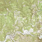
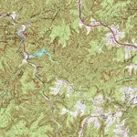
Beattyville and North through Crystal creek
BeattyvilleTOPO.jpg

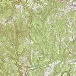
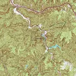
Lower Devils Creek off the North fork of KY River This is just South of Natural Bridge S.P. and Swift Camp Creek
LowerDevilsCreekTOPO.jpg

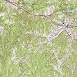
Campton is supposed to be where Swift made his camp and Swift Camp Creek runs North from there into the Red River Gorge. Notice how close Lower Devils Creek comes to Swift's Camp.
CamptonLDCreekTOPO.jpg

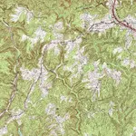
Just North West of the headwaters of LD Creek is Natural Bridge S.P. That is Mill Creek coming in on the top left (NW) of this map.
https://www.topoquest.com/map.php?l...nad83&zoom=8&map=auto&coord=d&mode=pan&size=m
LDCreek Mill Creek PineRidgeTOPO.jpg
The Middle fork of the Red River meanders North through Natural Bridge S.P. Up toward the Slade exit of the B.T.C. Mountain Pkwy.
https://www.topoquest.com/map.php?l...nad27&zoom=8&map=auto&coord=d&mode=pan&size=m
MillCreekNBSPTOPO.jpg

Natural Bridge S.P. Southern gateway into the RRGorge. A trace through here along the Middle fork of the Red River. Also a trace came up through Swift Camp Creek to the Red River.
NaturalBridgeSPTOPO.jpg

The Swift Camp Creek trace probably continued North up Indian Creek toward Frenchburg. The trace passing through Natural Bridge S.P. continued along the Middle fork of the Red River and Westward out of the mountains to the Indian Old Fields.
 

Last edited:
Looks like a great area !! For me not being familiar with it all , I'd be lost as to where to start without a map and legend/journal. Looks like lots of cliffs in the area to search out.
 

Bill Gibson, in the video I posted, said there was a boulder with or of silver on LD Creek. He went back for it and it was gone. He said someone must have used heavy equipment to remove it from where it was. Other reports from that area say that back in the early 1970s there was a lot of earth moving equipment used there. Where in the drain I don't know, I have yet to get into it and walk around. It was said they really tore up the place with excavators, back hoes and bulldozers. I'm not sure what is public and what is private from the maps. The popular carved rocks are either on private land of you have to go through private land to get to them. I'm guessing from the KY river North to where Indian Creek meets 460 is probably 25-30 miles. A life time of searching if you figure both sides of each drain and multiple levels of cliffs or ledges. Typically 3-4 ledges not counting the top as a ledge.
Remember the 'forks of the KY' is where Col. Harrod came to look for the Swift mines and lost his life. Lots of caves and around every turn are more nooks and crannies. Boomer said a number of iron pans and such were found on a drain called Boones Branch in this area, he said they came from FT Boonesboro down river to get salt there. Pretty historic area mine or no mine!
 

Last edited:
Looks like a great area !! For me not being familiar with it all , I'd be lost as to where to start without a map and legend/journal. Looks like lots of cliffs in the area to search out.

Mentally, I always start with Louisa, KY. To me that is the last 'known' journal entry as far as place of reference. From there things are broken, missing, vague and sometimes deceiving. That is why I say, find the traces and you can put the puzzle together and narrow your search. Maybe they followed Blaine into the Licking river valley then crossed over into the head waters of the Red, or went near Sandy Hook and turned North, or Southwest to Paint creek, or further on and found the headwaters of the KY river? Who knows...
 

Last edited:
One may never know and someone may be searching 250 yrs. from now who knows. I'm sure there are treasures that have been hunted for that long. I'll probably never make it down there to search, to much area to cover between here and there to be searched. lol
 

Top Member Reactions

Users who are viewing this thread

Back
Top