Navigation
Install the app
How to install the app on iOS
Follow along with the video below to see how to install our site as a web app on your home screen.
Note: This feature may not be available in some browsers.
More options
You are using an out of date browser. It may not display this or other websites correctly.
You should upgrade or use an alternative browser.
You should upgrade or use an alternative browser.
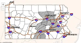
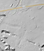
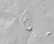
LIDAR Pennsylvania 2017
- Thread starter jeff of pa
- Start date
- Thread starter
- #2
Swaveab
Hero Member
Jeff, excuse my asking, but I'm having difficulty trying to see lidar images for Western Pa.. My eyesight isn't what it used to be making navigating this not so obvious to me so could you help me out and tell me what and where to go to to see this?
- Thread starter
- #4
Swaveab
Hero Member
OK, thanks for the effort.
doverturtle
Sr. Member
- Apr 23, 2010
- 378
- 222
- Detector(s) used
- Tesoro Tejon; Garrett AT Pro; Garrett Infinium; XP Deus; Minelab Excalibur 1000
Click on display imagery and scroll all the way to the bottom. There are several Lidar options available. I clicked on statewide and was able to view lidar images.
- Thread starter
- #7
Dah ! I Didn't see that the other day 
Loosin' My Mind ?
Thanks

Loosin' My Mind ?
Thanks

Swaveab
Hero Member
No left click working. Right click brings up some sort of yearly time line. the bottom of the map shows Advanced Download Options and hitting that brings up "List Files In Current Map Extent". Clicking on that gives me "Your view area is too large and will return too many image tiles. Please zoom in and try again." I can't do statewide as was indicated. I zoomed in and initially was able to select an area highlighted in yellow, but that's all I got. Maybe I should've hit download on that, but in trying to get to the same highlighted one again it brought up a 404 page. The site doesn't seem to be very user friendly.
Last edited:
doverturtle
Sr. Member
- Apr 23, 2010
- 378
- 222
- Detector(s) used
- Tesoro Tejon; Garrett AT Pro; Garrett Infinium; XP Deus; Minelab Excalibur 1000
I haven't had any issues with the site. Maybe try a different web browser.
Top Member Reactions
-
 3361
3361 -
 1907
1907 -
 1864
1864 -
 1153
1153 -
 1091
1091 -
 872
872 -
 853
853 -
 846
846 -
 835
835 -
 757
757 -
 755
755 -
 549
549 -
 527
527 -
 499
499 -
 442
442 -
 428
428 -
E
416
-
 402
402 -
 399
399 -
 392
392
Users who are viewing this thread
Total: 2 (members: 0, guests: 2)


