Kingsbury ferry mystery

Goldspeed

Full Member
Oct 13, 2016
114
165
Carolinas
Primary Interest:
All Treasure Hunting
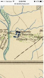
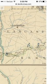
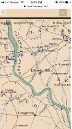
Has anyone found this place? It's as if it's vanished. It is clearly on Robert Mills Atlas as well as A few old civil war maps. I've read the union crossed here with much difficulty due to heavy rains and flooding. They camped nearby on both sides of the wateree. Kingsbury looks as if it may have been a small port town in heavy use before the railroad days. Liberty hill is just down the road and was one of the wealthiest cities in South Carolina before and during the civil war. The terrain is absolutely amazing and I can see why it was difficult on foot and with wagon trains. The area is rich with history and am hungry for more knowledge. Most of the area was pillaged and burned during the civil war. So I'm sure some amazing artifacts are around. I've done a little metal detecting but no major finds except a few clues. ImageUploadedByTreasureNet.com1531874198.346405.jpgImageUploadedByTreasureNet.com1531874232.204812.jpgImageUploadedByTreasureNet.com1531874272.645337.jpg
 

Upvote 0
Good Luck , I'd love to be close to that area.

I'd take down the Map. "IMO" only, nothing wrong with posting it as to get your point across.

The area could be flooded with more than rain. LOL

Best Wishes
Davers
 

I wouldn't wanna get in trouble over using it as research purposes. Curious. Flooded with more than rainwater? Like sewage? That's pretty gross if so. I've been out there and people fish and eat what they catch. Kinda scary. I looked at the terrain map and I found the old road and what appears to be a perfect ninety degree imprint. Maybe a house foundation.
 

Thank you for sharing! :occasion14:
 

I wouldn't wanna get in trouble over using it as research purposes. Curious. Flooded with more than rainwater? Like sewage? That's pretty gross if so. I've been out there and people fish and eat what they catch. Kinda scary. I looked at the terrain map and I found the old road and what appears to be a perfect ninety degree imprint. Maybe a house foundation.

No I meant 'Relic Hunters ' as sites are hard to come by these days.

I don't get my points across well cause i'm a terrible typist / writer.

From my experience Floods bring in trash & silt - making that trash deep ie, That 1980's Beer Can sounds like a Coin when it's at 1 - 2 feet deep.

I'd def, try to hunt the area or scout the ? house site & interesting looking areas.

Good luck
Davers
 

I've found the place using google maps terrain. Don't know exactly how I'll get there. But I can make out a perfect ninety degree angle on google maps. And it coincides with the locations of the older maps. It's way up on a hill. The terrain in this area is absolutely amazing. You feel as if you're in the mountains. Good news is it's not private property. It's actually public lands. Excited about cooler weather. Less snakes and bugs. And I go alone which is dangerous and a bit spooky at times. Just a few miles down is liberty hill South Carolina. It's got over 8000 acres of public land access. It was the wealthiest area in the early 1800's. Most of these grand plantation homes were burned to the ground by union troops.
 

Top Member Reactions

Users who are viewing this thread

Back
Top