Follow along with the video below to see how to install our site as a web app on your home screen.
Note: This feature may not be available in some browsers.
From Alexandria, Va. and going WEST, you would link with the GREAT WAGON ROAD (aka Indian Warriors Path) which is Rt. 11 in the Shenandoah Valley, TODAY. To get to Pound, Va. of the South West Virginia into Kentucky, "Wilderness Road" was used to get into Kentucky. MORE on these "old" Roads can be found by "googling" BUFFALO TRACE, listed by states.
The Moccasin Gap and the Pound Gap and several others were used by travelers long before the Cumberland Gap or the "Wilderness Road" cut by the Bryon Family and Daniel Boone. The Great Wagon Road from Pennsylvania to Old Salem, N.C. was cut by Rebecca Bryon's Family.
HOW did they get to Ft. Pitt...?
I googled 'Buffalo Trace' all I got were Bourbon links
Yes, Braddock's Road was cut to Ft. Pitt. from Alexandria. The problem I have with that route is all the mouths of creeks and rivers they would have to ford moving along the South bank of the Ohio River. The North bank had an Indian trace along it according to Indian trace maps of Ohio.
Harrod and his group came to KY via Ft. Pitt, they used raft like barges and used the natural flow of the Ohio River to take them along the same route but further down to the mouth of the KY river. They then took the KY upstream to a Buffalo trace/fording point near where Frankfort is and followed that trace to where they founded Ft. Harrod (Harrodsburg, KY). Swift does not mention boats/rafts/canoes at all, but the route taken by him is the same to the Sandy...
The Indian and Buffalo Traces are on the Jefferson and Fry Map as well as the Filson Map.
Here is a section of an article I was reading today. Remember this was several years before Boone blazed the trail through Cumberland gap.
The first migrants to cross the Appalachians soon discovered that the mountains were not the only obstacles to westward settlement. Other factors were the Native-American inhabitants and the ongoing dispute between the British and French governments as to who controlled this area. As such, the migrations of British colonists beyond the mountains was a principal cause of the French and Indian War (1754-1761).
After the war, migrants crossed the mountains in increasing numbers despite the British government's 1763 proclamation prohibiting settlement beyond the Appalachians. The British knew if the colonials continued their unrestrained encroachment upon Indian territory another Indian war would ensue, a situation they hoped to avoid. However, neither government prohibitions nor army blockades could stop the deluge of settlers that poured west after 1765. Separated by mountain ranges and hundreds of miles from the center of political authority in the East, migrants such as Daniel Boone, and John Sevier followed their own designs and ignored government policies that they deemed to be inconsistent with their interests. Other routes through the Appalachians were also discovered during this time, including the Cumberland Gap, which afforded migrants access to eastern Kentucky and Tennessee.
The 1763 proclamation didn't amount to nothing according to this article. People went exploring and looking for a new place to settle any how.
LOL!I googled 'Buffalo Trace' all I got were Bourbon links
https://www.encyclopediavirginia.org/media_player?mets_filename=evm00002619mets.xml
John Filson Map of Kentucky, 1784 :: Visual Materials
The major buffalo trace that basically made a loop of sorts through the bluegrass region and the warrior's path (north-south) were all I remember from those maps. Nothing in E.KY that crossed the creeks mentioned in VA. If they had to blaze a trail they would not have made the distance in the time mentioned of about 4 weeks. So looking for fords along the rivers getting to the Sandy is next...
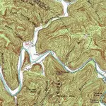
As an example, topo from 1968. Once a creek cuts to a solid rock bed it will not change for many years.
View attachment 1680386