Indian Waybill to the Swift Mines

Last edited:
Ki:

On the other hand I cannot help but always doubt everything anyone writes.

The Indian Way Bill is almost too exact, if he says go northeast 40 paces to another thing ..you go that direction and that many paces and you come to the thing he mentions, Its almost too perfect. Could an Indian remember this for a very long time and then write or dictate it to someone? Possible, as they did a lot of oral memory for keeping important things in the tribe/family. Why give it to a white family? He also could be a cover for someone finding a lot of Spanish/English coins. Some one that knew the area very well, and had obtained a lot of coins from a more questionable source.
 

KY hiker:
That could be,.... I was looking at them as being hollows or mountains..the other symbols are really curious as is the dotted/dashed lines that go to a hole. I often thought the dashes may be Spanish leagues or other measurement.

Map of Blackburn branch and Camp Branch off of Spaas Creek where Blackburn was buried and the ridge above Camp Branch was a large permanent Indian camp above Indian Creek.
https://www.topoquest.com/map.php?l...nad83&zoom=8&map=auto&coord=d&mode=pan&size=m

The dotted or dashed lines may be a standard of measurement for sure, maybe a pole fathem or league...or just a path or route?
 

Last edited:
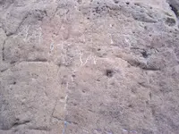
Tried to get to that site but I keeps saying try later. rock map maybe spainish2.jpg
 

good idea, already visited the book "of men and gold" by Steve Shafer looking for something that relates..am thinking Spanish but hey the French were within 30 miles of there in 1760s.
 

Top Member Reactions

Users who are viewing this thread

Back
Top