davin
Sr. Member
- Joined
- May 10, 2011
- Messages
- 326
- Reaction score
- 209
- Golden Thread
- 0
- Location
- north idaho
- Detector(s) used
- whites GMT
- Primary Interest:
- All Treasure Hunting
Paul,
Thought your posts were very even handed and without ambiguity.
I once sent a picture of a small stone head to Professor Michael Smith at the University of AZ. He answered that it looked like something "made in Mexico......
for tourist."
They are very good at that sort of thing, even to the point of creating aged patina. It's an art, and not necessarily without value. Not saying that's what BM has, but if not he should have it authenticated.
Hope to see you next month.
Take care,
Joe

A batch of Superstition gold. East side. One of Garman's old claims.

Sgtfda,
The photo(s) of the placer gold are truly impressive. I’ve found placer gold in the Superstitions but never in that quantity.
It’s really too bad the politics of the Dutchman community are what they are, otherwise we could have had some fairly interesting and rewarding conversations.
One of the few places I have seen some good indications of color is in Mill Site Canyon about a mile up from where Mill Site empties into Hewitt Canyon. Just past the Mill Site and Hewitt confluence a road runs up Mill Site on the right side of the canyon. Not quite a mile up that road begins some mining work and placer diggings. All the placer in Mill Site Canyon however does not appear to be down in the creek bottom.
Mill Site Canyon splits just above this area and if you take the left fork there are several mining sites and placer workings up to Quail Spring where a nice pool of water can be found for most of the year. Above Quail Spring Mill Site Canyon splits again and the terrain and canyon gets pretty rough.
This Mill Site canyon area is some of Robert Garman’s old workings although Garman contends he worked that area from around 1947, I believe he didn’t come on the scene there until the mid 1950's at the earliest.
Clarence O. Mitchell (Travis Marlowe) believed in the beginning the area of Hewitt and Mill Site Canyons was a key to the Stone Maps gold, mines, treasure. He had numerous conversations with Travis Tumlinson about that area and in 1954 Mitchell moved from Hawthorne, California to Apache Junction to be close to the Superstitions.
But Mitchell only stayed at AJ for a brief time. By 1956 he had moved to Queen Valley to be close to Hewitt, Mill Site, Robles, Rogers and Randolph canyons. Queen Valley is only a few miles from all those canyons.
Clarence Mitchell covered the area of Mill Site canyon from its mouth up canyon to past Quail Spring. He did not meet Robert Garman until about 1958, but was well aware that Travis Tumlinson, Wilbur Leasman and Phil Leasman had been working that area throughout the 1950’s.
There are several mining claims to the west of Mill Site over near Hardt Tank that “supposedly” are producing gold but I have been to those in the 1980’s and tried to help the owner. I know the original claim locator from his claims in the 1970's. I don't believe there is any significant mineral on those claims tho.
Matthew
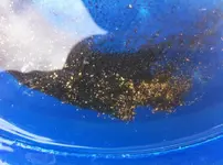
The pan with fine gold

The only reason you got gold out there was because of the Gold Witch!
Mike[/
True. She points and Woody and I dig. Though she tried to kill Woody and I. We survived. I strongly suspect she is a scam artist.


View attachment 1489892
sgtfda,
On the "Witch" map above it is clear the "Witch" is standing at a specific spot at the confluence of the Salt (Salina) and Gila Rivers which is located just southwest of Phoenix in today's Avondale.
This specific place is significant because it is the Gila-Salt Base Meridian point from which everything in Arizona is surveyed. The Gila-Salt meridian was first set in 1853 by the Barrett survey of the Southwest.
A monument was erected there and today that monument is still there and serves as the basis for every survey ever done in Arizona.
The "Witch is holding the cross right over that monument and pointing it to the east.
On this map the cross is not a cross at all in the religious sense but an "X" that represents the North-South and East-West points of the Gila-Salt Base Meridian monument.
View attachment 1489896
On this later version of the "Witch" map, the cross the "Witch" is holding has three lines extending from it.
One lines points to the place on Queen Creek where the "Peralta" Stone Maps were discovered.
A detailed map of the area beyond that Queen Creek point leads a person up into the Hewitt, Rogers, Millsite, Randolph canyon areas.
Another line from the cross points to the Salt and Verde River confluence. The Verde River on this map however is called "San Francisco".
Another line points up into the Four Peaks area.
My question has always been, were the additions to the map done to consolidate other information that was shown on separate maps that were relevant to this "Witch" map ?
The placement of the Witches hands holding the cross would have been VERY significant because anyone knowing where that monument that was set in 1853 was located would have had a perfect starting point to follow any specific directions they might have had.
Matthew
View attachment 1489973
The site of the Gila-Salt Meridian boundary marker set by Barrett in 1853 was not placed there by chance. There was a definite historical significance for his placing it there.
In 1939 Fr. Oblasser a Franciscan attempted to trace the route of Fr. Marco de Niza from Culican Mexico up into and through what is today's Maricopa and Pinal Counties Arizona.
He traced de Niza's route down the Gila River on the south side going through what is known today as Casa Grande, Blackwater, Sacaton, Komatke and to the confluence of the Gila and Salt Rivers.
There near the confluence he encountered a large community of Pima and erected a large monument of stones. de Niza crossed to the north side of the Salt River and continued up the Salt to Pueblo Grande and all the way to Pueblo Moroni where he crossed to the south side of the Salt and came down through present day Mesa. He continued on to the Salt River Mountains just south of today's Phoenix (South Mountain Park) where he inscribed his name and the expedition he was undertaking. From there he continued due south to the Gila River and followed it back up the Gila in the direction from which he had come and returned to Culican.
This large monument of stones erected by de Niza is what Barrett found and used as his starting point for the Gila-Salt Meridian boundary marker survey.
The inscription rock by de Niza in the Salt River Mountains has been studied by several archealogy departments and is believed to be authentic.
Fr. Oblasser's work established de Niza as having been one of the first if not the first white man to have seen the Salt-Gila confluence and the present day site of Phoenix and Mesa.
Matthew
View attachment 1489915
The Gila-Salt Base Meridian monument set in 1853 at the confluence of the Salt and Gila Rivers.
This photo shows the markers Base line looking east toward Apache Junction and Queen Valley.
If you follow this East line of the marker it falls about half way between Apache Junction and Queen Valley, almost on line with where the Peralta Stone Maps were discovered along Queen Creek.
Quite honestly Joe I thought my link might help BM date his find and give him a little more information about it as my assumption going in was that it was the real thing - I thought it was a pretty cool find. I didn't understand his response at all except I guess he thought I was making fun of his find which is 180 degrees from my intent. I often have a difficult time understanding when he's being serious as opposed to being sarcastic or trying to be humorous. Doesn't really matter now though.
I'll be there for the Rendezvous as well as a few days after to spend a few nights in the mountains alone renewing my spirit. See you then