SwampHunter
Sr. Member
- Mar 6, 2007
- 422
- 16
- Detector(s) used
- Minelab Xterra 70, Tesoro Silver uMax, Fisher 1265X, Garrett Ace 250, Garrett Pro Pointer
I am doing research on camp sites and battle sites in my area.
I have the description of a campsite from accounts from both sides. From the distance I know I am in the right area. The are however is large and there are several places a camp could be. The lay of the land is a high ridge(15 foot elevation above the rest) surrounded by low lands to the south and to west side. The ridge points towards the southwest at a sharp high point. There is a swampy lake to the southeast and a bay to the northwest. To the west just below the hill is a spur that comes off of the bay. To the south side and to the west side of the ridge there are OLD houses. No doubt that some of these houses were here back then. On the ridge leading to the northeast there is an old road. The whole ridge is no all farm land for as far as you can see. The bottom lands have tracts of timber and cane swamps.
At first I thought only a portion of the less than one thousand troops were Cavalry. I just found records that they were all Cavalry. They could still fit on this ground with no problem at all. There is lots of water for the horses and a gradually incline to take them down to the spur of the bay.
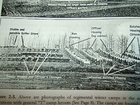
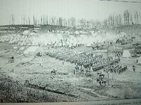
My question is were the horses and the men normally right beside each other? How far out would I need to look for relics? How much land does just shy of 1000 Calvary cover when camped out? There certain areas such as where old house places were that are really hot with iron and other metals. I have dug alot of the "other" metals and they all turn out to be junk.
How do you search a potential camp site where lots of other have been since the Cavalry camped here?
Any help is appreciated.
Thnaks!
Upvote
0


 ??
??

