Green Cabin wreck Location

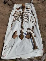
I met Barry Clifford at the Sedwick Coin Auction in Orlando last November. He had some interesting photographs like the Xray picture of a skeleton in a large concretion. There was a clump of silver coins like it was in a bag right next to the hip bone. Probably a pirate had it in his coat pocket. Cold water up there doesn't dissolve the bones like here in Florida.
 

Did the Spanish bury their dead? After a tragedy like this, bodies were obviously everywhere.

I'd say the bodies were more likely buried by the Spanish than any other possibility.

Any DNA would be interesting.
 

I met Barry Clifford at the Sedwick Coin Auction in Orlando last November. He had some interesting photographs like the Xray picture of a skeleton in a large concretion. There was a clump of silver coins like it was in a bag right next to the hip bone. Probably a pirate had it in his coat pocket. Cold water up there doesn't dissolve the bones like here in Florida.

Coat pocket, huh?

From Wiki: Captain Samuel Bellamy, now known as Black Bellamy, was well known to his contemporaries and chroniclers as a distinctive figure, a tall, strong, well-mannered and very tidy man. He liked expensive clothes, especially black coats.

I can't find that Bellamy was ever found. Maybe Barry has the Cap'n himself. How many pirates wore coats?
 

Last edited:
We never found any remains that even remotely suggested they might be from Bellamy.

WD
 

Hey Guys, how are you?

I was wondering if anyone had a "definitive" location/GPS for the Green cabin wreck on treasure coast.

I've looked at various books and maps but they all seem to have different locations that vary by more than a quarter mile. I know where the "scraggly tree is" which is where bob weller said the center of the wreck is, but then in the actual book it says that the wreck center is about 1000 feet south of Vero beach disney resort. The scraggly tree is MUCH further than 1000 ft south.

Also, i was wondering if there was any news on which ship the coins came from that were found directly behind disney in about 6 feet of water a few years ago.

They are 1715 coins, but there is no 1715 ship within a halfmile or more of that location. As i remember, they had 9 royales found which means that the coins came from a ship carrying treasure specifically for the king himself. Could there be another wreck undiscovered in that area?

Thanks

try this location:

WRECK NAME: Green Cabin Wreck 1618 (San Martin Almiranta of the Honduran fleet)
NEAREST CITY: North Beach, FL
BEACH ACCESS LOCATION: 27° 45.112' N 80° 23.396' W
BEACH ACCESS FOR GOOGLE MAPS: Wabasso Beach, Florida
DIRECTIONS FROM BEACH ACCESS LOCATION: Wreck site is approximately 3,990 feet southeast of the Wabasso Beach area. From the Wabasso Beach ramps to the beach turn right and go southeast down the beach to the wreck site.
APPROXIMATE BEACH HUNT LOCATION: 27°45'13.76"N, 80°23'27.60"W or this one (conflicting reports) 27 45.112N, 80 23.396W
WATER LOCATION OF WRECK: 27 45.250N , 80 23.326W
REPORTED FINDS: Spanish artifacts and coins

John
 

Half of The remaining 1715 fleet are yet to be found.Where are they ? Tacking hurricane paths for the last 300 years I would guess the remains of those ships & cargo are WAY North of Vero , and possibly N. of Cape Kennedy .
 

Half of The remaining 1715 fleet are yet to be found.Where are they ? Tacking hurricane paths for the last 300 years I would guess the remains of those ships & cargo are WAY North of Vero , and possibly N. of Cape Kennedy .

Well at least YOUR paying attention :)
 

Well at least YOUR paying attention :)

Look at a map of the east coast of America.Now look at that 'Hump of land' sticking out into the ocean( area we now call Cape Kennedy)......
Gold in a stream finds the low pressure zone of that stream to settle out in.....
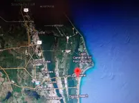
Those lost 1715 ships are just N. of Cape Kennedy (in that same low pressure zone) that hurricanes produced :) :tchest: 001.jpg Titusville to Daytona beach
 

Last edited:
Look at a map of the east coast of America.Now look at that 'Hump of land' sticking out into the ocean( area we now call Cape Kennedy)......
Gold in a stream finds the low pressure zone of that stream to settle out in.....
Those lost 1715 ships are just N. of Cape Kennedy (in that same low pressure zone) that hurricanes produced :) :tchest:View attachment 1754517 Titusville to Daytona beach

Two words...

Your close.

:)
 

Look at a map of the east coast of America.Now look at that 'Hump of land' sticking out into the ocean( area we now call Cape Kennedy)......
Gold in a stream finds the low pressure zone of that stream to settle out in.....
Those lost 1715 ships are just N. of Cape Kennedy (in that same low pressure zone) that hurricanes produced :) :tchest:View attachment 1754517 Titusville to Daytona beach


If this had happened today, the great whites would have a field day, we see them out on site all the time.
WD
White sharks are reported all the time by fisherman here , a mile out from Rudee Inlet. Humans aren’t a natural food source(yet). When an apex predatory is hungry they’re gonna eat! Regardless of what it is.

I don't like white sharks.
 

We have lots of them on the Whydah site, a swimmer died last year after being attacked just down the beach from us. The main reason for their increasing numbers is the abundance of seals, their favorite meal.


WD
 

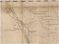
Always wondered what these ships were...........

View attachment 1755965

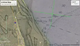
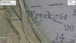
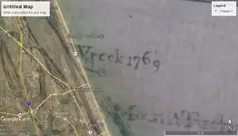
Playing around with google-earth... The cartography certainly wasnt up to geo-satellite standards but you can make some deductions and guesses and follow ground contours for educated guesses... The point of the cape probably wasnt there 3-400 years ago. Thats one of the big problems with old maps. Rivers shift, sand builds and cuts. A wreck on the beach then, could be hundreds of yards (or more) in the ocean, or cover by interstates and houses today.

wreck1.jpg

It looks like the southern wreck would be around pardon island

wreck1-2.jpg

It looks like the northern wreck would be about at Ormond beach. Anything interesting come out of those areas over the years?

wreck2.jpg
 

Nice, Jason. i love doing that in Google Earth. I wonder if anyone's ever explored that area for this wreck.
 

I find it fascinating that so many of the ships havent been found yet. The fact that so many of the ships managed to stay in a tight line through a hurricane that they all went to ground together is amazing. So if one group could do that, what about the others? Did they stay in a formation but were smart enough to stay in deeper water? Where were they in relation to the group that beached? So many questions, so much to speculate over.... storm eye location, storm path, ship location and decisions made, wind directions, sea currents.

Wish I had time and money to chase theories!
 

Nice, Jason. i love doing that in Google Earth. I wonder if anyone's ever explored that area for this wreck.

I see that the lower site is part of the canaveral national seashore so you can scratch that one off.
 

Top Member Reactions

Users who are viewing this thread

Latest Discussions

Back
Top