Gonzales' mina

I wish you great fun with a lot of mistery.

The thrill of the chase. Is what it's all about. H/p is my baby as people believe the maps are fake and lead to nothing. I believe the original maps I do believe we're Jesuit. All the Jesuit maps have me interested. I'm sure the Peraltas didn't know latin. The latin heart is an enigma that u can't get past. If I wanted treasure I'd be in NM or north of the salt. Knowledge is more is more the fun than getting rich. I got all I want or need, I'm rich with the family and friends I have already.
 

Last edited:
The thrill of the chase. Is what it's all about. H/p is my baby as people believe the maps are fake and lead to nothing. I believe the original maps I do believe we're Jesuit. All the Jesuit maps have me interested. I'm sure the Peraltas didn't know latin. The latin heart is an enigma that u can't get past. If I wanted treasure I'd be in NM or north of the salt. Knowledge is more is more the fun than getting rich. I got all I want or need, I'm rich with the family and friends I have already.
are you trying to say those maps are spanish or jesuit?:icon_scratch:
 

Clearly Irish with a hint of korean. Why they are so damn hard for everyone to solve...
because we all know who carved them and it sure wasn't spanish or jesuit....and they sure wern't carved 300 years ago...his entire surviving family testifies to travis carving the doorstops..not one of them that was interviewed said different...why is it so hard for you to comprehend that?
 

I had no idea Travis was Irish.....with a hint of Korean.
 

Hi everybody

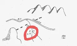
After decrypting some maps and tales , I came to the conclusion how the mine which is depicted in Gonzales map ( Charles Clark's version ) is the same with the Two Soldiers mine , Haywood mine , Salazar's survey mine , the black dot ( circle ) from the Cuenta del Oro map and John Carrol's mine from the Barry Storm publication .

The Gonzales map is a coded map and what you see depicted on it , represents only 50% from what the author wanted from you to see compared to the real landmarks and orientation of the range .

View attachment 1660876

Do you have actual pictures of the site that you can share?

I have a little bit different version of the map, and I was wondering what the cross is for? Unnamed Map.jpg
 

Do you have actual pictures of the site that you can share?

I have a little bit different version of the map, and I was wondering what the cross is for? View attachment 1906734

No , I don't have pictures of the site. The cross hasn't any significance because the map is a bad reproduction of the Charles Clark's map.
The map that i have posted in the post #1, is that which Clark had copied from the Gonzales original map. In the Clark's map, the map maker used two different treasures codes, which one of them to be available, prompts the line to cross at the base of the canyon's drawing. The other code ( an usual Peralta's code ) are the " X "s which if used in a proper math combination, give the degrees from the canyon's base to the mine.
 

Last edited:
No , I don't have pictures of the site. The cross hasn't any significance because the map is a bad reproduction of the Charles Clark's map.
The map that i have posted in the post #1, is that which Clark had copied from the Gonzales original map. In the Clark's map, the map maker used two different treasures codes, which one of them to be available, prompts the line to cross at the base of the canyon's drawing. The other code ( an usual Peralta's code ) are the " X "s which if used in a proper math combination, give the degrees from the canyon's base to the mine.

OH OK.
 

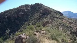
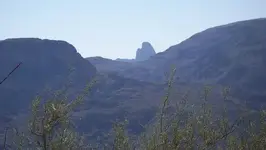
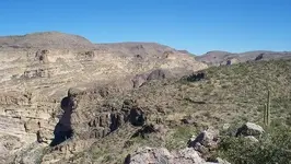
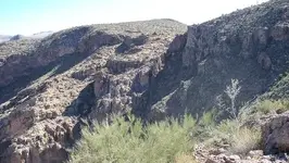
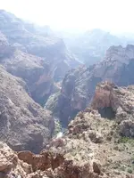
Some shots from the vicinity of Fish Creek Canyon, where "no name" canyon intersects....

High point at NW end of Coronado Mesa

100_0203.JPG

From the summit, looking south.

100_0205.JPG

From the summit, looking NNE.

100_0210a.JPG
 

From the same place as the 1st photo....also looking NNE.

100_0202.JPG

From an abandoned mine up high on the NE end of BCB.

100_0038.jpg

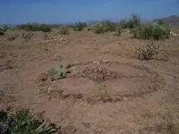
The Medicine Wheel, looking west.

100_0045 Medicine wheel.jpg

Another of the wheel, looking south.

View attachment 100_1610sm.bmp
 

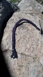
Something I found not far from the wheel.

100_0111 hooked staff.jpg

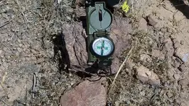
A compass heading on the bottom spoke.

100_0115.jpg

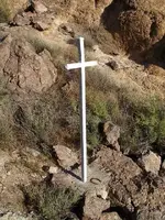
The white cross on Black Cross Butte.

100_0027.jpg

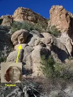
A rock about 100 ft. from the abandoned mine.

Picture_026 Yavapai anguish 2.jpg
 

Last edited:
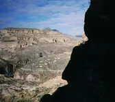
from a narrow ledge high on the NW face of BCB.....looking north.

horse_mesa_village.jpg
 

Last edited:
Wayne, thanks for the pictures, but seems you didn't read this thread from the beginning. Spanish/Mexican treasure maps are so tricky, that only after someone has been able to " read " them, can understand their supremacy.
I will give you three tips in form of a riddle, in regards to lead you little close to the solve of the Gonzales mapa:

- The Salt River was used in the map only for the first treasure code.
- The Canon Fresco don't start at the point the line is crossing it.
- Gonzales lied to Clark about at which Peralta camp he was.

You're quite welcome Marius. :occasion14:
I'm always happy to be able to share a few photos now and then.
And likewise, thanks to you for sharing your sagely superior knowledge and advice.......I'll keep it in mind whenever I'm out in the mountains.
 

Last edited:
You're quite welcome Marius. :occasion14:
I'm always happy to be able to share a few photos now and then.
And likewise, thanks to you for sharing your sagely superior knowledge and advice.......I'll keep it in mind whenever I'm out in the mountains.


Ahh I see your on game again but them must be pic’s not from today. Today their was so much dust in the air it sucked.

babymick1
 

Somehiker

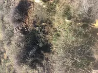
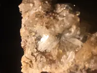
I did manage to hike in and grab a couple samples from another one of those pit mines you all talk about.

6EEE9687-4852-4D32-B107-56E2D36C2B5F.jpg


516128AE-2642-4377-B9D3-89AB6A1CF449.jpeg

babymick1
 

Top Member Reactions

Users who are viewing this thread

Back
Top