Down Time means Research Time. I can't stress this enough, the Finding is 80 to 85 percent of RESEARCH or Research is the VITAL CLUE to whatever your looking for. Gold and other Valuable Metals and Minerals are Mother Nature's Creations that are Geologically Connected and usually by Geography. FAULTS are what Geologists call "STRUCTURES", they are like what the old movie "The Maltese Falcon with Humphrey Bogart" are, "the things Dreams are made of". Study, do in-depth study of the Structures in the Gold Bearing Areas of your interest, Desert or Mountains. California is Cracked with multi-thousands of faults, structures. Visit a Seismic Museum to get the full perspective, they usually have lot's of maps and books. When you read or find a piece of Quartz, think about where it came from or how it became to be. Old Time Miners call Quartz "HOT ICE" for a Reason, wherever quartz is found, there's a fault close by in most cases. Of all of the Treasure Stories that you've read on Lost Gold Mines and alike, you could take a story and narrow it down just by finding the fault or structure in the neighborhood. The Kern River Canyon for the most part rides or cuts through a fault. The Dam of Isabella was built on top of a Fault, that's what has everybody up there nervous about. If you haven't been to the Museum in Kernville Alex, have your Dad take you, it's well WORTH IT. It will give you a greater perspective of that area along with the History and they have lot's of books and Maps and they are close to the Ranger Station and they also have Books and Maps. In my perspective, the Museums are better than the Internet ANY DAY OF THE WEEK. SHERWIN PASS is North of Kernville, that's where BRUSH CREEK is, there's Old Myths and Legends (with some supporting Fact) that the Old Mexican and Spanish Mined Gold up in that area back when California belonged to them. If I found Gold up there (which ofcourse I have) then you can too. It's the Road to Kennedy Meadows, there's MAGNIFICENT SLIDE FALLS (you can see from the road as your traveling to Kennedy Meadows), just past that point, look on the mountainside for a Faint Trail with rock supports, that's a Old Burro Trail built by the Mexican/Spanish Miners, there's Old Spanish Trail Signs and Symbols in that area and then there's also a Rural Campground a little farther up (Look for the Heliport at the Entrance). Cattleman and Miners and hordes of Old Abandoned Mines scatter the area. BIGFOOT !, Yes I mean SASQUATCH, has been sighted and recorded up there as well. The Old Timers up there know that area for the Giant WALNUT TREES that are found within the Campground area and the Trout Fishing ain't bad either, hee,hee.......Good Luck with Your Arm....Darrell
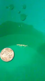
 ?? Does anyone get a gram in a whole day of work