Asmbandits
Bronze Member
- Mar 4, 2014
- 1,039
- 2,290
- Detector(s) used
- Fisher GB2, Bazooka Prospector 36", EZ sluice, Blue Bowl..
- Primary Interest:
- All Treasure Hunting
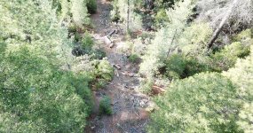
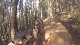
Im looking into a way to transport people to my claim via 4x4 vehicle. Currently there is only access by ohv single track trail that limits access to foot or motorcycles and atv but the trail is much to difficult for atv as there are some gnarly switchbacks that are so narrow and steep its almost impassable. This current route would be in passable width wide for sure in a 4x4 jeep or equivalent. I've always noticed a bald spot along the ridge that looks to be a straight shot down to the man made ohv crossing over the creek, I imagine at one time FS bulldozed straight down the ridge to this location and used during construction of the crossing.It is currently overgrown with shrubs and has some fallen trees to deal with but im thinking might be resurrect-able. The entrance has been blocked off by a mount of dirt forcing people to use the trail. Honestly I always knew it was there and didn't really pay it much mind until recently when I purchased a utv and would like to somehow get down to the creek with it allowing me to bring people in and out of the claim easily. At least half of both paths down are within my claim boundaries, all is US forest land.
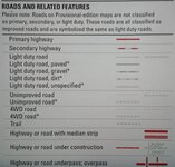
This fist map is a 1950's map courtesy of usgs, it shows what I believe is the road I am wanting to use and somewhat resurrect. You can see what is either marked as a trail or 4x4 road just below the number ten, this is the road in question.
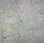
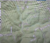
Here is a current map and the current route.
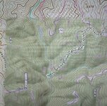
This third map I created and blended the two maps together best I could and it looks to be just as I remember seeing it. if all goes as planned soon ill be mapping the wanted road path with my drone, and hopefully if possible clearing the route enough to use.
I would like to know where I stand if I were to take it upon myself to make this route passable to access the claim. I believe it would only require some cutting of shrubs and moving some fallen trees. I would think that since its an existing road that I would be within my rights to do so given the circumstances. I wanted to run it by the crowd in case I'm missing something, last thing I want to do is ask the FS as I'm sure they would not be happy, but I feel I'm within my rights regardless here.
This fist map is a 1950's map courtesy of usgs, it shows what I believe is the road I am wanting to use and somewhat resurrect. You can see what is either marked as a trail or 4x4 road just below the number ten, this is the road in question.


Here is a current map and the current route.

This third map I created and blended the two maps together best I could and it looks to be just as I remember seeing it. if all goes as planned soon ill be mapping the wanted road path with my drone, and hopefully if possible clearing the route enough to use.

I would like to know where I stand if I were to take it upon myself to make this route passable to access the claim. I believe it would only require some cutting of shrubs and moving some fallen trees. I would think that since its an existing road that I would be within my rights to do so given the circumstances. I wanted to run it by the crowd in case I'm missing something, last thing I want to do is ask the FS as I'm sure they would not be happy, but I feel I'm within my rights regardless here.
Upvote
0


