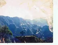
Dowsing

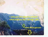
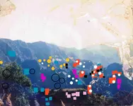
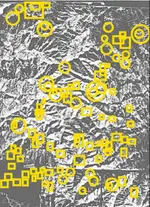
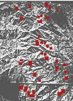
I get only one spot same place where red hit high.....that the only signal i get maybe if you had a picture that went a little more for the dowsers to work with (1).jpg down.
 

I did at first get a couple not marked here, that were high up also. So, maybe I thought those might be interference from the ones below.
 

I want to check, but need to take time out for supper right now.
 

There still can be more places. Some of these high up might be that way, because of mountains blocking the view.
 

Attachments

  • for the dowsers to work with-B.jpg
    for the dowsers to work with-B.jpg
    390.5 KB · Views: 96
Last edited:
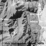
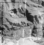
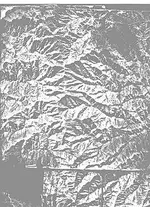
Makes sense now, map rotated to look east. The one emerald mine should be bottom 3rd at left side of map.
 

Attachments

  • Aerial-rotate.jpg
    Aerial-rotate.jpg
    72.8 KB · Views: 73
Last edited:
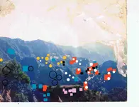
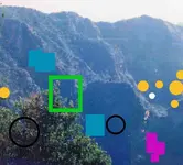
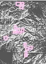
I guess I'd got tired of marking spots. Was a couple more hits would have marked except the map getting cluttered made me stop. So, here are the ones for where I'd stopped marking.....not much, see if makes any difference.
 

Attachments

  • for the dowsers to work with-B2.jpg
    for the dowsers to work with-B2.jpg
    376.2 KB · Views: 92
  • for the dowsers to work with-B2crop.jpg
    for the dowsers to work with-B2crop.jpg
    80.2 KB · Views: 89
Last edited:
REd the are all hot spots. But you haven't hit the point of interest yet. Yer doing a fantastic job though.. I think you begin to see why te Jesuits kept it quiet and worked it on the qt. It was considered the richest mine in North America.

I must admit that with so many hot points it must be interfering with each other, in other words the background is alive.

More if you want to work some more?
 

Last edited:
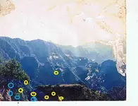
Blue is Silver hit's......yellow is Gold hit's,for the dowsers to work with.jpg these are not hot spot's,it's rich.
 

This is the ONLY Rich "Natural Gold" spot in these mountains.. this Gold sector-1(where the black arrow points) starts at 12.5 meters deep, it is 10 meters long, 2 meters wide, 1.5 meter thick.. Then underneath, at 15.5 meters deep, starts Gold Sector-2, it is 8 meters long, 2 meters wide, 2 meters thick
 

Attachments

  • PicsArt_04-30-07.23.13.jpg
    PicsArt_04-30-07.23.13.jpg
    19.1 KB · Views: 144
Last edited:
ALhit, that is an unknown area, further down at the 900 ft leve (as measured on the Eastern cliff side,there are two enormus Silver deposits, they stoped out an area some 200 meters at the 900 ft level and again at the 600 ft level. They are interconnected.

Your zone sonds quite interesting. Gracias

Oops, I just realized that you could be pointing to the other side of that ridge,. That is where the Paramo AU placer is.
 

Last edited:
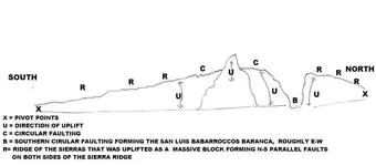
AZ, you are correct. tis a rich zone. There are pictures of it on this forum, and thisdoesn't include the oter side of the Intrusion or the Upliftig which created two paralell faults on each side ot the sierra ridge for some kilometers. Have fun with this .

FN S aults paralell to the  crestof the mt range.JPGpostulation.JPG.
 

Last edited:
Yellow is for native gold.
 

Attachments

  • FN S aults paralell to the  crestof the mt range.JPG
    FN S aults paralell to the crestof the mt range.JPG
    164.4 KB · Views: 85
This is yet other types of search method.
 

Attachments

  • FN S aults paralell to the  crestof the mt range-B.JPG
    FN S aults paralell to the crestof the mt range-B.JPG
    152.2 KB · Views: 78
  • FN S aults paralell to the  crestof the mt range-C.JPG
    FN S aults paralell to the crestof the mt range-C.JPG
    148.7 KB · Views: 70
Last edited:
Red the usual for your efforts. On the right side it is in Sonora, Part of he faulting produced the richest Au placer n Mexico, unknown today. Also there is a mining vilage called 'Espobachi' in the upper sierrra,Which is included in the picture.

Can you locate the village ?
 

Last edited:

Top Member Reactions

Users who are viewing this thread

Latest Discussions

Back
Top