Dowsing request

Attachments

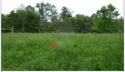
  • TNET COINS 5-morbiusandneo.jpg
    TNET COINS 5-morbiusandneo.jpg
    124.2 KB · Views: 74
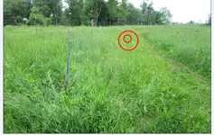
  • TNET COINS 6-morbiusandneo.jpg
    TNET COINS 6-morbiusandneo.jpg
    158.4 KB · Views: 71
Last edited:
I don't know what #5 an #6 mean.

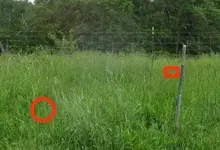
But, yes the photos overlap. You can see the shovel handle sticking up, which was not moved in both photos.
That was on the file names TNET COINS 5 and TNET COINS 6.
 

I had checked for deeper signals, found one past the shovel handle, then decided it must not be important. Are there any pipelines or other similar anomalies close to the shovel? Or even dug holes?
 

Thanks RED!!

Looks like my partner was standing right on top of your first dowse location when taking the second pic with the shovel in it!! LMAO!!

Question: No gold signal for this dowse? Just a general dowse for "valuables" or something like that?
 

Last edited:
RED,
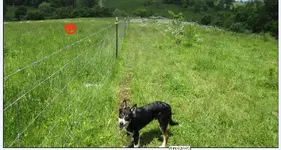
Could be past dug holes by partner yes. No reason for pipes, buildings are very far away. That fenceline is the top if a hill, that slopes down like 300-400 feet to a creek from the fenceline. Used as grazing pasture for cows, and horses over the years.
 

There it is, even if not important.
 

Attachments

  • TNET COINS 5-morbiusandneocrop.jpg
    TNET COINS 5-morbiusandneocrop.jpg
    20.5 KB · Views: 103
Here is another place to check, I'd detect first to see if loose surface coins or relics.
 

Attachments

  • TNET COINS 4-morbiusandneo.jpg
    TNET COINS 4-morbiusandneo.jpg
    141.3 KB · Views: 81

Ripper, we found a large iron ring, maybe from a barrel, exactly at your spot(!!) with the T808 deep seeker.
Went all around 50-60 feet with it,and no other hits, then did the same with the Ace250.

So, dowsing works, but it was not gold, but iron.

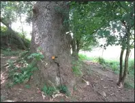
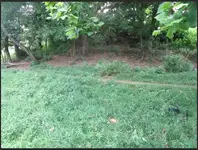
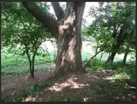
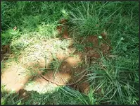
TNET RIPPER 1.jpg

TNET RIPPER 2.jpg

TNET RIPPER 3.jpg

TNET RIPPER 4 ring.jpg

Chose to do this spot because it was EXTREMELY hot & humid, and it was very shady for this target. HOT summer sun!!
Thanks for your time & effort Ripper!!
 

There is a simple or you could say gold only signal, in this map section here.

RED DESERT!! (Sorry, only one image was sent to me)

DOWSING works!! One of my partners found your dowsed target -->EXACTLY where you marked above today. I will let him tell you exactly:

"This was an easy find. I went up to the quartz rock (I think it is granite rock) and lined it up with that big tree behind it. See the photo. Then I walked away from it toward the treeline, at the same angle. I scanned a very large area with the 808 and right in what seemed to be the bullseye, was a lovely mangled aluminum hubcap or pail. It was hard to determine what it used to be. It was located exactly in what seemed to be the target. I kicked it aside and continued to scan the entire area.

I probably scanned a 50' circle. I feel like I was thorough. It was hot. I could go back and do it again if you think I should. This Red Desert is very accurate with his dowses so far, but... no gold :) No need to tell him that though, right? This is just training for me anyway. I don't mind.
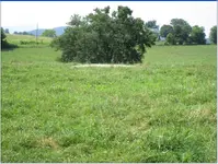
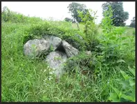

Tomorrow, I will check out Art's art, and then I will check out Okie's site. Okie Dokie??"

The adventure continues!!!

TNET red desert 1.jpg
 

Last edited:
Let's see what is located next time. Thanks for your time and efforts. I appreciate it. I am positive, upbeat and hopeful, because several respected and well known dowsers gave their time and efforts to help us with our project telling us they believe that there is gold coins in the area.

I send you a PrivateMessage
 

Okie,

WITH 1000% RESPECT to you and every dowser here, I wrote this because I am ignorant. You mentioned "rings" to me, which I have ZERO understanding what that is. This is why I said dowsing baffles me so much!! I DO NOT understand what rings is/are.
I in no way, shape nor form was ever implying you are a liar. I am a simple idiot TRYING to learn, and asking for help.
I am SO grateful for your help and anybody else that takes time and effort to help me, ALWAYS!! PLEAsE do not throw this BABY out with the bathwater!! I AM a BABY!! WITH dowsing this is what I meant!! I have been dowsing for many years, and it just makes me complex because the more the years go by the more I realize that I don't know ****!! I get signals I dont understand. I NEED HELP. My sincere and most humble apologies for my causing you distress!! I NEVER MEANT TO DO THAT EVER!!

Thanks Okie!! Seems your location moved a couple hundred feet from your original dowse. You are now right about right where Art located it after a blow-up image, too. The more I learn about dowsing the more it baffles me!! lol.
 

This message was directed to you OKIE, and to ALL that are so GRACIOUS to help a simple idiot like me in my quest. Respectfully,
Steven.

Let's see what is located next time. Thanks for your time and efforts. I appreciate it. I am positive, upbeat and hopeful, because several respected and well known dowsers gave their time and efforts to help us with our project telling us they believe that there is gold coins in the area.
 

Kindly reply.

Us people which believe in dowsing must stick together. This is what I feel strongly. We are rare and must help one another, because so many haters , well HATE us for what we believe is true and factual. Understanding takes time, patience and belief, which as we know is the key. It is NOT the "placebo" effect! SPAIN did NOT grow wealthy in the 15-18th century on placebo effects!!
 

Last edited:
Stay tuned here. I have a big post to make here tonight.
 

*THIS LOCATION IS ART's-aarthrj3811 AND OKIEDOWSER's DOWSED LOCATION.* (PHOTOS)

We need the pictures dowsed, please. Here is the information I received from my partner:

"The tree line was easy to find, however the "clay patch" in the satellite photo was harder to pin down because this turns out to be a cattle crossing, one of many; There were about 6-7 of these along this tree line with a very small spring fed creek, also. I chose what I thought to be this clay patch, did the measurements, and it was all wrong. So I walked up the tree line a little further and decided I had chosen one cattle crossing too soon. The one I believe to be the visual one was one more up the creek, probably about 40-50 feet further up. I was freakin' hot and I didn't want to do the measurements again with the compass, so... when I did the visual measurements, I found a rock pile. It seemed to be precisely where Art indicated, but I may be wrong. I took photos for him to check, and I can go back out there and re-do the measurements again, using the second cattle crossing, which I think is the correct one. It was super-hot and I was sweating profusely.

Instead of doing the measurements... I just got out the detectors and started scanning the rock pile. They both gave me hits, but they were inconsistent and I was not sure if it was reading the rock minerals or if there was something deeper. The garrett repeatedly said 8" plus each time, meaning maybe the cache is too deep for it? the 808 gave me a more intensive signal each time I passed it over but it was kind of weak too. I don't know.


I think we should show these pics to Art. I know it is very close to his target.


Here are descriptions of the photos:


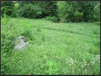
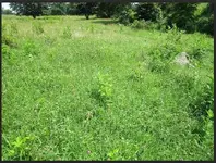
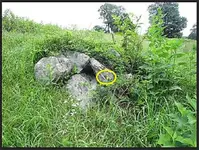
6049: The rock pile. Visually, I believe this to be in the light blue box from this second clay cattle crossing which shows up on the satellite photo. I can go back and measure it, but it is going to be very close to your measurements.
TNET ART 1.jpg


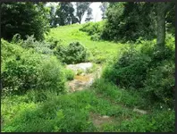
6051: This is the clay cattle crossing which shows up in the satellite photo (I believe). This angle is looking back at it from near the rock pile. The rock pile is on the left in the photo.
TNET ART 2.jpg


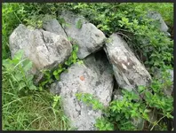
6052: Note the animal rubbings on this rock pile. The cattle and deer use this rock pile to scratch themselves.
TNET ART 3.jpg


6054: This photo is just a closer look at the clay cattle crossing. From the direction of the rock pile, which is behind me and not shown in this photo.

TNET ART 4.jpg
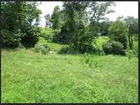
6055: This is a scope photo showing the cattle crossing and the rock pile is to the far right below those tall weeds.

TNET ART 5.jpg
6066: This is another scope photo with the rock pile on the right.
TNET ART 6.jpg


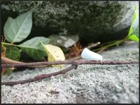
6067: This photo is just for fun. This little "fairy" moth flew out of the brambles after two strikes of my shovel when I started chopping down the greenbriars and poison ivy which were growing out of the rock pile. Her wings look more like skin than powdery wings :-)
TNET ART 7.jpg


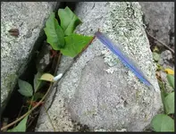
6068: This photo is just for fun. This is the blue jay feather that flew out of the rocks after my first strike of the shovel. So I took a photo of both!! What does it mean? I don't know!
TNET ART 8.jpg


I have more scope photos if needed."


So Gentlemen!!!
This looks to me like a marker "hiding in plain sight" - this pile of stones. I am really excited about this!!!

I look forward to your dowses ART & OKIE of these newest pictures from today!! Thank You BOTH so very much!!
 

Last edited:
Here the first place i'll look,i check the other picture's and see if i get another hit.TNET ART 1.jpg
 

Thanks OKIE!! This is INCREDIBLE!!! You guys are amazing!!
(I'm so excited I am gonna wet myself!! LOL.)
 

It is not unusual for the target to move when you post a smaller version. On some larger maps I have been up to 300 feet off. 300 foot is not bad when you are using Dowsing rods.
 

Top Member Reactions

Users who are viewing this thread

Back
Top