Detecting American river at Salmon Falls

The devil is in the details Goldwasher.

Try using the Land Matters California Land Status Map and look closer. The government provided Land Management files we use to build that layer aren't super accurate but you will notice if you zoom in that the river itself is not shown as within the BLM land. That should tip you off that you need to look closer.

The first step to looking closer is to turn on the Master Title Plat (MTP) layer and click to download the MTP for 11N 9E. These are the status maps that the Federal government uses to layout the status of all the lands they manage and to show the patents for the lands they don't manage. These maps can be hard to read because they don't show many of the features of the land that we normally use to find our bearings.

Look at the area in Section 21 to get a simplified idea of the issue here. See that dotted line? Notice that the dotted line is west of the solid line? The solid line is the private boundary of the river course and the dotted line is the extent of the BLM land management. Just like the map when you zoom in the BLM land does not include the river.

See that area to the East of the dotted BLM line? It's marked with nothing but the number 4. That number 4 is the Patent number for that private land (very old patent). You can look up California Patent 4 at the General Land Office (GLO). That Patent will describe the exact area of the patent in metes and bounds. Now look at the BLM portion west of the river. See how the arrow indicates it's CACA 25889 P4 Recon US All Min? That is the pointer to the BLM Serial number that describes how P4 is part 4 of the reconveyance of that portion of the Patented land back to the United States. Look up that CACA 25889 number in the Serial Register page at the LR2000 and you will find some of the details and restrictions of that transaction. More details of that transaction will be found at the GLO under the CDI and Historical Index.

As you can see the Feds don't make this easy. If you think that was tough to understand try looking at Section 10 on the MTP where it looks like the whole section is hunky dory go prospect your azz off land on the overall Land Management layer. Once you work your way through understanding whats going on there give me a call. I could use some people that can research land status on that level. :thumbsup:

That GLO/LR2000 back and forth thing can be a nightmare even for experienced land status researchers. We are close to providing Patents, CDI, Surveys and Historical Indexes with a click on the Land Matters Maps to help save you the time and frustration searching multiple government data sites. That's high on our long list of new research tools but we're going to need more than a little time to get that done. We all have to make a living in the meantime just like you.

Now that you have met the devil I will tell you that I see a few very small areas that might be legally prospected - if you can legally get there. That might be is in those devilish details. Those details really don't leave room for broad statements like "you can metal detect above the bridge" or "you can't metal detect west of 49". It's really just not that simple.

Heavy Pans
 

Last edited:
Got it....kind of.....so if the rafters raft the river and have ingress egress....to the bathrooms down on blm....who owns the river?...I'm on my phone so I can't really do any back and forth at the moment....I was trying to use the info tool...getting better. But it also sounds like I wasn't zoomed enough...I was on tha Ca. Land status page.... I didn't see dots or dashes... I'm sure I'll see it when I look but how do I " turn on" the mtp?..... And like I said blm...says...PAN HERE!!!! AND THE land looks the same.....so when I get home tonight and am looking at this stuff...what are the dashes vs. Solid lines....the property from the other side carries over ?...I'll look into this evening...Thanks for the help!
 

After reading some of these posts, I'm confused, ASRA allows sluicing,Panning,detecting, no dredging,and they get a little miffed it you leave your area in a shambles ie; boulders upended leaving large depressions,unfilled holes.

This is where the ASRA ends. They have no right under their management agreement to permit or prevent those activities.

From Part 12 b 6 page 36 of the ASRA management agreement:

The State is not granted authority to issue special use permits or other
types of authorizations related to the following activities as identified in 43 CFR
429.3 Grazing, farming or agricultural uses; Infrastructure including
transportation, telecommunications, utilities, pipelines; Removal or exploration
of sand, gravel or other minerals
; or timber harvesting.

Those rangers don't have any right to control, permit or prevent prospecting. Add to that the fact that most of those lands are private or BLM and you've got management by threat and fear only. These guys are rent a cops with swollen egos when it comes to prospecting.

Heavy Pans
 

Got it....kind of.....so if the rafters raft the river and have ingress egress....to the bathrooms down on blm....who owns the river?...I'm on my phone so I can't really do any back and forth at the moment....I was trying to use the info tool...getting better. But it also sounds like I wasn't zoomed enough...I was on tha Ca. Land status page.... I didn't see dots or dashes... I'm sure I'll see it when I look but how do I " turn on" the mtp?..... And like I said blm...says...PAN HERE!!!! AND THE land looks the same.....so when I get home tonight and am looking at this stuff...what are the dashes vs. Solid lines....the property from the other side carries over ?...I'll look into this evening...Thanks for the help!

The water in the river is owned by the people of the State of California. The bed of the river is owned by whoever owns the land. The State holds the water in trust for the beneficial users. Everyone has the right to passage (travel) on the rivers.

The MTPs are in a download link when you use the [i] information tool with the Master Title Plat turned on. You won't see them displayed on the map except some areas of Alaska.

Not very convenient but that's the government. Land Matters is the only place where you can find most State's MTP downloads on a map. Finding a specific MTP in any other manner is usually a nightmare.

In California they use JP2 image format for the MTPs. Some States use PDF others use JPG and some States are only available from the General Land Office - then there's Utah...

Welcome to my world. :laughing7:

The Serial Register for that BLM reconveyed land around Section 21 has a note at the top of the legal land description:
PORTION OF W2 LYING WEST OF THE SOUTH FORK OF THE AMERICAN RIVER

The legal description "SOUTH FORK OF THE AMERICAN RIVER" includes the bed and the banks. The BLM managed land lies West of there. By their own description they don't have management authority over the river. The fact that they are telling you it's OK to prospect private land isn't new or unusual. Much like the ASRA managers they can't be held liable for giving you bad information.

It all comes back to the fact that only the prospector has the legal duty to DYODD - Do Your Own Due Diligence.

Heavy Pans
 

Last edited:
Getting back on track, I am sure metal detecting is illegal at the location specific to this thread. I once saw a guy using one right down from the parking but he did not seem to worried about rangers i guess.

Regarding tools, I have no moral issues sluicing and using hand tools in the area.
 

Getting back on track. Let's be clear here. The question was:

Can anyone tell me if detecting here upstream is legal.

The simple answer is - no, you can not legally prospect by any method on the river above Salmon Fall bridge without the permission of the landowner. The land in question on the river is private property. The south half of Section 30 further upriver is prospectable and then you are back to private land upstream from there.

I'm not the prospecting nanny. Many people have different morals. Some people believe that if the other guy did it then it's moral. Others believe that if they don't get caught then it's moral. So be it. I answered the question as asked. It's up to each individual to choose their path from there.

Salmon Falls and the river above it is not my property. It's not the ASRA property, it's not the BLM property and it's not a State Park.

Curiously no one has bothered to ask who's property it is. ???

Heavy Pans
 

Last edited:
I was gonna but figured I would try to look first :)....dinners ready I just finished putting skulls on pikes and building a graveyard give me a minute Barry sheesh
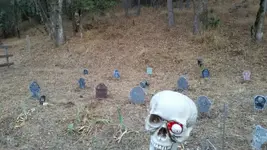
 

I was gonna but figured I would try to look first :)....dinners ready I just finished putting skulls on pikes and building a graveyard give me a minute Barry sheesh

Yeah I gotta go shoot a couple of dingos and burn their flesh too. Enjoy your meal the answer isn't going to change anytime soon. :laughing7:

Heavy Pans
 

Clay thanks for all the help. I was able to download the plat file but it is encoded in JP2 and need to find a viewer for it. Will continue once I have that.
 

; )...not dingo flesh but.............
 

Attachments

  • 1444010813600.webp
    1444010813600.webp
    111.3 KB · Views: 93
Above the bridge until where the lake boundary ends is open to prospecting.
 

ok...well I figured out how to turn the mtp on...duh :] And of course even though I have downloaded many pdf adobe whatevers this one isn't. I honestly didn't realize that on several maps I have that there is more going on within shaded and supposedly designated areas...I am pretty sure Joe is ok though as the area he hits is within BLM that covers both banks...and is not claimed. Barry whats up with BOR? I do know about the houses across from what we call Gorilla Rock...and know people who prospect there with owner permission. So if the river and bed is owned but we source material from BLM...which we do for sure according to the boundaries I see...are we not allowed to sluice or pan in the river? beneficial use?.....Is it ARC that "owns" the land....or the southern bank properties? I have heard from numerous people that property goes to the middle of the river in El Do. county..I heard...and have never been able to confirm.. Now I have to make my laptop jive with these file it may be quick maybe not...I promise you however Barry and I know I speak for Joe too that we truly looked and believed based on the info we could gather...and I am not lazy on trying to determine these things, that we were all goo. It does appear that we have been in an open area. in fact I have met and spoke with a guy that owns property near skunk hallow, he is a customer and was in the shop. he described his property and the adjoining blm as I believed it to be. I'm glad you pointed out that it goes deeper and am trying to use the tools provided. Any info you can offer without shaming us and our lack of further investigation is greatly appreciated....go team BURLAP:laughing7:
 

You were right I was wrong Goldwasher. A portion of 11N 9E Section 30 on the American River is BLM managed.

You did your Due Diligence. I know you would never trespass on purpose, I never doubted that. I just overlooked that corner of the MTP. Definitely my bad, I apologize, and just another example of why you DYODD rather than take someones word - even mine.

The BOR "lands" are a management overlay like the ASRA, your School District or a Fire District. Just like the ASRA, School District or Fire District the BOR doesn't own or even manage the lands but they do have some limited authority to control water features in their water management district. The lands the BOR sits over in that area are privately owned as shown on the MTP.

Heavy Pans
 

Cool....I didn't install a reader yet...but I will be checking it out soon. Especially now that I better know how to access it..You may get something in your inbox ...and there may be a little more here. Again and I know I speak for more than myself THANK YOU. For your effort and patience! !!!!!!
 

Above the bridge until where the lake boundary ends is open to prospecting.

The Southern portion of Section 30 is open to prospecting (thanks Goldwasher). Above the bridge and all of Section 25 is all private land or ROW. The patent was granted in 1862 and is still in effect.

Heavy Pans
 

Stay in the city. You don't belong out there AND your not welcome...if it's not privately owned by a US citizen or claimed by one I will do as I please. If there are consequences with ranger Rick, I'll deal with it at that time. I've been through way to much in my life to be scared about some perceived threat of a fine or jail time. The government is good at coming with rules but doesn't have the cash to enforce them so that there problem. That being said, I would however respect a citizens private property or mineral caim. I know that's gonna rub some of you the wrong way but... I'm okay with that ;)

I'm sick of seeing millions of gallons of water minipulated in a drought so people can ride down in a raft because it generates tax dollars but anything that doesn't generate $ for the man is a problem.... F that. We need to take this country BACK.
 

Last edited:
Stay in the city? Who's in the city? What city? Scared? What threat of fine or jail time? Are we on the same thread?

Ranger Rick in the Folsom SRA has the same restrictions as Ranger Ron in the Auburn SRA.

From the Folsom SRA Management agreement:

The State is not granted authority to issue special use permits or other
types of authorizations related to the following activities as identified in 43 CFR
429.3 Grazing, farming or agricultural uses; Infrastructure including
transportation, telecommunications, utilities, pipelines; Removal or exploration
of sand, gravel or other minerals
; or timber harvesting.

Look familiar? Ranger Rick doesn't have any more authority to restrict prospecting than you do.

I think you might be surprised how often your attitude is supported by the laws and regulation. Lose the attitude and get educated. It's not about fear it's about knowledge. Knowledge is power.

Educate yourself and prosper! :thumbsup:

Heavy Pans
 

What clay is referring to is privately owned...and your attitude is not gonna help...and going rogue just blows,it for the guys like me who make every attempt to stay legal.....you are in fact giving country away if you do thing as suggested. ..FYI the special use permits, fees for rafting mainly go to the county and isn't a lot...and companies pay a lot for insurance etcetera...if you belive the Government is manipulating for the sake of the rafters bottom line or c the county coffers you must not know how much per head per boat goes to county and state fees vs. Overhead...its,hard to run a business and build up revenue when you are only open five or six months.....the raft companies have NOTHING to do with any of this land status stuff...don't let your self get distracted and lose focus from a real issue by blaming it on a non issue
 

Last edited:

Top Member Reactions

Users who are viewing this thread

Back
Top Bottom