Cache Creek Colorado

I'm told it's a lot less crowded these days as the main source of water has been redirected by an upstream landowner. There is definitely still gold to be found but you may have to carry paydirt further to your sluice... That said, there are certainly other places to prospect here in CO as well. Near Cache Creek is Point Bar Rec Area on the Arkansas River. Info on the BLM website.
 

KevinInColorado Is there still enough water to sluice at cache? And do you know anything about Prospecting on Clear Creek, the one that flows from Winfield Ghost Town into the Arkansas River?
 

Last edited:
KevinInColorado Is there still enough water to sluice at cache? And do you know anything about Prospecting on Clear Creek, the one that flows from Winfield Ghost Town into the Arkansas River?
As of now there's enough but hard to predict. Don't know about the other spot you are talking about, sorry. Can you give coordinates or PM details to me so I can check?
 

KevinInColorado,
It's headwaters are around Virginia Peak, and it flows into the Clear Creek Reservoir, not the Arkansas River, my mistake. It is just south of Cache Creek.
 

KevinInColorado, It's headwaters are around Virginia Peak, and it flows into the Clear Creek Reservoir, not the Arkansas River, my mistake. It is just south of Cache Creek.
Ah right, that area is of interest but I don't have any personal experience or stories from friends to relay. I do know there's old placer workings in that area though so that's encouraging. Just be as sure as you can that the land you are on is open to your prospecting. That area is in Chaffee County so you can identify property ownership via the Chaffee County Assessor's website which includes a nice interactive map(!) which shows property boundaries and gives contact info for owners. When using the interactive map, be sure to check the box on the left for "Lakes and Rivers" so you can see Clear Creek reservoir easily. Of course if the landowner is United States of America then check the county clerk in Salida to see if there are current mining claims to avoid.

PS to find the interactive map:
1. Google Chaffee county assessor
2. On their site, choose Search Assessor Database
3. Click to accept their disclaimer
4. Choose Search by Map
5. Have fun with the cool interactive map tool!
 

Last edited:
KevinInColorado
Thanks! I'll see if I cant find some gold there in when I go.
 

Ive spent some time there found my first nugget on clear creek, above the reservoir, cache creek was dry and posted signs every where, dont think cache creek ever carried that much water because there's only a culvert going under the road, the dam on clear creek is right beside the road, and a pretty good bridge under the road to the river, i found gold where water spilled out of the culvert on the river side of cache creek, but got ran off, the old man came upon me at about 1pm and politely told me it was a private claim, he said looks you got a pretty good spot there, you can stay today but dont come back tomorrow, we visited awhile and he told me to come take a look at his operation anytime, i went to what i thought was his camp a couple of days later and the people there didnt know who or what i was talking about but let me look around, there was an old wooden sluice that ran about 7 miles down the river through what they called the gorge. this has been 30 years ago i went there in late march, still real cold up that high camped above the reservoir right next to the creek, by an old cottenwood tree that had fallen during the winter, cut it up for firewood the next few weeks, and dug the dirt off the roots and panned it thats where i found the nugget, about three grains, still got it some where, also found good gold in the hole where the tree used to be, the tailing piles around the old mines in leadville are great for rock hunting, leadville is the highest city in the united states, good gold all up and down the arkansas river gpaa has a good claim there, buena vista has a bridge across the river, go across the river and take a right about a mile down you will come to a hill fairly close to the river and you can see the diggings up high where people have dug caves back into the hill looking for garnets, they call it ruby mountain, there are numerous apache tears down low and up high the garnets are beautiful right when you dig them but turn kindly brown after they have been in the air for awhile, i used to take vials with glycerine oil with me and drop them in as soon as i dug them to preserve them, you used to could camp free here but that was 30 years ago. i'll try to remember more and get back
 

That's awesome BIGSCOTT! So if cache creek is dry Clear Creek is a good place to go then? The Arkansas River probably is the next best bet. Although I do prefer smaller creeks, the Arkansas river should be another good backup. So there is gold on clear creek! I'll post about my trip when I get back. Still 3 months though. meh.
 

View attachment 1022983View attachment 1022971View attachment 1022981View attachment 1022982View attachment 1022969View attachment 1022981View attachment 1022982View attachment 1022983QUOTE=Sluiceguy42;4036336]KevinInColorado,
It's headwaters are around Virginia Peak, and it flows into the Clear Creek Reservoir, not the Arkansas River, my mistake. It is just south of Cache Creek.[/QUOTE]

Where the creek flows into the Arkansas is claimed so I have never worked there. I have worked the Arkansas some in different places, but right now (early June), the water is WAY TOO high to do anything. The water level is over 150% I understand from a gold panning friend who lives in the area. I would guess Clear Creek is that way also right now. I was on Chalk Creek (not for gold reasons) last year at this time and it was raging; we have more snowmelt this year, so I doubt you can do much on Clear Creek either.

A lot of the area around Winfield, etc., is private. Kevin gave some good instructions for determining open areas.
 

Last edited:
[snip] cache creek was dry and posted signs every where, dont think cache creek ever carried that much water because there's only a culvert going under the road,[snip]

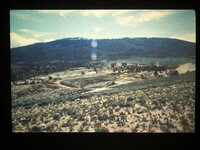
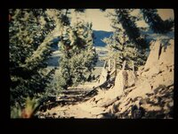
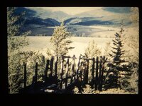
You are correct. Water was diverted from Clear Creek to do the ground sluicing in Cache Creek (at least the main area). There are remains of the sluice/flume that carried the water on the south side of the main Cache Creek placer area.

I have attached pictures showing the remains of the sluice/flume as it was in 1985. Also you can see some of the ground sluiced areas in the background of the photos. gold pictures 3 048.JPGgold pictures 3 049.JPGgold pictures 3 050.JPG
 

Last edited:
High water levels shouldn't be a problem for me because i'm going there in late july-early August for 2 weeks.
 

Sorry i'm kind of bumping my own thread but I have another question. Is the road and parking area smooth enough to pull up a camper?
 

Sorry i'm kind of bumping my own thread but I have another question. Is the road and parking area smooth enough to pull up a camper?
it is mostly un- maintained so had to say...maybe not. Hope someone who has been up there recently can give a local report!
 

Last edited:
Sorry i'm kind of bumping my own thread but I have another question. Is the road and parking area smooth enough to pull up a camper?

Yes. Several people have taken campers in there. However, there is a dry creek the road goes through that has a bit of an down-up situation that might be tricky, depending on the camper you are taking in.
 

Last edited:

Top Member Reactions

Users who are viewing this thread

Latest Discussions

Back
Top