Listed in a Site Book as Ghost Towns
(I don't Know How close to Gone they Realy are)
I hope Someone can use this Info.
ASYLUM
Lat N41 42.778' Long. W76 20.012'
Located about 2 Miles SW of Durell at the Cross Section
of Frenchtown Road (ssr2014) and Gun Club Road
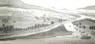
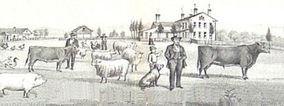
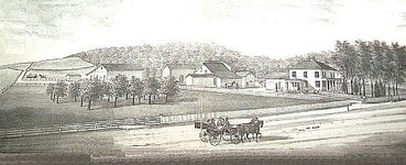
1870's Prints
Valley Farm, Asylum, then owned by FH Hagerman
WEST LEROY
Lat. N41 39.903' Long. W76 44.384'
about 5 1/3 Mi. S.E. of Alba at Cross Section
SR 414 and West Leroy Road
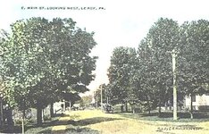
1912 E. MAIN ST LOOKING WEST
WARRENHAM
Lat. N41 58.300' Long. W76 09.156'
2 3/4 mile NE of Warren Center at Cross section
Little Meadows Road and Owego Montrose pike
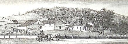
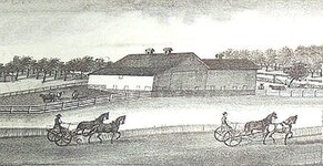
1870s Prints
FARM AND DAIRY JOHN BEARDSLEE Warrenham
(I don't Know How close to Gone they Realy are)
I hope Someone can use this Info.
ASYLUM
Lat N41 42.778' Long. W76 20.012'
Located about 2 Miles SW of Durell at the Cross Section
of Frenchtown Road (ssr2014) and Gun Club Road
1870's Prints
Valley Farm, Asylum, then owned by FH Hagerman


WEST LEROY
Lat. N41 39.903' Long. W76 44.384'
about 5 1/3 Mi. S.E. of Alba at Cross Section
SR 414 and West Leroy Road
1912 E. MAIN ST LOOKING WEST

WARRENHAM
Lat. N41 58.300' Long. W76 09.156'
2 3/4 mile NE of Warren Center at Cross section
Little Meadows Road and Owego Montrose pike
1870s Prints
FARM AND DAIRY JOHN BEARDSLEE Warrenham


