Abandoned village hunt! with, research, mapping and lidar tips

DownEast_Detecting

Sr. Member
Joined
Feb 26, 2020
Messages
428
Reaction score
1,102
Golden Thread
0
Location
Maine
Detector(s) used
Garrett AT Pro, Minelab CTX 3030
Primary Interest:
All Treasure Hunting
ok this is going to be a doozy. i apologize in advance but if you like history, maps, research and relics stay with me. This is my abandoned village site, there is not a lot of info on it. But people were here from 1820-1940. It use to be the main road that connected two larger towns back in the day. It had its own school house and general store with a dance hall on the second floor(red circle). Both the vertical and horizontal roads are just paths now. (See map below) Some think after the highway was built. The reason to take this road was gone. and the village failed. Or it could be that in some spots if you dig down past a foot you hit ledge. So their farms could have failed. Or all the men going off to the civil war. (this is the place i found my model 1826 shoulder belt plate and infantry officers cuff buttons) Some not coming back to their wives and kids. Others coming back to get their family and move to better farmland. Either way everybody left by 1940 i think most were gone at the end of the 19th century. Its a large site. around 1 mile from the large barn cellar hole at the bottom (light blue) to the house cellar hole at the top(white circle). I live pretty close so i always am just picking one home site and search around it for an hour or so. This weekend i put in the longest hunt ive done. 3 hours on Friday, 7 hours on Saturday and 2 hours this morning. I searched ALL over and got some first's and great finds. Im amazed how much ive gotten since i know its been hunted by others before. i ran into one guy last summer.
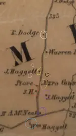
Below is a topo map from 1857 showing most of the houses and school house and store with the 2nd floor dance hall. Next to that is the lidar from the same area. I have circled the different buildings in corresponding colors so you can see their cellar holes on the lidar map. Also there were several mica, feldspar and mineral mines. Some bigger ones just south of map. There are some smaller ones (circled in pink) on maps below. also the town has a rather large dump (circled in black) in edition to the smaller individual pits and privies.
This took me most of the second have of the day to clean finds, picture them, and put together this post. Maybe i went a little far, but i like to be thorough. and i know some of you enjoy the history and maps and such.
1E321E56-6BD0-477F-BD97-EE9DAA07DAD9.jpeg
19235623-D9FC-45D1-A503-F27C0CE711DE.jpeg


and now here are my finds
BD9975F3-7DB0-4247-BEB4-6EE983A20BCE.jpeg

all of them together

6B2C3302-115B-477C-AD6D-469B371E3E47.jpeg
A37ACCB9-0FC2-497F-9118-117AAB55E2D7.jpeg

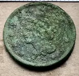
#1 1842 large cent
#2 1865 2 cent piece again in amazing condition, just like my 1871 Indian head penny i found here. There must be something in the soil up on top of the hill.

CCD4471E-A176-4159-9FFC-06D7DA6043B1.jpeg
F686DF77-549E-4B5E-B865-768AF1519A5E.jpeg

#3 1929 mercury dime and #4 old Chinese coin?
#5 1891 Indian head penny and #5 again whoops i think this thing is from one of the first combination pad locks, only had 8 numbers? haha #6 spoon bowl

9F025753-FB24-4732-8ED7-BFFD80E78C60.jpeg
7C4137CE-A2CE-4F7F-B7B8-99FEFDC7BC3B.jpeg

#7 Spoons. amazing how many times ill find a spoon from going into the backyard areas finding the biggest boulder and searching all around it. I figure people must have had picnics on the rock.
#8 baby spoon handle? its small. #9 is the biggest silverware piece i have ever found. It must of been a serving spoon or something. Also someone definitely carved a P into the back right?

20EA138E-BE2E-4C39-B90E-27F272C39187.jpeg
4ACF9528-D455-4EF3-BA17-B913A3587DB3.jpeg

#10 Crotal bell how old im not sure. has a number 2 stamped at the top. and i swear there is a 1 stamped near the slit. # 11 is a women's Timex watch. Not super old probably 1960's? im not sure.
# 12 is a bell. I found this in sort of the backyard of the school area. In my mind it was on the outside to ring. to get kids back to school. But who knows. #13 is a friggin lobstah pickah guy.

49F4F930-02BC-4542-B334-5B2D8E7D580E.jpeg
7F334B66-B6A7-41B5-8FB2-749C578FE4C8.jpeg

#14 is maybe pocket watch cover? does it have another P carved into it? it was in the same lot as the serving spoon with a P on it too. Maybe the same persons.
#15 i dont know. Toy wheel? its heavy.
#16 bits of mica. I fInd lots of this in house lots digging. There was a mica and feldspar mine in this town. #17 some type of Santa Claus pin? #18 thought it might be modern but could also be on old 2 piece shoe button or something not sure.

F31CF78C-87BA-4054-B383-3ACB722A552B.jpeg
46FDB117-F205-479F-AA79-A92C37925322.jpeg

#19 #20 #21 #22 Flat buttons not sure on age. #21 still has some gold gilt on it. #23 im not sure. Thought it was a modern snap from jeans, but not sure. #24 is probably the best back condition button ive ever dug. Still has all its gilt. I had a heart attack when i saw it in the dirt at first. Thought it was a gold coin.
I keep track of all my finds on GPS mapping program. This is a 1900 topo map from that app. all numbers correspond to my finds above.
Significant finds from previous hunts
#25 1871 Indian head penny
#26 US army Model 1826 Enlisted mans shoulder belt plate( civil war eagle plate)
#27 infantry officers coat cuff buttons(2)

B264E9E9-C272-430A-9C44-2F6D0808251C.jpeg

and all the junk.

CE1432E8-362F-4F85-874C-79E9A090DBAE.jpeg
FA5B1621-120F-47D8-8ACB-82A8EC706498.jpeg

This is the towns dump on left. (circled in black on map.) Every home or building has a little dump pit out back somewhere but this is a pretty large dump for the whole village.
one of the nicer cellar holes on right.(circled light purple on map)

8B945204-FB33-46B7-9873-07C8AF90D286.jpeg
4057E9C8-79BD-44C3-9B28-77E2CCC8CAE6.jpeg

one of the smaller mica or feldspar cuts on left. Exploratory dig maybe. (circled in pink on map)
spoil pile from the smaller mine on right


589ED882-D481-4CE2-A2DC-3F9618ED4C03.jpeg

left over equipment from smaller mica or feldspar mine. top of steam boiler?
 

Attachments

  • F574FD22-D2B0-4EB8-9DFD-C2B0DCAD5328.jpeg
    F574FD22-D2B0-4EB8-9DFD-C2B0DCAD5328.jpeg
    120.1 KB · Views: 119
  • 558F3168-C5D8-4F4F-A835-B70B124D13E8.jpeg
    558F3168-C5D8-4F4F-A835-B70B124D13E8.jpeg
    257.5 KB · Views: 46
Last edited:
Upvote 36
i dont believe anyone has an app for lidar. so i have to use an internet browser on my phone
I apologize for sidetracking the thread, but what URL do you go to that can make lidar images like you show? I've been all over everything I can find on the USGS national map and lidar pages, and I can't find anything that will do that. I can get a topo map all day long, but no lidar map, even on their page that says it's a lidar visualizer. I've tried Safari and Firefox on Mac, and Microsoft Edge on Windows, thinking maybe it was a browser problem, but none of them show me anything different. The closest thing I found online was on opentopography.org -- that will show me the lidar images, but it only goes to 10m resolution, so the smallest detail it will show is 10m, which is honestly kinda useless for this purpose, and it only generates images that are less than a hundred pixels tall. (It calls these "full resolution", which seems ludicrous.)
 

Same here, topographical or other mapping but not the grey scale where it shows defined details.
Just one question on the LiDAR, if I may. I’ve seen several references to it, and your usage of it looks amazing. But I never seem to see a link to what site people use to get these images. I found one government site (USGS, I think) but all it would do is give me a “data set” or something, I didn’t see a way to actually view images like what you show here?

So the raw lidar data is basically useless unless you know how to use it. The raw DEM's (Digital Elevation Models) are usually .IMG or .TIF files that have elevation values applied to each pixel and can vary in fineness (pixel size) depending on the way data was collected and processed. Nowadays you see a lot more 1 or 2 meter resolution data which is generally sufficient for locating stone walls/foundations/etc in the woods. Back say 10 years ago most data was at a 10 or 20 meter resolution.

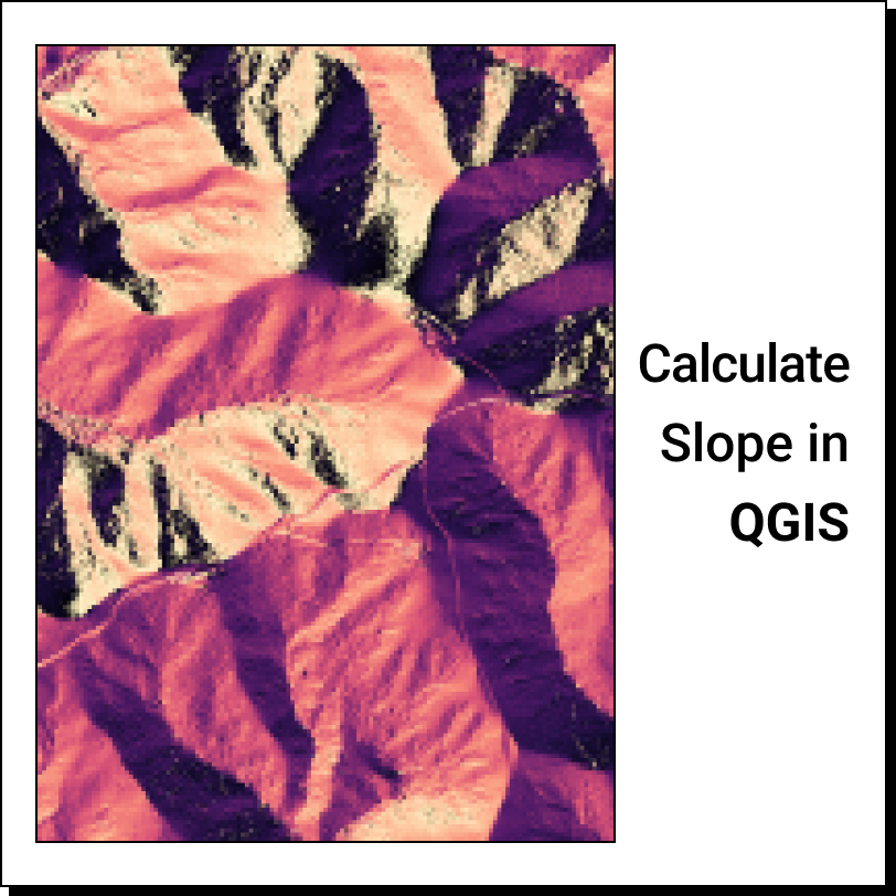
The grayscale mapping you see linked above by the OP has had a "slope" tool applied to it which allows you to output a map showing elevation changes with enhanced detail. See below example in a place by me I know has old foundations.

Raw 1-meter DEM:
2023-08-02_10-42-26.png


Output image after running slope tool in ArcGIS (note the arrows pointing to cellar holes)

2023-08-02_10-43-35.png


This was done in ArcGIS, which is a paid software, but there are some free ones available such as QGIS which can accomplish the same thing. See this article for example.


Feel free to PM me if you need any help with it.
 

I apologize for sidetracking the thread, but what URL do you go to that can make lidar images like you show? I've been all over everything I can find on the USGS national map and lidar pages, and I can't find anything that will do that. I can get a topo map all day long, but no lidar map, even on their page that says it's a lidar visualizer. I've tried Safari and Firefox on Mac, and Microsoft Edge on Windows, thinking maybe it was a browser problem, but none of them show me anything different. The closest thing I found online was on opentopography.org -- that will show me the lidar images, but it only goes to 10m resolution, so the smallest detail it will show is 10m, which is honestly kinda useless for this purpose, and it only generates images that are less than a hundred pixels tall. (It calls these "full resolution", which seems ludicrous.)
After some googling i know realize i might have a resource that others don't know about or use. I honestly thought everybody used lidar the same way i do. I see know i have an extremely valuable tool. I love to pass on knowledge and help other hunters. But i dont like when i log in here and see 150 people viewing "today's finds" but then look to see that only 8 are members. Im sure a lot of people are just browsing cool looking treasures. But some are gaining massive knowledge with contributing anything to this wonderful community. For that reason i feel i shouldn't just post this magic tool for anyone to see here. But if you PM me i will gladly share a link to this amazing mapping resource. Im not downloading any maps or data to interpret. its just a viewer like any GPS map program or site. I will automatically send this link to anybody on this thread that asked about how i do it. If i forget you or you want to know just send a PM asking about it. Or drop into this thread and request a PM from me. and ill send it right over. Honestly though if you have read through this post and have been paying attention, im surprised nobody "figured it out" you will see what i mean if we PM. Wish there was a member's only section.
So the raw lidar data is basically useless unless you know how to use it. The raw DEM's (Digital Elevation Models) are usually .IMG or .TIF files that have elevation values applied to each pixel and can vary in fineness (pixel size) depending on the way data was collected and processed. Nowadays you see a lot more 1 or 2 meter resolution data which is generally sufficient for locating stone walls/foundations/etc in the woods. Back say 10 years ago most data was at a 10 or 20 meter resolution.

The grayscale mapping you see linked above by the OP has had a "slope" tool applied to it which allows you to output a map showing elevation changes with enhanced detail. See below example in a place by me I know has old foundations

This was done in ArcGIS, which is a paid software, but there are some free ones available such as QGIS which can accomplish the same thing. See this article for example.
i'm not doing any of that. Im literally opening a map website and clicking on a layer. Maybe the web app is doing all that for me behind the scenes, i dont know. Its just like opening google maps and putting the satellite view on. Its as easy as that. I can zoom in plenty far to make it extremely useful. Your examples above seem pretty zoomed out, tiny cellar holes. I dont think we are using the same thing. not to mention if you hit the crosshairs like any GPS software. It locates where you are with a blue dot that moves as you do. So you can walk right over to a cellar hole if you in a new area.
341CE6BC-574A-4319-BC77-7C6732D48D81.jpeg
6B83E862-F27D-4749-9539-1511349651D8.jpeg


59F0590A-562F-4A11-9683-37EF2658C4E0.jpeg
 

Last edited:
What a great mix of finds; hard to pick my favorite. Very informative and interesting post too.
 

After some googling i know realize i might have a resource that others don't know about or use. I honestly thought everybody used lidar the same way i do. I see know i have an extremely valuable tool. I love to pass on knowledge and help other hunters. But i dont like when i log in here and see 150 people viewing "today's finds" but then look to see that only 8 are members. Im sure a lot of people are just browsing cool looking treasures. But some are gaining massive knowledge with contributing anything to this wonderful community. For that reason i feel i shouldn't just post this magic tool for anyone to see here. But if you PM me i will gladly share a link to this amazing mapping resource. Im not downloading any maps or data to interpret. its just a viewer like any GPS map program or site. I will automatically send this link to anybody on this thread that asked about how i do it. If i forget you or you want to know just send a PM asking about it. Or drop into this thread and request a PM from me. and ill send it right over. Honestly though if you have read through this post and have been paying attention, im surprised nobody "figured it out" you will see what i mean if you we PM. Wish there was a member's only section.

i'm not doing any of that. Im literally opening a map website and clicking on a layer. Maybe the web app is doing all that for me behind the scenes, i dont know. Its just like opening google maps and putting the satellite view on. Its as easy as that. I can zoom in plenty far to make it extremely useful. Your examples above seem pretty zoomed out, tiny cellar holes. I dont think we are using the same thing. not to mention if you hit the crosshairs like any GPS software. It locates where you are with a blue dot that moves as you do. So you can walk right over to a cellar hole if you in a new area.
View attachment 2097186View attachment 2097187

View attachment 2097185
Yeah, it's definitely doing it behind the scenes.

Same end results, different ways of getting there.
 

What a great mix of finds; hard to pick my favorite. Very informative and interesting post too.
Thank you lenmac.
Yeah, it's definitely doing it behind the scenes.

Same end results, different ways of getting there.
Well let me show you an amazing shortcut. just PM'd you. Merry Christmas!
 

I apologize for sidetracking the thread, but what URL do you go to that can make lidar images like you show? I've been all over everything I can find on the USGS national map and lidar pages, and I can't find anything that will do that. I can get a topo map all day long, but no lidar map, even on their page that says it's a lidar visualizer. I've tried Safari and Firefox on Mac, and Microsoft Edge on Windows, thinking maybe it was a browser problem, but none of them show me anything different. The closest thing I found online was on opentopography.org -- that will show me the lidar images, but it only goes to 10m resolution, so the smallest detail it will show is 10m, which is honestly kinda useless for this purpose, and it only generates images that are less than a hundred pixels tall. (It calls these "full resolution", which seems ludicrous.)
I've also been all over USGS. They sure don't make it easy to navigate.
 

ok this is going to be a doozy. i apologize in advance but if you like history, maps, research and relics stay with me. This is my abandoned village site, there is not a lot of info on it. But people were here from 1820-1940. It use to be the main road that connected two larger towns back in the day. It had its own school house and general store with a dance hall on the second floor(red circle). Both the vertical and horizontal roads are just paths now. (See map below) Some think after the highway was built. The reason to take this road was gone. and the village failed. Or it could be that in some spots if you dig down past a foot you hit ledge. So their farms could have failed. Or all the men going off to the civil war. (this is the place i found my model 1826 shoulder belt plate and infantry officers cuff buttons) Some not coming back to their wives and kids. Others coming back to get their family and move to better farmland. Either way everybody left by 1940 i think most were gone at the end of the 19th century. Its a large site. around 1 mile from the large barn cellar hole at the bottom (light blue) to the house cellar hole at the top(white circle). I live pretty close so i always am just picking one home site and search around it for an hour or so. This weekend i put in the longest hunt ive done. 3 hours on Friday, 7 hours on Saturday and 2 hours this morning. I searched ALL over and got some first's and great finds. Im amazed how much ive gotten since i know its been hunted by others before. i ran into one guy last summer.
Below is a topo map from 1857 showing most of the houses and school house and store with the 2nd floor dance hall. below that is the lidar from the same area. I have circled the different buildings in corresponding colors so you can see their cellar holes on the lidar map. Also there were several mica, feldspar and mineral mines. Some bigger ones just south of map. There are some smaller ones (circled in pink) on maps below. also the town has a rather large dump (circled in black) in edition to the smaller individual pits and privies.
This took me most of the second have of the day to clean finds, picture them, and put together this post. Maybe i went a little far, but i like to be thorough. and i know some of you enjoy the history and maps and such.
View attachment 2096720View attachment 2096756


and now here are my finds

View attachment 2096776
all of them together


View attachment 2096768
#1 1842 large cent


View attachment 2096769

#2 1865 2 cent piece again in amazing condition, just like my 1871 Indian head penny i found here. There must be something in the soil up on top of the hill.


View attachment 2096767
#3 1929 mercury dime and #4 old Chinese coin?


View attachment 2096766
#5 1891 Indian head penny and #5 again whoops i think this thing is from one of the first combination pad locks, only had 8 numbers? haha #6 spoon bowl


View attachment 2096764
#7 Spoons. amazing how many times ill find a spoon from going into the backyard areas finding the biggest boulder and searching all around it. I figure people must have had picnics on the rock.


View attachment 2096763
#8 baby spoon handle? its small. #9 is the biggest silverware piece i have ever found. It must of been a serving spoon or something. Also someone definitely carved a P into the back right?

View attachment 2096765
#10 Crotal bell how old im not sure. has a number 2 stamped at the top. and i swear there is a 1 stamped near the slit. # 11 is a women's Timex watch. Not super old probably 1960's? im not sure.


View attachment 2096761
# 12 is a bell. I found this in sort of the backyard of the school area. In my mind it was on the outside to ring. to get kids back to school. But who knows. #13 is a friggin lobstah pickah guy.


View attachment 2096760
#14 is maybe pocket watch cover? does it have another P carved into it? it was in the same lot as the serving spoon with a P on it too. Maybe the same persons.
#15 i dont know. Toy wheel? its heavy.


View attachment 2096759
#16 bits of mica. I fInd lots of this in house lots digging. There was a mica and feldspar mine in this town. #17 some type of Santa Claus pin? #18 thought it might be modern but could also be on old 2 piece show button or something not sure.


View attachment 2096762
#19 #20 #21 #22 Flat buttons not sure on age. #21 still has some gold gilt on it. #23 im not sure. Thought it was a modern snap from jeans, but not sure.
#24 is probably the best back condition button ive ever dug. Still has all its gilt. I had a heart attack when i saw it in the dirt at first. Thought it was a gold coin.


View attachment 2096755
i keep track of all my finds on GPS mapping program. This is a 1900 topo map from that app. all numbers correspond to my finds above.
Significant finds from previous hunts
#25 1871 Indian head penny
#26 US army Model 1826 Enlisted mans shoulder belt plate( civil war eagle plate)
#27 infantry officers coat cuff buttons(2)

View attachment 2096775
and all the junk.


View attachment 2096758
This is the towns dump. (circled in black on map.) Every home or building has a little dump pit out back somewhere but this is a pretty large dump for the whole village.

View attachment 2096738
one of the nicer cellar holes.(light purple)

View attachment 2096742
one of the smaller mica or feldspar cuts. Exploratory dig maybe. (circled in pink)


View attachment 2096744
spoil pile from the smaller mine


View attachment 2096743
left over equipment from smaller mica or feldspar mine. top of steam boiler?
Very Nice!!!! Great Research!!! Congrats!!!
 

Thank you for this very informative ( and fun) post! You obviously put in some time to organize all this data. You certainly have earned all of those great finds with some outstanding research. I have also been somewhat frustrated trying to access/ use lidar maps. I really appreciate the insights that you have shared. Cheers!
 

Good work & good results.

Not sure if you have spotted & searched this area?

lidar image.JPG
 

Good work & good results.

Not sure if you have spotted & searched this area?
9F621661-574B-446E-BA73-4F6B5100E7A8.jpeg
9C22E64E-0CC8-487D-8B45-123E9562D533.jpeg

well apparently i haven't searched that area very much at all.
 

Has anyone contacted LiDAR with a question regarding the area they live in?
LiDAR seems to be a open public knowledge usage site, but is there a pay to use section (premium)?
 

i forgot to add that it seems Canada does not have the same detail level. If you live in the USA my method works great so PM me and ill share with you this amazing tool. If you live in Canada though my site doesn't have enough detail to be useful. Sorry Canucks (is that nickname considered derogatory or endearing?)
 

i forgot to add that it seems Canada does not have the same detail level. If you live in the USA my method works great so PM me and ill share with you this amazing tool. If you live in Canada though my site doesn't have enough detail to be useful. Sorry Canucks (is that nickname considered derogatory or endearing?)
More endearing I would say.
Well unless one has their head stuck up.....🤣
I wish I could figure this LiDAR thing out.
Time isn't always the best commodity in life.
Would like to get it sorted before the fall season.
Need to pinpoint many spots on permissions.
But tramping through a few hundred acres of tick infested bush doing a wild goose chase is a hard day out.
 

I have also been somewhat frustrated trying to access/ use lidar maps.
well thats all about to change. I just PM'ed you. welcome to the club and merry Christmas:wink:
 

Fantastic bunch of finds and a great bunch of info!
I too have been struggling through the not-very-user-friendly USGS site, and your post has given me a few clues to better see what I'm looking for, Thank you!
 

Fantastic bunch of finds and a great bunch of info!
I too have been struggling through the not-very-user-friendly USGS site, and your post has given me a few clues to better see what I'm looking for, Thank you!
welcome to a whole new world . Im PM'ing you now. Merry Christmas
 

Top Member Reactions

Users who are viewing this thread

Back
Top