Pedro Navarez in Caballo Mountains or Organ Mountains????

whiskeyrat

Hero Member
May 7, 2012
539
1,247
mid Michigan
Primary Interest:
Prospecting
Over the years I have found what seems to be the same treasure legend about Pedro Navarez, however, it seems to have 2 different versions that read almost the same except two different locations.

On story Posted below has the instruction to go 4 days north of Paso Del Norte and look for mountains on the left (west) with 2 large passes.

The other story has the instruction to go 2 days north of Paso Del Norte and look for mountains on the right (east) with 2 large passes.

Then both stories go on to give petty much the same directions about finding a spring, etc etc.

They have to be the same legend. But how are they so different on location, yet very much the same on directions after you arrive on the scene?

Pedro Navarez and the Caballo Mountains

Mexico City
Convent of St. Augustine
February 5, 1650

“Ask in Paso Del Norte where the Caballo Range is. You will find it four days by horse at a good pace up the river and not very far therefrom. Most of these mountains are of equal height and they have two large passes and a small amount of juniper trees. Coming along the King’s Highway (El Camino Real) from the pass, one will see on the left a range of mountains [this is after crossing the river at the pass and entering upon the first leg of the journey], to the right a flat plain (Jornada del Muerto) where the naked eye cannot circumscribe. There is a small hill a great distance from the road. [This is the point of the rocks] These marks you will find to your right where the point of the compass points to the sunrise. This range has two wide gaps which end in two arroyos, one running in the direction of the sunrise and the other toward sunset. The two have many ash trees, one having more than the other. In the gap where the sun rises, look for a small spring. The gap is not very big, a city could be built in the plain. The spring is not far from this gap, and it is well covered with juniper trees, stones, earth and large and small rocks on top. Look carefully at this spring, for it contains great riches. You can take out much gold beneath its surface. And from this spring count 250 varas toward the brow of the mountain, keeping to the level ground. Here you will find a stone with a very large cross chiseled upon its face. The stone is not of this region, having been brought in by mule train. From this point, count 100 varas and examine a small piece of ground closely. It has a few rocks so look carefully at its condition. Here you will find silver bars, there should be 18 atajas. Remove the boards under the bars and take 11 more atajas in finished silver. These marks are to the right before entering the gap, at the point of the compass where the sun rises. When you have finished this work, return to the spring in order that you may climb the mountain to your left. You will look for a very deep cave. There are 90 atajas of silver buried in this cave. I warn you to be careful and not to make a mistake for there are two other caves, but this one is the deepest of the three. The three are where the sun sets and I must tell you that there are some smaller caches and little springs, but all of them have been covered. And if any of these markings should be destroyed, then proceed with the utmost care in carrying out of the task. Return to the spring and climb the mountains to the right in the direction of the rising sun. Not very high up you will find a high rolling mesa, a placer, Here you can cut the copper with an axe and I believe that the spring comes from here. Other signs you will also find. In some places, painted figures with many writings engraved in copper. Therefore I urge you to search well for these marks. Thousands of families would be helped thereby.”
 

Well what is your source of this quotation if it is a legend? And I’m confused the quotations are clearly for the caballos in specific
 

It's time here to remind folks of some proven facts. Facts are nasty problems when it comes to treasure legends, but what do you prefer to believe - the treasure magazines or your own lyin' eyes?

There are many versions of the famous El Chato gallows confession directing searchers to the Caballo Mountains where he allegedly hid his bandit loot. I don't know when and by whom this waybill was first cooked up, but all of them are fraudulent copies of each other.

The authentic man, Pedro Navarez ("El Chato"), was was a noted and well-documented bandit active in Chihuahua, Mexico, in the early 1800's, not in the 1600's. Much folklore surrounds his memory as a Robin Hood-type character who cached robbery proceeds all over the Satevo-Parral-Delicias country south of Chihuahua city. Reports of his death are highly romanticized in Mexico, but the waybills to his treasures were apparently disclosed by his daughter in the 1840s and consisted mainly of coins buried in clay pots on several ranches. There is little reason to believe he was ever in New Mexico, where the pickings for roadside bandits were very slim along the Rio Grande, especially compared to the riches available in Chihuahua at the time. Somebody stole El Chato's life story and tried to apply it to New Mexico, where nobody knew the truth. Here, read about him for yourself:
La leyenda siempre viva del Chato Nevárez

El Real de Chihuahua

Suspenso y Terror de Chihuahua There's plenty more you can find on your own - if you care about the truth, that is.

By the way, speaking of facts, the 1650 El Chato waybill directs one to the "Caballo Mountains", north of El Paso on the Rio Grande. But did you know that those mountains were named by Zebulon Pike during the winter of 1806-07? Before that, on an 1804 map, the range was called "Las Peneulas". Before that, in 1771, they were known as "Sierra el Perillo." If someone's going to dream up a good treasure story, it's a good idea for him to check the facts before he starst.


Always appreciate your fact checking.
wr
 

1996 , a research team entered the Cookes Range with a Copy of the Original 1650 Pedro Navarez Document .
That Copy was found beneath the Podium of a small Mission in Northern Mexico .
The Copy was made from the Original and sent North to that Mission .

The Team found the Two Camps and Map Rock ( Isema Rock )of El Chato in the Cookes Range near Deming N.M.

The Documents had Maps and a Ledger of Symbols , 3 pages of Hand Written Directions , 7 hand drawn Maps , a scroll with a legend of symbols .

I am sorry to refute your statement Sir
Copy Paste of prior posting

" It's time here to remind folks of some proven facts. Facts are nasty problems when it comes to treasure legends, but what do you prefer to believe - the treasure magazines or your own lyin' eyes?

There are many versions of the famous El Chato gallows confession directing searchers to the Caballo Mountains where he allegedly hid his bandit loot. I don't know when and by whom this waybill was first cooked up, but all of them are fraudulent copies of each other.
end copy pasted quote .

These Maps and directions , do not name any Mountain Ranges .
The Name Caballo is not for a Range of Mountains , it is rather for a Peak that the South Facing Out Cropping of , looks like a Horse Head
with over sized Ears .

On the Maps and in the Redeterro , Pedro refers to it as Horse Head Peak , Cabesa De Caballo more or less , and his Drawing Matches
the South Face of Cookes Peak when viewed from an Old Trail near the Green Leaf Mine .

The Land Mark stated as a small Mountain at a distance , is not point of rocks .
The actual Term he uses is for a Mesa , and that Mesa is where the Green Leaf Mine is located today .

Pedro directs the reader to turn to the right and into the Mountains at the first sight of three small Peaks .
These Peaks are the Tres Hermanas just South of the Florida Mountains , which Happen to block a riders view of the three
as he rides from the East from the Old Road .

The Big Lake is but a small Pond today , do to a Rancher whose wells drain the Water from the Mountains .
Pedro directs the reader to a Mine where a Smelter is within the Shaft , he Speaks of three caves , of which one has a sealed shaft descending .
We've Photo's we can post of these sites and some artifacts .

Pedro directs you to three Isema Rock area's , a forth if you are riding in from the South West .
The supposed translation for the word Isema , is that it is a Coated with a Sealant Large Boulder , So the term relates a Map Rock the surface
of is Coated or Sealed with a Cement type coating which contains Iron , Sandstone , Cliche .

The Map was inscribed into the Coating as it dried into a Hard Cement type surface .

So we may think of the term as a Sealed Map Stone .

There were several Made in the area of the three sites he speaks of .
Sadly , The One on the side where the Sun Rises , was drilled and Blasted and is now Rubble and two big Holes .

I will later add Photos and a Google Map of the three sites .
The sites are under protection and it's required that people not enter the area and attempt to recover any Artifacts .

Digging on these sites is Prohibited and or Restricted .
 

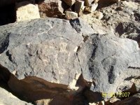
A Photo of the Urn Petroglyph with the El Chato Documents .

copy pasted from other Thread .

A Urn with Journals inside.JPG


Photo of the Petroglyph that marked the location of the Urn .
The Urn Contained El Chato's Journals , it was sealed with Bee's Wax to preserve the Documents .
Some Copper Scrolls and Maps Painted on Hides , we believe Antelope Hides were used for some Maps .
 

The Mine Site .
El Chato spoke of a Mine that was Ancient , That the Clothing and Weapons of those People " Of those Times "
could be found in a Sealed side Tunnel within the Mine .

They were not Anasazi indigenous Tribes .
The Dating is European , mid 13th Century .
Perhaps 1244 , due to a Relic Recovered .
I'll post the Photo of the Mine Later .

This Photo Shows My Knife Stuck between the Layer of Hand Crafted Cement Coating , and the Original Rock .
This is what is meant by " Isema "
A Coating or more correctly , a Sealant over Stone .

Many Cave Entrances that Secrete Artifacts , are sealed in this Manner , Camouflaging the entrance .

A Hand Stacked Stone Wall will close off the Entrance , That Wall will then be Coated and smoothed over to cover the Surface .

Coated Isema Stone.JPG
 

El Chato Treasureman, your posts need a citation where they can be verified to be considered valid.
 

El Chato Treasureman, your posts need a citation where they can be verified to be considered valid.

In El Chato Treasureman's defense, I will say that the Cookes Range is a pivotal "treasure scene" in NM. That's my opinion, based on a lot of stuff I've found and a lot of stuff others have found in those hills too. Many of those things I've made available to the public in the past, and if ECT has indeed spent time there, they are things he should recognize.

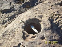
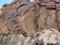
His story sounds promising so far, and I hope he posts some more. I suspect he has been in areas that I may be quite familiar with, but I'm not sure yet. The bedrock mortar photo isn't particularly compelling, but the petroglyph is. The figure shown is IMO a simplified version of a much more detailed carving of the same figure found in the Cookes Range ("Cuco"), and I'd like to know where ECT found it. I'm looking forward to a photo of the mine he mentioned as well as the map and other photos.

The many versions of the alleged El Chato gallows waybill are tied to the Caballo Mountains, but others have also tried to link it to the Cookes Range or the Santa Rita/Pinos Altos district, both of which ought to be on the table. This makes sense as these two possibilities offer much more promise than the Caballos, IMO. Anyway, let's hope ECT provides more to ponder.
Cuco rock 2.JPG
Cuco
 

El Chato Script 003.JPG
After Pedro Directs us through the Various Land Marks we follow to the Sites , He States : This Mountain has Two Wide " Passes/Gaps/Canyons "

One on the side where the Sun Rises , One on the Side where the Sun Sets .
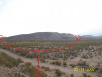
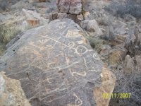
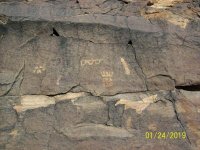
Photos are from Site #1 where the Lake and Tules are , Looking North from the Petroglyphs there , the Symbol is showing the
Trails to both Gaps .

Next Post , The Symbol
 

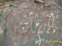
The Dog Man Glyph

The Head is a Profile of a Boulder That will be found over in the Gap where the Sun Rises , Note that the Face/Skull/and Back are all
Chiseled much Deeper , this is one of the Techniques found in Shadow Symbol Engraving , Another Property used in Shadow Symbol
inscribing is Holding the Chisel at a Certain Degree of Angle .

I'll explain that at a later time .
The Body of this Man , is actually another Boulder , with a Flat Top and the Leg represents a Vertical turned to Horizontal Tunnel
Beneath the South End of the Boulder .

So , represented here are Two Different Boulders , Each with their own Deposit .
Note that The Figure is Storing Something ( That Portion of the Glyph was destroyed by Vandals trying to Treasure Hunt .


El Chato Script 017.JPG
 

We now go to the Site where the Sun Rises .
again another Man whose Body is Actually Two Boulders , he Too is Storing something , The Cache produced Two Gold Bars
and an Ancient Sword .Chato Site 2 Sword 2 gold bars.JPG
 

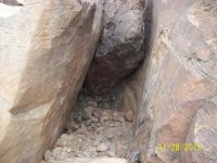
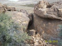
This is the Recovery Site that Above Glyphs directed to . Yes , all those Stones set on top of the Deposit .
Next Photo was Taken from a bit more Distance , you can see the Black Stone was Blasted off the Huge Boulder on the right .
Vandals Grabbing Treasure ?
Yes , and destroy the Guiding Glyphs after the Recovery .

Chato Treasure Recovered.JPG
 

Now a Step Back for a Fuller View of the Recovery Site .
You may note the Sitting Boulder is where the Black Chunk came from .

We know whom these people are , so keep faith , what we can prove is different than what we know ,
so it takes time for justice .


Chato Treasure Recovered3.JPG
 

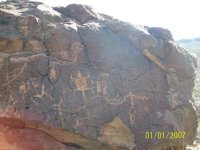
The Glyph with the Contents ledger , I'm sorry , three Gold Bars .
The Triangles each represent a Gold Bar .

Triangle Gold Bar Symbol.JPG
 

Cypher of above Photo

Crowned Profile is Facing a Phallic shaped Glyph , that Glyph actually Represents the Stack of Stones over the Treasure site that
was Dug up by the Vandals .

above the Crown , three connected Triangles , each is a Gold Bar .

Next , a small Vault at the base of a Bluff where several Silver Bars were Recovered .
 

Top Member Reactions

Users who are viewing this thread

Back
Top