signumops
Hero Member
- Feb 28, 2007
- 756
- 230
- Detector(s) used
- Garrett, Minelab, Aqua-Pulse
- Primary Interest:
- All Treasure Hunting
You can say you saw it on Treasurenet first.
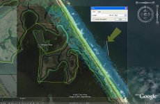
The attached image is a comparitive view of the shoreline Near Pardon Hammock on Klondike Beach. On the left is the USGS view and on the right is the LIDAR view of the same area. This is 2004 LIDAR from NOAA. Klondike Beach is within the Canaveral National Seashore.
The LIDAR is a swath about 1000 feet wide. You can obtain the data yourself directly from NOAA. If you are familiar with the area, you know that the bottom is almost entirely sand for miles. The anomaly I have highlighted here is almost certainly a hull.
You won't be able to find out though, because the NPS won't let you dig it up. And they won't dig it up either. But, you might just walk by there after a Noreaster or hurricane and find 'something' of interest. Who knows?
I did not put a scale on the image, but, the anomaly is about 150 feet long, plowed into the shore from the north to the south I believe.
If somebody else has LIDAR covering this area from a different year, I would like to see it, just to find out if the anomaly exists repeatedly. After all, no harm can be done because nobody can excavate it.
My next question is "how can the Federal government use remote sensing along the shoreline of Florida without acquiring a permit from the Bureau of Archaeological Resources ?" (LOL)


