Withdrawn from mineral entry database question

Bodfish Mike

Hero Member
Dec 12, 2014
504
1,369
Bodfish and Marin county CA
Detector(s) used
Garrett , Whites
keene puffer drywasher , Keene A51 Sluice
Primary Interest:
Other
How can I fine out if an area is withdrawn -- New claim markers have been posted on a spot I go that that is marked with BLM signs saying entering Recreational Mining area and leaving Recreational Mining area.

I met the new owner (nice guy) he says there is no record of it being withdrawn from mineral entry -- he filed his claim and BLM took his Money.
I think he is wrong but I respected his marker and did not mine.
BLM even has maps online showing it's a Recreational Mining area.
I'm trying to find info to back it up
Cheers Mike
 

Upvote 0
No not yet -- BLM took his money when he filed -- so I think a call would be useless
Cheers

Don’t give up so easily.
BLM is very indiscriminate when it comes to cashing checks that are mailed in.

If the area was withdrawn from mineral entry, it will take them at least a year to cancel his claim in their database.

They are very helpful in my experience and have access to databases that we do not.
Maybe there is a way easier way than filtering through all the land orders...
I’m sure Clay will pipe in and tell is it’s easy to do on Land Matters! (Hopefully).


This is a good place to see scanned pages of the actual orders.

https://www.federalregister.gov/documents/search?conditions%5Bterm%5D=%22public+land+orders%22&order=newest#advanced

If it was withdrawn for a specific reason like..a wild and scenic designation, wilderness, hydroelectric projects, etc. you might be able to do some pdf searches to help narrow it down more quickly. It would be easiest to call your state BLM office.
 

I think you can search that information on LR2000 under Pub CR Case reports or public status reports. It doesn’t work on my tablet, but I think it’s all there.
 

Last edited:
I'll spill the beans it's in Keyesville CA. If this guy gets away with this it will open up some sweet sections of the kern river to claim.
Maybe I should keep my mouth shut.
Cheers Mike
 

So far I can tell it was withdrawn in March 1968 to prevent illegal occupancy.
You can look at the year and probably get an idea of the troubles they were having...
 

How can I fine out if an area is withdrawn -- New claim markers have been posted on a spot I go that that is marked with BLM signs saying entering Recreational Mining area and leaving Recreational Mining area.

I met the new owner (nice guy) he says there is no record of it being withdrawn from mineral entry -- he filed his claim and BLM took his Money.
I think he is wrong but I respected his marker and did not mine.
BLM even has maps online showing it's a Recreational Mining area.
I'm trying to find info to back it up
Cheers Mike

Your questions are answered in the Master Title Plat and Historical Index.

The Master Title Plat is the current government record of land status across all federal agencies. It should be the first bit of research you do on any potential mining claim.

You can download the Master Title Plat for any public land area in the west directly from the Land Matters Land Status Maps.

It's much easier to research the Master Title Plat before putting boots on the ground. :thumbsup:

Heavy Pans
 

Master title plat, if there is a withdrawal it will have a PLO number search the Federal register,
most last 20 years then have to be renewed, noticed some on BLM in Oregon haven't been renewed.
going to do some more research before filing, wouldn't want to lose my filing fees.

fyi don't know how often they update the MTP
 

Last edited:
The Master Title Plat (MTP) along with the Historical Index (HI) are the most current record of federal public land status. They are updated every time there is a change in land status. Until the MTP/HI are updated there is no change in land status - they are the controlling documents.

Expired withdrawals still exist until the MTP/HI is updated. This is a really messed up system because even though the withdrawal has run it's course you can't make a legal claim until the record is updated by the BLM. I know of quite a few formerly withdrawn areas that are in BLM limbo because the BLM hasn't bothered to update the record.

Some withdrawals like the Small Tract Act were repealed as long ago as 1976 but the BLM still hasn't opened most of those areas to mineral entry. The first link shows just one instance but there are many more.

Heavy Pans
 

Last edited:
Your questions are answered in the Master Title Plat and Historical Index.

The Master Title Plat is the current government record of land status across all federal agencies. It should be the first bit of research you do on any potential mining claim.

You can download the Master Title Plat for any public land area in the west directly from the Land Matters Land Status Maps.

It's much easier to research the Master Title Plat before putting boots on the ground. :thumbsup:

Heavy Pans

Thanks Clay working on it can't open JPEG2000 format -- need to
download plugins for IrfanView.
Thanks Mike
 

Thanks Clay working on it can't open JPEG2000 format -- need to
download plugins for IrfanView.
Thanks Mike

Ya that is a poor choice for image format. I couldn’t open them either despite supposed support. Irfanview will do it once the plugins are installed.

So I’m not worthless as tits on a boar hog..
Here’s the decoder map..your going to need it.
Pay special attention to line types.
https://www.blm.gov/or/pubroom/files/MTP_Help.pdf
 

Another thing you should do is get a copy of his paperwork. He may have filed it somewhere else and either doesn't know where he is, or is saying that it's his claim, when it isn't. I had a guy tell me that I was on his claim, which is why I went down there, because he was running off the locals. I asked to see a copy of his paperwork and when he couldn't produce it, I pulled out my copy along with the maps and showed him where his claim was on the other side of the hill... It all went well and he quit running people out of the withdrawn area.
 

BLM does have public rec areas in several counties I know of. they tend to be a a whole section removed from mineral entry.

BLM can give bad info. But. those withdrawn areas they have are real and exist so I would really check on it.

Yes they will take your money. In Ca. it can take years for them to admit their mistakes.

I don’t see it as a BLM mistake. The prospector makes a mistake filing without checking the MTP. The BLM fee is based on what it costs them to adjudicate your claim (figure out if it’s valid or not). If the answer turns out to be “no”, they still spent the time/money to figure out the answer.
 

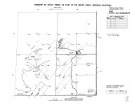
Well i found the MTP (master title plate) but all it tells me is "BLM O CL Mult Use".
Not sure what that means? the spot I'm talking about is in SEC 25 and
his signs are in the "BLM O CL Mult" Use" boundaries.
Was looking for something in writing saying "withdrawn from mineral entry"
Still searching Thanks Mike.
CA210260S0320E0-1005.jpg
 

Well i found the MTP (master title plate) but all it tells me is "BLM O CL Mult Use".
Not sure what that means? the spot I'm talking about is in SEC 25 and
his signs are in the "BLM O CL Mult" Use" boundaries.
Was looking for something in writing saying "withdrawn from mineral entry"
Still searching Thanks Mike.
View attachment 1795296

That's as close as you will get to "in writing" on an MTP Mike. The MTP is a visual representation of land status. It's written in a language that is unique to MTPs - welcome to government efficiency. :BangHead:

If you read the MTP tutorials I linked to earlier you will see that the dot-dash line indicates a withdrawal.

Read the linked Land Status Tutorials and view the videos and you will see that BLM O CL Mult Use code is explained beginning in the magic code list around page 174 of Legal Description and Land Status - A Self-Study Guide. Briefly that indicates a multiple use withdrawal CLassification by the BLM. The "O" stands for "Order". Usually an order is either a PLO (Public Land Order), an SO (Secretary's Order) or an EO (Executive Order). There is also a notation "S 573".

Now go to the linked Historical Index(s) and look for Section 25 on the left. There will be a bunch of lines with Section 25 on those Historical Indexes so keep looking until you find the one(s) matching "BLM O CL Mult Use S 573". There will be more details on when and how that Order was made as well as the authority for the order. There will also be an indication of the location and extent of the Order.

Then you just need to find the refrenced order. For that you will need to look it up in the Federal Register. The Federal Register is where every government public action is recorded - every day. For withdrawals it helps to note the date of the order in the Historical Index and search within that time period. Once you find the original publication you will see the withdrawal order in it's original text.

I know that sounds like a lot of work. It is a lot of work but we are talking about free gold in the ground ownership here. :headbang:

Sometimes you will be really surprised by what is and what isn't in a withdrawal order. I haven't read this particular withdrawal but there is a good chance that minerals are withdrawn from location. You won't know for sure until you track down the original order.

We are working on making all this a lot easier at Land Matters. Within the month we will begin introducing a map system that will give you links to all the relevant documents. BIG shortcut but I'm pretty sure California isn't going to be one of the first states completed. That could change if enough users request it. :thumbsup:

Heavy Pans
 

Last edited:
That's as close as you will get to "in writing" on an MTP Mike. The MTP is a visual representation of land status. It's written in a language that is unique to MTPs - welcome to government efficiency. :BangHead:

If you read the MTP tutorials I linked to earlier you will see that the dot-dash line indicates a withdrawal.

Read the linked Land Status Tutorials and view the videos and you will see that BLM O CL Mult Use code is explained beginning in the magic code list around page 174 of Legal Description and Land Status - A Self-Study Guide. Briefly that indicates a multiple use withdrawal CLassification by the BLM. The "O" stands for "Order". Usually an order is either a PLO (Public Land Order), an SO (Secretary's Order) or an EO (Executive Order). There is also a notation "S 573".

Now go to the linked Historical Index(s) and look for Section 25 on the left. There will be a bunch of lines with Section 25 on those Historical Indexes so keep looking until you find the one(s) matching "BLM O CL Mult Use S 573". There will be more details on when and how that Order was made as well as the authority for the order. There will also be an indication of the location and extent of the Order.

Then you just need to find the refrenced order. For that you will need to look it up in the Federal Register. The Federal Register is where every government public action is recorded - every day. For withdrawals it helps to note the date of the order in the Historical Index and search within that time period. Once you find the original publication you will see the withdrawal order in it's original text.

I know that sounds like a lot of work. It is a lot of work but we are talking about free gold in the ground ownership here. :headbang:

Sometimes you will be really surprised by what is and what isn't in a withdrawal order. I haven't read this particular withdrawal but there is a good chance that minerals are withdrawn from location. You won't know for sure until you track down the original order.

We are working on making all this a lot easier at Land Matters. Within the month we will begin introducing a map system that will give you links to all the relevant documents. BIG shortcut but I'm pretty sure California isn't going to be one of the first states completed. That could change if enough users request it. :thumbsup:

Heavy Pans

Well i search all the Historical Index and could not find one that said "BLM O CL Mult Use S 573".
So maybe the guy is right no record of it -- even though it is marked as withdrawn on the MTP.
Thanks for helping and I learned a lot -- The good news is I looked up another spot I have been
working and it is withdrawn also -- why is this good new -- I was thinking of claiming it.
Thanks Clay and Cheers Mike

I’d look further...or of course talk to BLM (pick up the phone and ask..they will answer and directly help you without any BS). They set you straight quickly in my limited experience or at least get you started looking in the right direction.
I’ll guarantee there is a chain of orders! It’s their job to track these types of things.

If you ask a specific question, they will research it and get back to you. If you send in a check without doing so...they will cash it and move on.

Don’t be the second guy in this thread to file a claim and waste your money on withdrawn land.
 

Last edited:

Top Member Reactions

Users who are viewing this thread

Back
Top