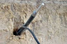
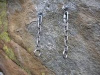
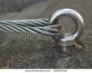
What's this picture mean?

delpieroqu

Tenderfoot
Nov 11, 2016
5
1
Primary Interest:
All Treasure Hunting
IMG-20161105-WA0024.jpegIMG-20161105-WA0024.jpeg
 

Looks like something I put my fishing pole in.
 

how big is it, does not look more than about 3 inches.
 

Any information on the surrounding area, like where they blasting in that area in the past 30 years for something like a major highway, is there a coastline near by.

Where is this at.
 

Delpieroqu, The larger of the two holes tells you how far to travel, direction is from the big hole to the small hole, I need to see the bottom, the circumference, depth and across, are there more drill holes in the area
 

First thing that comes to mind. Grinding morse.
Put seads or herbs in it and grind it with a smaller rock.
The local aboriginals had them here at all their camp sites. So as they moved around the country they would always have access to one without taking anything with them

Sent from my SM-G900I using Tapatalk
 

Those signs in middle east

Sounds good, but having studied the Ottomans you hopefully know as well as I do that you are talking about thousands of cultures over just as many years that cover a lot of ground.

What part of the middle east exactly, do you have a grid or even the province of the nation, heck even a region would be of more help. You do not need to worry about folks on here trying to run down something over there, Fox News pretty much took care of all social engineering of that for the western world about the middle east.

But what you will find on here is that many people just love to help out, there is a great deal of knowledge on this site and who knows you may be able to add it all up and at least be pointed in the right direction.
 

looking at the grass growth position, I guessing

IMG-20161105-WA0024.jpg

IMG-20161105-WA0024 - Copy.jpg
 

Last edited:

Top Member Reactions

Users who are viewing this thread

Back
Top