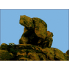
What does this mean to you..?

goverton said:
On my map I have a "610" w/line ....I believe this to mean 610 feet and line is topo line......

But near this is "R V"......Now I know this is not RV Camp site.....this map is from 1880's

close by this "RV" is a Dagger crossing a line.

NE clues?

Can you scan the map and post a picture?
 

Springfield said:
goverton said:
On my map I have a "610" w/line ....I believe this to mean 610 feet and line is topo line......

But near this is "R V"......Now I know this is not RV Camp site.....this map is from 1880's

close by this "RV" is a Dagger crossing a line.

NE clues?

Can you scan the map and post a picture?


I would rather not post my map just now.......

I thought that it might be bible verse, 6th book, 10 verse......but that did not reveal anything.....
I am leaning toward elevation for the "610" but not sure on the "RV"
 

Old Dog said:
The dagger on those early maps indicated north

I have seen daggers on the ground not pointing North and this
one is not pointing North unless it is the Hilt of Knife....that is pointing North
 

treasurechest said:
Rv is obviously an abbreviation of something. Maybe it means Right Valley, and the dagger means it's dangerous. :icon_scratch:

"Right Valley" was a good guess BUT,not quite right .....I believe it is

ReVerse........which would mean Mirror image the line
This seems to work as the line now lines up to topo line showing height and curvature of hill, etc. :hello2:
 

thom,
nice to see correct logic and knowledge :read2: in action to solve a sign....nice also to see the 1 2 19 5 14 3 5 15 6 3 15 6 21 19 9 14 as well... :hello2:
rangler :thumbsup:
7fd1641e0768a200b146b4d4c5e6a8d163e22cbe_t.jpg.gif
(c) copyright 2003-all right reserved-rangler
- turtle in the supers
 

Old Dog said:
You are very correct but only use the "R" as the reverse.
The "V" is probably 5 and tells you how far to go back.

Since the "V" is on the line(line runs thru it) could it possibly mean flip it Here.....where "V" is?
 

if you used that line to approach the "R" ...
What unit of measure did you use to get there? If you used varas go back 65 varas. Feet etc. or what ever you used.
If you just walked up... go back and figure out what distance is used so you can find the point that they want you to work from.
There will be something there not to miss.
 

Hello Gov, does it have any even small space between the #'s or letters, on one site that I worked if there's a tiny space that's irregular between then I found that using those X 2, such as 6 10- 61 0, as a better example the letters were O RO 15th book of the Bible Ezra, chapter 2 = ( RO ) verse 18 and 15, 112 bars and 454 grams = 1 pound. Good Luck
 

Old Dog said:
if you used that line to approach the "R" ...
What unit of measure did you use to get there? If you used varas go back 65 varas. Feet etc. or what ever you used.
If you just walked up... go back and figure out what distance is used so you can find the point that they want you to work from.
There will be something there not to miss.

When I hold up copy of map and use back side and line up with this "610 RV" and then compare to todays Topo
Map, it lines up with lines on Topo map and height.
 

gov,
it lines up with lines on Topo map and height.

unless this is a kgc site [or a worked over kgc area], the spanish would not be able to single out a single 610' elevation line-
they navigated from high point to high point for the most part...they could find the highest
point and confirm it by boiling water and timing the minutes...it took for the water to boil
but picking out individual elevation topo lines not do-able for the colonial Spanish!

Are you aware of the highest point in this area? It might factor in to your map and give
you some orientation.
rangler
 

rangler said:
gov,
it lines up with lines on Topo map and height.

unless this is a kgc site [or a worked over kgc area], the spanish would not be able to single out a single 610' elevation line-
they navigated from high point to high point for the most part...they could find the highest
point and confirm it by boiling water and timing the minutes...it took for the water to boil
but picking out individual elevation topo lines not do-able for the colonial Spanish!

Are you aware of the highest point in this area? It might factor in to your map and give
you some orientation.
rangler

Hmmm I will have to give this some thought.....I assumed it was 1800's map and outlaw map in relation to how
I worked the map out. Did they have elevation lines in the old maps from that time?? Not sure.....It could mean something totally different that what I suspect. I did try Bible Verse but no connection I could see. I need to work on that aspect some more.
...
 

Could this mean:
6 Book of Bible
10 Chapter
R=18 verse
V=22 Verse

Joshua 10 (6th book 10th chapter)

18 And Joshua said, Roll great stones upon the mouth of the cave, and set men by it for to keep them:

22 Then said Joshua, Open the mouth of the cave, and bring out those five kings unto me out of the cave.


Maybe look for a CAVE with Rock covering entrance?
 

rangler said:
gov,
thats as good as it get for confirming a bible verse..
rangler

Now I just have to find a Cave....LOL! :tongue3: :help:
 

Top Member Reactions

Users who are viewing this thread

Back
Top