hkentcraig
Tenderfoot
- Oct 18, 2011
- 6
- 1
- Detector(s) used
- Garrett Ace 350
- Primary Interest:
- All Treasure Hunting
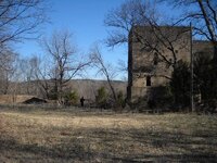
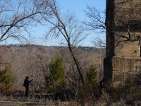
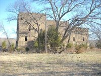
Does anyone know the history behind the old ruins four or five miles north of Daugherty OK on State Road 110? They've intrigued the heck out of me since first find them while out exploring a couple of years ago. When I asked about them at the general store in Daugherty, all they would say is: "it's the old office building used by a sand and gravel company". Uhmmm, I don't think so.
For one thing the building is massive in size (see attached photos) and has the feel of being very old, at least a hundred years or older and simply is out of place in the middle of nowhere even for Oklahoma.
In another modest mystery, there is a perfect circle about 5 feet wide of numbers about 6" tall each painted on the parking lot at the Daugherty general store and when I tried to take a photo of them, the proprietor came out and very politely asked me not to take any photos of the circle of numbers to which I equally politely complied. When I checked on the circle of numbers a couple of weeks ago, it had been obscured by gravel and dirt etcetera so I didn't push things.
Getting back to the ruins, if you go to GoogleMaps and type in the following coordinates:
N 34 24.863
W 097 02.508
a map will come up with two photos to the left that when clicked on will show enlargements labeled "Unknown Ruins"
Anyway, both are good mysteries, would love to know what they actually are!


