Alex Burke
Hero Member
- #1
Thread Owner
I thought it might be helpful to share a few links that might help people gather historical maps of their areas, as well as some links about how to use the geo referenced historical maps into google earth so people might find some interesting old spots to check out.
The link to download the historical maps is here: USGS Historical Topographic Maps | topoView - click "Get Maps" to enter the viewer.
After selecting your area of interest use the panel on the right to adjust the scale of maps you are looking at, the smaller the scale the better for local searches but play around and see which scale versions are available for your area.
There is a timeline slider at the top, so it is good to start way back in time and see which maps appear as you scroll forward in time, checking out the oldest maps first would obviously be the best strategy when looking for old cabins or homesteads.
Next download the Geo Tiff version of the map from the bottom left corner of the viewer. You could I think just download the KMZ file of the map but it won't always display accurately in my experience and it is worth going through the extra step or two to use the Geo referenced Tiff file.
Extract the files from the zip file you have downloaded and open Google Earth Pro available here for free if you need it: Google Earth
Click open file (make sure you have geo tiff selected as the file type you are looking to upload or you won't see the extracted geo tiff file) GE will then fly to the location and ask you if you want to build a super overlay, crop etc. I usually just pick the super overlay option and I can always just delete the small files it builds later.
Here is a more in depth explanation and tutorial: https://www.google.com/earth/outreach/tutorials/importgis.html
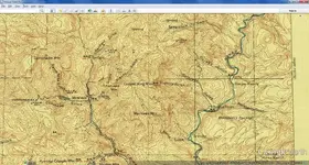
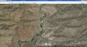
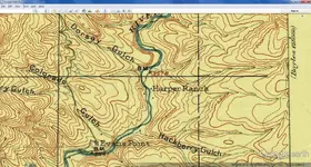
The final product should be a map you can turn the opacity layer of the old map on and off allowing you to see where the old structures once were:


Hope maybe some of this info helps, happy hunting.
The link to download the historical maps is here: USGS Historical Topographic Maps | topoView - click "Get Maps" to enter the viewer.
After selecting your area of interest use the panel on the right to adjust the scale of maps you are looking at, the smaller the scale the better for local searches but play around and see which scale versions are available for your area.
There is a timeline slider at the top, so it is good to start way back in time and see which maps appear as you scroll forward in time, checking out the oldest maps first would obviously be the best strategy when looking for old cabins or homesteads.
Next download the Geo Tiff version of the map from the bottom left corner of the viewer. You could I think just download the KMZ file of the map but it won't always display accurately in my experience and it is worth going through the extra step or two to use the Geo referenced Tiff file.
Extract the files from the zip file you have downloaded and open Google Earth Pro available here for free if you need it: Google Earth
Click open file (make sure you have geo tiff selected as the file type you are looking to upload or you won't see the extracted geo tiff file) GE will then fly to the location and ask you if you want to build a super overlay, crop etc. I usually just pick the super overlay option and I can always just delete the small files it builds later.
Here is a more in depth explanation and tutorial: https://www.google.com/earth/outreach/tutorials/importgis.html
The final product should be a map you can turn the opacity layer of the old map on and off allowing you to see where the old structures once were:


Hope maybe some of this info helps, happy hunting.
Amazon Forum Fav 👍
Last edited:


