Treasure Mountain, CO - Lost Frenchmens Gold

Here is the story as we have come to know it:

In 1662, Governor Diego de Penalosa led 80 Spanish and one thousand Indian warriors to the northeast to investigate reports of French intrusion into Spanish territory. While on this campaign, he learned “of the Lake of Copalla, where the richest mines of Moqtegsuma (Montezuma) are located, from which mines the gold stones the Governor bought.” While on his way back to Santa Fe, he was arrested on charges of “unrestrained language against the priests and blasphemy.” He was brought back to Santa Fe in chains and imprisoned for 32 months. He was banished to Spain and forbidden from returning to the New World. Governor Penalosa approached the French monarch and gave a detailed account of the riches in “Teguayo.” He offered his assistance in leading an expedition to this land by establishing a military fort in the east and marching across the continent to the lands in the west. The French monarch considered this offer, but ultimately, they didn’t trust a man who would turn his back on his king and serve another; the French decided to send Robert Cavelier Sieur de La Salle instead.

In 1684, at the tender age of 13, Jean L’Archeveque, accompanied by Pierre Meusnier from Paris and Jacques Grollet, joined Robert Cavelier Sieur de La Salle on his expedition in pursuit of the Mississippi Delta. After getting lost, their journey took an unexpected turn when they landed at Lavaca Bay, Texas. Tragedy struck in 1687 when a mutiny led to an ambush, resulting in the murder of Sieur de La Salle. Sensing imminent danger, L'Archeveque, Grollet, and Meusnier escaped and sought refuge with the Teyas Indians. In 1689, they were ransomed by the Spanish, who discovered them during an expedition into Texas in search of the rumored French intrusions into their territory. Both L'Archeveque and Grollet were sent to Spain, where there was an official inquisition into their involvement in Sieur de La Salle's murder. Cleared of any involvement in La Salle's demise, L'Archeveque and Grollet returned to Paso del Norte in 1692, where they joined General Vagas's army to help reclaim the province, which they had lost during the Pueblo Revolt of 1680. As a Captain, Juan Archibeque (who changed his name to conform to Spanish society) continued his military service while residing in Santa Fe, New Mexico.

While Archibeque and Grollet pursued a military career, Meusnier pursued a career in trading and bartering with the Native Americans. He invited Archibeque to join his venture. Because Archibeque was now a high-ranking military official, he could travel into Ute territory without obtaining a license from the governor. This allowed him access to a massive trade network that no one else had access to. The Utes and Archibeque formed a great relationship, probably because Archibeque traded horses and guns, which was illegal. In 1704, the Utes led Archibeque to a mine and cache illegally operated before the Pueblo Revolt of 1680. The Utes allowed Archibeque to bring a small contingent of men who mined every summer. The mining operation by Archibeque was illegal and not sanctioned by the crown; because of this, he had to keep it quiet. We know that Archibeque maintained his contact with the French, and in 1715, a group of Frenchmen came to the fair in Taos and asked around to look for Archibeque. This created a stir among the upper class, who believed Archibeque was secretly working for the French. An investigation was launched, and ultimately, nothing could be proven against Archibeque.

In August 1720, Archibeque embarked on an expedition to the Arkansas River with Commandant Don Pedro de Villazur. Sent by Governor Valverde to investigate rumors of French settlements in present-day eastern Colorado and Nebraska, their target was El Cuartelejo, a fort constructed by Kiowa, Jicarilla Apache, and Pueblo Indians. Despite learning of the Frenchmen's departure upon their arrival, Villazur's expedition proceeded into the South Platte Valley near Fort Morgan. Ignoring warnings about the nearby presence of Pawnees and the group they sought, Villazur set up camp. Tragedy struck at dawn on August 16, 1720, as a surprise attack claimed the lives of most expedition members, including Villazur and Archibeque. Sergeant Felipe de Tamaris, one of the few survivors, recounted the ordeal. Archibeque's loyal servant, Sanchez, despite sustaining multiple wounds, stayed by his master's side until his final breath before fleeing on Archibeque's horse. Ironically, according to Tamaris and Sanchez’s account, Jean L'Archeveque, also known as Juan de Archibeque, fell victim to Frenchmen wanted for questioning regarding La Salle's murder. L'Archeveque had confided in Sanchez about one of the assailants being a survivor of La Salle's earlier expedition, adding a tragic twist to his untimely demise.

Following the death of Juan Archibeque (Jean L'Archeveque), his two sons took over the family trading and gold mining business. His biological son Agustin de Archibeque married Manuela Trujillo in 1729. Their son was Antonio Domingo Archibeque. He married Casilda Gonzales on April 6, 1750. They had two sons, Juan Domingo, born January 6, 1751, and Agustin Antonio, born June 20, 1753. In 1749, Governor Tomas Cachupin was appointed and took on a new philosophy regarding relationships with the Utes. Rather than continue to make it illegal to trade with the Utes or to enter their territory, he sought a peace treaty with the Ute Nation. The chiefs, miners, and traders agreed upon terms to enter the country legally. Agustin de Archibeque recognized this as his opportunity to expand his mining business.

The Archibeque family’s issue was that you had to have a permit to mine. They had been mining for many years without one; if you did not have one, there were severe consequences, including imprisonment and forfeiture of all your property. The family needed to pay the required king's fifth, which was also a significant issue. Fortunately for the Archibeque family, Frenchmen Jacques Bellecount and Jean Petitjean came to Sante Fe with Pierre Mallet when he returned in 1748. Jacques Bellecount is a mining engineer trained in Paris. I don’t think it’s a coincidence that a mining engineer showed up and joined the Archibeque family’s endeavor; I suspect the French government sent him. Jacques Bellecount reached out to his contacts in New Orleans. He informed them that the Archibeque family wanted to partner with the French monarch to secretly mine gold in the northern reaches of the New Mexico territory and secretly move it to Canada (it could not be taken to New Orleans because there were too many Spanish spies). The gold would be stored in a vault until it could be retrieved. The issue the French had was they did not have treasure galleons like the Spanish did. Large quantities of gold would need to be stored until smaller ships could move it. It could take several trips across the Atlantic to move the gold. So, the French government sent 250-300 troops to meet with the Archibeque family in 1751.

The 250-300 Frenchmen joined the Archibeque family and, along with hundreds of Pueblo slaves, began a massive mining operation at La Mine de La Ventana. The central vault was expanded, and two additional vaults were added. The two additional vaults were called the “Southern Vault” and the “Most Southern Vault”. The mining continued for five years, with regular trips to store gold in Canada. But even with those regular trips, they were mining more gold than they could move. During the entire French expedition, the Ute Indians were not happy that such a large force of men was in their country.

To make matters worse, the French were rude and disrespectful to the Utes. They often bartered with them and ripped them off. It all came to a head in 1756 when the French disregarded a Ute warning not to enter the Pagosa Hot Springs, as this was a sacred place to the Utes. In the fall, the French left the Pagosa Hot Springs and headed to their lower camp for winter. The Utes attacked, and a fierce battle was fought. Ultimately, most of the Frenchmen were killed, a handful made it to New Orleans, and roughly 15 made it to Canada. The French never moved their gold in the winter and left it in the secured caches.

Several members of the Archibeque crew were injured and killed in the Ute attack. They elected not to pursue mining for a few years. Eventually, one of the Archibeque family members contacted the Ute chiefs and apologized for inviting the French. He gave them horses and guns as a peace offering and asked permission to mine again. They agreed if it was no more than a handful of men. The mine was operated from 1750 to 1756 with the French government's assistance. Following the French massacre, the mine was operated by the Archbeque family up to 1770 with the help of four men. Toribio Hernandez - a Spaniard from Santa Fe; Felicito Garcia - a Spaniard from Santa Fe; Jacques Bellecount - a Frenchman who came with Pierre Mallet; and Jean Petitjean - who also came with Pierre Mallet. They mined gold for several years, storing even more gold in the caches. They only brought back enough gold to get them through the year; they were also scared of being discovered, which almost happened in 1768. Governor Tomas Cachupin had heard reports of sizeable illegal mining operations in the northern territories and sent Father Juan Maria de Rivera on two separate expeditions to investigate.
Fortunately for the Archibeque family, he missed them by about 20 miles.

The mine changed hands within the Archibeque family. By 1767, Antonio Domingo de Archibeque was 43 years old and running the mining operation. Antonio ignored the treaty his father (Agustin de Archibeque) had made with the Utes to keep the operation small. The operation grew to include several dozen men and many slaves. The Utes again got angry and told the miners not to return the following year. The miners ignored the warnings, and after three years of demanding they not return, the Utes decided it was time to act. In the fall of 1770, they attacked and killed most of the miners. Antonio Domingo de Archibeque was killed at the mine along with Torbio Hernandez. Jacques Bellecount survived and took all the paperwork, maps, and manuscripts back to Paris, where they were filed with the French Government. Jean Petitjean was uninjured in the attack and made it back to Sante Fe. Villalpondo was a Spaniard from Taos who was unharmed and made it back to Santa Fe. Felicito Garcia was severely injured and made it back to Santa Fe, where he died a short time later. Before Felicio died, he gave his son a detailed account and a map. His eldest son was wealthy from his family’s gold mining ventures and didn’t think it was wise to test his luck with the Utes. This ended Garcia’s involvement in the mine. There is a record of one of the descendants sharing a map with some people in the SLV in 1915, including giving a copy to Thomas Summers, who had some newspaper articles written about him in the 1920s searching for the mine.

Fast forward to 1799, the Louisianan Territory is now under Spanish rule. It had been secretly ceded to them following the French defeat of the French and Indian War in 1767. France did not want Great Britain to have the territory, so they gave it to the Spanish. In 1799, Napolean was wagging a global war and needed funds. He knows about the vast mineral resources in the Louisianan Territory and northern New Mexico country. An explorer named Louis de Villmont had made a trip out west two years previously and reported the finding of Gold. Napolean is also told there are documents in the archives that show where a large mine and three caches filled with gold are located. Napoleon sent 2,000 troops from his Egypt campaign and plans to send more. The 2,000 troops are on their way to New Orleans when they receive word there is a slave revolt in Haiti, now called The Haitian Revolution. This is a big problem because Haiti was like the gas station for voyages to the New World. All the ships would stop there and resupply before carrying on. Two hundred troops continued to New Orleans while the remainder headed to Haiti to help quash the revolt. Unfortunately for those men, the slaves were more of a match than they anticipated, and the French were finally defeated in 1804; Haiti declared its sovereignty a year later. The 200 troops land in New Orleans and are sent to Fort Arkansas, or Arkansas Post as some refer it, far enough away from the busy New Orleans port. They did this so the troops could hunker down and not draw unwanted attention until it was time to leave for the expedition. The fort's commandant is Louis de Villmont’s brother, Don Carlos de Villmont. This makes it very convenient to hide the troops and gather supplies without the Spanish officials knowing. The Villmont family and their service to the French, Spanish, and Americans is incredible. They were double agents for the French while serving the Spanish in high-ranking positions. They then sold their knowledge to the Americans after the Louisiana Purchase.

In early March 1799, the expedition was equipped and ready to leave New Orleans. The expedition consisted of:

Two hundred twenty fully equipped armed soldiers mounted on horses.
Thirty guides, scouts, and hunters mounted on horses and led 20 extra horses.
Eighty miners, assayers, doctors, surveyors, and veterinarians all mounted on horses leading pack mules.
Ten-pack mules loaded with camping equipment.
Ten-pack mules loaded with dried food.
Five-pack mules loaded with extra guns, parts, and ammunition.
Three-pack mules loaded with winter clothing and replacements.
Two mules empty for replacements.
Twenty-five-pack mules are loaded with mining equipment, including tools, roasting furnaces, surveyors and assayers' equipment and instruments, doctors' and veterinarians' equipment, and medicine.

A total of 60 mules, 350 horses, and 350 men.

I won’t get into all the specifics on which route they took to get to the mountains or where they found gold; I will include all that when I one day finish my book. While the 1751-1756 expedition primarily focused on the La Ventana mine, the 1799-1803 expedition spread and mined everywhere. They had mining operations that extended most of the southern part of the Colorado Rockies. They found the 3-caches and used them to store the gold they mined in spring and summer. I don’t know if they ever mined La Ventana; I have some information that suggests they did not.

In September 1803, word came that Napoleon was selling the Louisiana territory to the United States for $11,250,000, and they were to return to New Orleans. The group knew they could not move this much gold and decided to leave the past few years' accumulation in the cache vaults until another expedition could be mounted. They decided to take 3 1/3 tons of gold with them. On September 18, 1803, the group was heading to Hayden Pass when an overwhelmingly large group of warriors attacked them; the survivors estimated there were over 1,000. Most of the soldiers were in the front of the caravan and held off the attackers while the rest fled with the gold. The soldiers who were protecting the civilians attempted to help the other soldiers in the battle, and ultimately, all the soldiers were killed. While the Utes gathered horses, guns, and supplies from the dead, the civilians fled down a well-known trail. They eventually made it to an area they were familiar with and camped. They knew they could not get away with their lives and gold, so they buried the gold in a rockslide near their camp. On the morning of September 20, 1803, the gold was placed in a cistern dug at the base of the rockslide. The men all fled and were hunted down, and most of them were killed. One man made it to Taos, where he shared the story with a Spanish priest before dying; two more men made it back to French territory and on to New Orleans.

This brings us to the 19th century. There have been claims of numerous expeditions to look for the caches and mine. I don’t doubt there were several. However, there is only one that I have found that has historical documentation to support it. From my information, the French government sent five men from California to Santa Fe. The men hired Bernando Sanchez as a guide. The only name we have found for any group member other than Sanchez is Carven (unknown if first or last name). They found the gold in the rockslide and loaded 1,000 pounds, all they could carry with the horses they brought. They went downriver and found a suitable camping location at the confluence of two Rivers. While Sanchez was away getting supplies, Ute warriors attacked the group, and two of the men died right away. The remaining three men held off the Utes until nightfall. They hid the gold and fled the area as fast as they could. A few days later, there was another battle, and another man was killed. The last two survivors made it to Taos; one of the men was arrested (unknown what for), and the other fled and made it to Fort Leavenworth. The survivor was Carven, who recanted his story to a local historian in New Orleans years later. Carven never returned to France and, as far as we can tell, never attempted to retrieve any of the gold. We do have a detailed account of where they hid the gold and believe we have found that location based on signs they left and geographical features. The gold left in the rockslide was taken out slowly over many years by Mexican sheepherders in the 1920s. There is historical documentation of this that I will include later when I have time to dig more into my notes.
 

Here's a PA story for you tamrock.
LAD
Neat. I so enjoyed going down that way and if mama ever says get out it'll be Silver City for me. I very often would head back north after I finished the area on 180. I'd always have dinner at a little dinner in Reserve. It's one of those places folks would talk with you and you'd feel like you were over for dinner with some friends.
 

Here is the story as we have come to know it:

In 1662, Governor Diego de Penalosa led 80 Spanish and one thousand Indian warriors to the northeast to investigate reports of French intrusion into Spanish territory. While on this campaign, he learned “of the Lake of Copalla, where the richest mines of Moqtegsuma (Montezuma) are located, from which mines the gold stones the Governor bought.” While on his way back to Santa Fe, he was arrested on charges of “unrestrained language against the priests and blasphemy.” He was brought back to Santa Fe in chains and imprisoned for 32 months. He was banished to Spain and forbidden from returning to the New World. Governor Penalosa approached the French monarch and gave a detailed account of the riches in “Teguayo.” He offered his assistance in leading an expedition to this land by establishing a military fort in the east and marching across the continent to the lands in the west. The French monarch considered this offer, but ultimately, they didn’t trust a man who would turn his back on his king and serve another; the French decided to send Robert Cavelier Sieur de La Salle instead.

In 1684, at the tender age of 13, Jean L’Archeveque, accompanied by Pierre Meusnier from Paris and Jacques Grollet, joined Robert Cavelier Sieur de La Salle on his expedition in pursuit of the Mississippi Delta. After getting lost, their journey took an unexpected turn when they landed at Lavaca Bay, Texas. Tragedy struck in 1687 when a mutiny led to an ambush, resulting in the murder of Sieur de La Salle. Sensing imminent danger, L'Archeveque, Grollet, and Meusnier escaped and sought refuge with the Teyas Indians. In 1689, they were ransomed by the Spanish, who discovered them during an expedition into Texas in search of the rumored French intrusions into their territory. Both L'Archeveque and Grollet were sent to Spain, where there was an official inquisition into their involvement in Sieur de La Salle's murder. Cleared of any involvement in La Salle's demise, L'Archeveque and Grollet returned to Paso del Norte in 1692, where they joined General Vagas's army to help reclaim the province, which they had lost during the Pueblo Revolt of 1680. As a Captain, Juan Archibeque (who changed his name to conform to Spanish society) continued his military service while residing in Santa Fe, New Mexico.

While Archibeque and Grollet pursued a military career, Meusnier pursued a career in trading and bartering with the Native Americans. He invited Archibeque to join his venture. Because Archibeque was now a high-ranking military official, he could travel into Ute territory without obtaining a license from the governor. This allowed him access to a massive trade network that no one else had access to. The Utes and Archibeque formed a great relationship, probably because Archibeque traded horses and guns, which was illegal. In 1704, the Utes led Archibeque to a mine and cache illegally operated before the Pueblo Revolt of 1680. The Utes allowed Archibeque to bring a small contingent of men who mined every summer. The mining operation by Archibeque was illegal and not sanctioned by the crown; because of this, he had to keep it quiet. We know that Archibeque maintained his contact with the French, and in 1715, a group of Frenchmen came to the fair in Taos and asked around to look for Archibeque. This created a stir among the upper class, who believed Archibeque was secretly working for the French. An investigation was launched, and ultimately, nothing could be proven against Archibeque.

In August 1720, Archibeque embarked on an expedition to the Arkansas River with Commandant Don Pedro de Villazur. Sent by Governor Valverde to investigate rumors of French settlements in present-day eastern Colorado and Nebraska, their target was El Cuartelejo, a fort constructed by Kiowa, Jicarilla Apache, and Pueblo Indians. Despite learning of the Frenchmen's departure upon their arrival, Villazur's expedition proceeded into the South Platte Valley near Fort Morgan. Ignoring warnings about the nearby presence of Pawnees and the group they sought, Villazur set up camp. Tragedy struck at dawn on August 16, 1720, as a surprise attack claimed the lives of most expedition members, including Villazur and Archibeque. Sergeant Felipe de Tamaris, one of the few survivors, recounted the ordeal. Archibeque's loyal servant, Sanchez, despite sustaining multiple wounds, stayed by his master's side until his final breath before fleeing on Archibeque's horse. Ironically, according to Tamaris and Sanchez’s account, Jean L'Archeveque, also known as Juan de Archibeque, fell victim to Frenchmen wanted for questioning regarding La Salle's murder. L'Archeveque had confided in Sanchez about one of the assailants being a survivor of La Salle's earlier expedition, adding a tragic twist to his untimely demise.

Following the death of Juan Archibeque (Jean L'Archeveque), his two sons took over the family trading and gold mining business. His biological son Agustin de Archibeque married Manuela Trujillo in 1729. Their son was Antonio Domingo Archibeque. He married Casilda Gonzales on April 6, 1750. They had two sons, Juan Domingo, born January 6, 1751, and Agustin Antonio, born June 20, 1753. In 1749, Governor Tomas Cachupin was appointed and took on a new philosophy regarding relationships with the Utes. Rather than continue to make it illegal to trade with the Utes or to enter their territory, he sought a peace treaty with the Ute Nation. The chiefs, miners, and traders agreed upon terms to enter the country legally. Agustin de Archibeque recognized this as his opportunity to expand his mining business.

The Archibeque family’s issue was that you had to have a permit to mine. They had been mining for many years without one; if you did not have one, there were severe consequences, including imprisonment and forfeiture of all your property. The family needed to pay the required king's fifth, which was also a significant issue. Fortunately for the Archibeque family, Frenchmen Jacques Bellecount and Jean Petitjean came to Sante Fe with Pierre Mallet when he returned in 1748. Jacques Bellecount is a mining engineer trained in Paris. I don’t think it’s a coincidence that a mining engineer showed up and joined the Archibeque family’s endeavor; I suspect the French government sent him. Jacques Bellecount reached out to his contacts in New Orleans. He informed them that the Archibeque family wanted to partner with the French monarch to secretly mine gold in the northern reaches of the New Mexico territory and secretly move it to Canada (it could not be taken to New Orleans because there were too many Spanish spies). The gold would be stored in a vault until it could be retrieved. The issue the French had was they did not have treasure galleons like the Spanish did. Large quantities of gold would need to be stored until smaller ships could move it. It could take several trips across the Atlantic to move the gold. So, the French government sent 250-300 troops to meet with the Archibeque family in 1751.

The 250-300 Frenchmen joined the Archibeque family and, along with hundreds of Pueblo slaves, began a massive mining operation at La Mine de La Ventana. The central vault was expanded, and two additional vaults were added. The two additional vaults were called the “Southern Vault” and the “Most Southern Vault”. The mining continued for five years, with regular trips to store gold in Canada. But even with those regular trips, they were mining more gold than they could move. During the entire French expedition, the Ute Indians were not happy that such a large force of men was in their country.

To make matters worse, the French were rude and disrespectful to the Utes. They often bartered with them and ripped them off. It all came to a head in 1756 when the French disregarded a Ute warning not to enter the Pagosa Hot Springs, as this was a sacred place to the Utes. In the fall, the French left the Pagosa Hot Springs and headed to their lower camp for winter. The Utes attacked, and a fierce battle was fought. Ultimately, most of the Frenchmen were killed, a handful made it to New Orleans, and roughly 15 made it to Canada. The French never moved their gold in the winter and left it in the secured caches.

Several members of the Archibeque crew were injured and killed in the Ute attack. They elected not to pursue mining for a few years. Eventually, one of the Archibeque family members contacted the Ute chiefs and apologized for inviting the French. He gave them horses and guns as a peace offering and asked permission to mine again. They agreed if it was no more than a handful of men. The mine was operated from 1750 to 1756 with the French government's assistance. Following the French massacre, the mine was operated by the Archbeque family up to 1770 with the help of four men. Toribio Hernandez - a Spaniard from Santa Fe; Felicito Garcia - a Spaniard from Santa Fe; Jacques Bellecount - a Frenchman who came with Pierre Mallet; and Jean Petitjean - who also came with Pierre Mallet. They mined gold for several years, storing even more gold in the caches. They only brought back enough gold to get them through the year; they were also scared of being discovered, which almost happened in 1768. Governor Tomas Cachupin had heard reports of sizeable illegal mining operations in the northern territories and sent Father Juan Maria de Rivera on two separate expeditions to investigate.
Fortunately for the Archibeque family, he missed them by about 20 miles.

The mine changed hands within the Archibeque family. By 1767, Antonio Domingo de Archibeque was 43 years old and running the mining operation. Antonio ignored the treaty his father (Agustin de Archibeque) had made with the Utes to keep the operation small. The operation grew to include several dozen men and many slaves. The Utes again got angry and told the miners not to return the following year. The miners ignored the warnings, and after three years of demanding they not return, the Utes decided it was time to act. In the fall of 1770, they attacked and killed most of the miners. Antonio Domingo de Archibeque was killed at the mine along with Torbio Hernandez. Jacques Bellecount survived and took all the paperwork, maps, and manuscripts back to Paris, where they were filed with the French Government. Jean Petitjean was uninjured in the attack and made it back to Sante Fe. Villalpondo was a Spaniard from Taos who was unharmed and made it back to Santa Fe. Felicito Garcia was severely injured and made it back to Santa Fe, where he died a short time later. Before Felicio died, he gave his son a detailed account and a map. His eldest son was wealthy from his family’s gold mining ventures and didn’t think it was wise to test his luck with the Utes. This ended Garcia’s involvement in the mine. There is a record of one of the descendants sharing a map with some people in the SLV in 1915, including giving a copy to Thomas Summers, who had some newspaper articles written about him in the 1920s searching for the mine.

Fast forward to 1799, the Louisianan Territory is now under Spanish rule. It had been secretly ceded to them following the French defeat of the French and Indian War in 1767. France did not want Great Britain to have the territory, so they gave it to the Spanish. In 1799, Napolean was wagging a global war and needed funds. He knows about the vast mineral resources in the Louisianan Territory and northern New Mexico country. An explorer named Louis de Villmont had made a trip out west two years previously and reported the finding of Gold. Napolean is also told there are documents in the archives that show where a large mine and three caches filled with gold are located. Napoleon sent 2,000 troops from his Egypt campaign and plans to send more. The 2,000 troops are on their way to New Orleans when they receive word there is a slave revolt in Haiti, now called The Haitian Revolution. This is a big problem because Haiti was like the gas station for voyages to the New World. All the ships would stop there and resupply before carrying on. Two hundred troops continued to New Orleans while the remainder headed to Haiti to help quash the revolt. Unfortunately for those men, the slaves were more of a match than they anticipated, and the French were finally defeated in 1804; Haiti declared its sovereignty a year later. The 200 troops land in New Orleans and are sent to Fort Arkansas, or Arkansas Post as some refer it, far enough away from the busy New Orleans port. They did this so the troops could hunker down and not draw unwanted attention until it was time to leave for the expedition. The fort's commandant is Louis de Villmont’s brother, Don Carlos de Villmont. This makes it very convenient to hide the troops and gather supplies without the Spanish officials knowing. The Villmont family and their service to the French, Spanish, and Americans is incredible. They were double agents for the French while serving the Spanish in high-ranking positions. They then sold their knowledge to the Americans after the Louisiana Purchase.

In early March 1799, the expedition was equipped and ready to leave New Orleans. The expedition consisted of:

Two hundred twenty fully equipped armed soldiers mounted on horses.
Thirty guides, scouts, and hunters mounted on horses and led 20 extra horses.
Eighty miners, assayers, doctors, surveyors, and veterinarians all mounted on horses leading pack mules.
Ten-pack mules loaded with camping equipment.
Ten-pack mules loaded with dried food.
Five-pack mules loaded with extra guns, parts, and ammunition.
Three-pack mules loaded with winter clothing and replacements.
Two mules empty for replacements.
Twenty-five-pack mules are loaded with mining equipment, including tools, roasting furnaces, surveyors and assayers' equipment and instruments, doctors' and veterinarians' equipment, and medicine.

A total of 60 mules, 350 horses, and 350 men.

I won’t get into all the specifics on which route they took to get to the mountains or where they found gold; I will include all that when I one day finish my book. While the 1751-1756 expedition primarily focused on the La Ventana mine, the 1799-1803 expedition spread and mined everywhere. They had mining operations that extended most of the southern part of the Colorado Rockies. They found the 3-caches and used them to store the gold they mined in spring and summer. I don’t know if they ever mined La Ventana; I have some information that suggests they did not.

In September 1803, word came that Napoleon was selling the Louisiana territory to the United States for $11,250,000, and they were to return to New Orleans. The group knew they could not move this much gold and decided to leave the past few years' accumulation in the cache vaults until another expedition could be mounted. They decided to take 3 1/3 tons of gold with them. On September 18, 1803, the group was heading to Hayden Pass when an overwhelmingly large group of warriors attacked them; the survivors estimated there were over 1,000. Most of the soldiers were in the front of the caravan and held off the attackers while the rest fled with the gold. The soldiers who were protecting the civilians attempted to help the other soldiers in the battle, and ultimately, all the soldiers were killed. While the Utes gathered horses, guns, and supplies from the dead, the civilians fled down a well-known trail. They eventually made it to an area they were familiar with and camped. They knew they could not get away with their lives and gold, so they buried the gold in a rockslide near their camp. On the morning of September 20, 1803, the gold was placed in a cistern dug at the base of the rockslide. The men all fled and were hunted down, and most of them were killed. One man made it to Taos, where he shared the story with a Spanish priest before dying; two more men made it back to French territory and on to New Orleans.

This brings us to the 19th century. There have been claims of numerous expeditions to look for the caches and mine. I don’t doubt there were several. However, there is only one that I have found that has historical documentation to support it. From my information, the French government sent five men from California to Santa Fe. The men hired Bernando Sanchez as a guide. The only name we have found for any group member other than Sanchez is Carven (unknown if first or last name). They found the gold in the rockslide and loaded 1,000 pounds, all they could carry with the horses they brought. They went downriver and found a suitable camping location at the confluence of two Rivers. While Sanchez was away getting supplies, Ute warriors attacked the group, and two of the men died right away. The remaining three men held off the Utes until nightfall. They hid the gold and fled the area as fast as they could. A few days later, there was another battle, and another man was killed. The last two survivors made it to Taos; one of the men was arrested (unknown what for), and the other fled and made it to Fort Leavenworth. The survivor was Carven, who recanted his story to a local historian in New Orleans years later. Carven never returned to France and, as far as we can tell, never attempted to retrieve any of the gold. We do have a detailed account of where they hid the gold and believe we have found that location based on signs they left and geographical features. The gold left in the rockslide was taken out slowly over many years by Mexican sheepherders in the 1920s. There is historical documentation of this that I will include later when I have time to dig more into my notes.
Great recap. Indeed find those accounts of these sheepherders to share.
 

Great recap. Indeed find those accounts of these sheepherders to share.
i just want to find one button from one uniform, draggin that metal detector all over the san juans and slv! maybe some horseshoes...

also curious about Banca in all of this: "In 1811, 270 years later a man named Baca while exploring in the Sangre de Cristo Mountains in the vicinity of Marble Mountain stumbled upon a stash of mined gold nuggets and some rugged and primitive made gold bars." (ref)

classic treasure tale where the real treasure is learning

glad to be amongst y'all
 

Here is the story as we have come to know it:

In 1662, Governor Diego de Penalosa led 80 Spanish and one thousand Indian warriors to the northeast to investigate reports of French intrusion into Spanish territory. While on this campaign, he learned “of the Lake of Copalla, where the richest mines of Moqtegsuma (Montezuma) are located, from which mines the gold stones the Governor bought.” While on his way back to Santa Fe, he was arrested on charges of “unrestrained language against the priests and blasphemy.” He was brought back to Santa Fe in chains and imprisoned for 32 months. He was banished to Spain and forbidden from returning to the New World. Governor Penalosa approached the French monarch and gave a detailed account of the riches in “Teguayo.” He offered his assistance in leading an expedition to this land by establishing a military fort in the east and marching across the continent to the lands in the west. The French monarch considered this offer, but ultimately, they didn’t trust a man who would turn his back on his king and serve another; the French decided to send Robert Cavelier Sieur de La Salle instead.

In 1684, at the tender age of 13, Jean L’Archeveque, accompanied by Pierre Meusnier from Paris and Jacques Grollet, joined Robert Cavelier Sieur de La Salle on his expedition in pursuit of the Mississippi Delta. After getting lost, their journey took an unexpected turn when they landed at Lavaca Bay, Texas. Tragedy struck in 1687 when a mutiny led to an ambush, resulting in the murder of Sieur de La Salle. Sensing imminent danger, L'Archeveque, Grollet, and Meusnier escaped and sought refuge with the Teyas Indians. In 1689, they were ransomed by the Spanish, who discovered them during an expedition into Texas in search of the rumored French intrusions into their territory. Both L'Archeveque and Grollet were sent to Spain, where there was an official inquisition into their involvement in Sieur de La Salle's murder. Cleared of any involvement in La Salle's demise, L'Archeveque and Grollet returned to Paso del Norte in 1692, where they joined General Vagas's army to help reclaim the province, which they had lost during the Pueblo Revolt of 1680. As a Captain, Juan Archibeque (who changed his name to conform to Spanish society) continued his military service while residing in Santa Fe, New Mexico.

While Archibeque and Grollet pursued a military career, Meusnier pursued a career in trading and bartering with the Native Americans. He invited Archibeque to join his venture. Because Archibeque was now a high-ranking military official, he could travel into Ute territory without obtaining a license from the governor. This allowed him access to a massive trade network that no one else had access to. The Utes and Archibeque formed a great relationship, probably because Archibeque traded horses and guns, which was illegal. In 1704, the Utes led Archibeque to a mine and cache illegally operated before the Pueblo Revolt of 1680. The Utes allowed Archibeque to bring a small contingent of men who mined every summer. The mining operation by Archibeque was illegal and not sanctioned by the crown; because of this, he had to keep it quiet. We know that Archibeque maintained his contact with the French, and in 1715, a group of Frenchmen came to the fair in Taos and asked around to look for Archibeque. This created a stir among the upper class, who believed Archibeque was secretly working for the French. An investigation was launched, and ultimately, nothing could be proven against Archibeque.

In August 1720, Archibeque embarked on an expedition to the Arkansas River with Commandant Don Pedro de Villazur. Sent by Governor Valverde to investigate rumors of French settlements in present-day eastern Colorado and Nebraska, their target was El Cuartelejo, a fort constructed by Kiowa, Jicarilla Apache, and Pueblo Indians. Despite learning of the Frenchmen's departure upon their arrival, Villazur's expedition proceeded into the South Platte Valley near Fort Morgan. Ignoring warnings about the nearby presence of Pawnees and the group they sought, Villazur set up camp. Tragedy struck at dawn on August 16, 1720, as a surprise attack claimed the lives of most expedition members, including Villazur and Archibeque. Sergeant Felipe de Tamaris, one of the few survivors, recounted the ordeal. Archibeque's loyal servant, Sanchez, despite sustaining multiple wounds, stayed by his master's side until his final breath before fleeing on Archibeque's horse. Ironically, according to Tamaris and Sanchez’s account, Jean L'Archeveque, also known as Juan de Archibeque, fell victim to Frenchmen wanted for questioning regarding La Salle's murder. L'Archeveque had confided in Sanchez about one of the assailants being a survivor of La Salle's earlier expedition, adding a tragic twist to his untimely demise.

Following the death of Juan Archibeque (Jean L'Archeveque), his two sons took over the family trading and gold mining business. His biological son Agustin de Archibeque married Manuela Trujillo in 1729. Their son was Antonio Domingo Archibeque. He married Casilda Gonzales on April 6, 1750. They had two sons, Juan Domingo, born January 6, 1751, and Agustin Antonio, born June 20, 1753. In 1749, Governor Tomas Cachupin was appointed and took on a new philosophy regarding relationships with the Utes. Rather than continue to make it illegal to trade with the Utes or to enter their territory, he sought a peace treaty with the Ute Nation. The chiefs, miners, and traders agreed upon terms to enter the country legally. Agustin de Archibeque recognized this as his opportunity to expand his mining business.

The Archibeque family’s issue was that you had to have a permit to mine. They had been mining for many years without one; if you did not have one, there were severe consequences, including imprisonment and forfeiture of all your property. The family needed to pay the required king's fifth, which was also a significant issue. Fortunately for the Archibeque family, Frenchmen Jacques Bellecount and Jean Petitjean came to Sante Fe with Pierre Mallet when he returned in 1748. Jacques Bellecount is a mining engineer trained in Paris. I don’t think it’s a coincidence that a mining engineer showed up and joined the Archibeque family’s endeavor; I suspect the French government sent him. Jacques Bellecount reached out to his contacts in New Orleans. He informed them that the Archibeque family wanted to partner with the French monarch to secretly mine gold in the northern reaches of the New Mexico territory and secretly move it to Canada (it could not be taken to New Orleans because there were too many Spanish spies). The gold would be stored in a vault until it could be retrieved. The issue the French had was they did not have treasure galleons like the Spanish did. Large quantities of gold would need to be stored until smaller ships could move it. It could take several trips across the Atlantic to move the gold. So, the French government sent 250-300 troops to meet with the Archibeque family in 1751.

The 250-300 Frenchmen joined the Archibeque family and, along with hundreds of Pueblo slaves, began a massive mining operation at La Mine de La Ventana. The central vault was expanded, and two additional vaults were added. The two additional vaults were called the “Southern Vault” and the “Most Southern Vault”. The mining continued for five years, with regular trips to store gold in Canada. But even with those regular trips, they were mining more gold than they could move. During the entire French expedition, the Ute Indians were not happy that such a large force of men was in their country.

To make matters worse, the French were rude and disrespectful to the Utes. They often bartered with them and ripped them off. It all came to a head in 1756 when the French disregarded a Ute warning not to enter the Pagosa Hot Springs, as this was a sacred place to the Utes. In the fall, the French left the Pagosa Hot Springs and headed to their lower camp for winter. The Utes attacked, and a fierce battle was fought. Ultimately, most of the Frenchmen were killed, a handful made it to New Orleans, and roughly 15 made it to Canada. The French never moved their gold in the winter and left it in the secured caches.

Several members of the Archibeque crew were injured and killed in the Ute attack. They elected not to pursue mining for a few years. Eventually, one of the Archibeque family members contacted the Ute chiefs and apologized for inviting the French. He gave them horses and guns as a peace offering and asked permission to mine again. They agreed if it was no more than a handful of men. The mine was operated from 1750 to 1756 with the French government's assistance. Following the French massacre, the mine was operated by the Archbeque family up to 1770 with the help of four men. Toribio Hernandez - a Spaniard from Santa Fe; Felicito Garcia - a Spaniard from Santa Fe; Jacques Bellecount - a Frenchman who came with Pierre Mallet; and Jean Petitjean - who also came with Pierre Mallet. They mined gold for several years, storing even more gold in the caches. They only brought back enough gold to get them through the year; they were also scared of being discovered, which almost happened in 1768. Governor Tomas Cachupin had heard reports of sizeable illegal mining operations in the northern territories and sent Father Juan Maria de Rivera on two separate expeditions to investigate.
Fortunately for the Archibeque family, he missed them by about 20 miles.

The mine changed hands within the Archibeque family. By 1767, Antonio Domingo de Archibeque was 43 years old and running the mining operation. Antonio ignored the treaty his father (Agustin de Archibeque) had made with the Utes to keep the operation small. The operation grew to include several dozen men and many slaves. The Utes again got angry and told the miners not to return the following year. The miners ignored the warnings, and after three years of demanding they not return, the Utes decided it was time to act. In the fall of 1770, they attacked and killed most of the miners. Antonio Domingo de Archibeque was killed at the mine along with Torbio Hernandez. Jacques Bellecount survived and took all the paperwork, maps, and manuscripts back to Paris, where they were filed with the French Government. Jean Petitjean was uninjured in the attack and made it back to Sante Fe. Villalpondo was a Spaniard from Taos who was unharmed and made it back to Santa Fe. Felicito Garcia was severely injured and made it back to Santa Fe, where he died a short time later. Before Felicio died, he gave his son a detailed account and a map. His eldest son was wealthy from his family’s gold mining ventures and didn’t think it was wise to test his luck with the Utes. This ended Garcia’s involvement in the mine. There is a record of one of the descendants sharing a map with some people in the SLV in 1915, including giving a copy to Thomas Summers, who had some newspaper articles written about him in the 1920s searching for the mine.

Fast forward to 1799, the Louisianan Territory is now under Spanish rule. It had been secretly ceded to them following the French defeat of the French and Indian War in 1767. France did not want Great Britain to have the territory, so they gave it to the Spanish. In 1799, Napolean was wagging a global war and needed funds. He knows about the vast mineral resources in the Louisianan Territory and northern New Mexico country. An explorer named Louis de Villmont had made a trip out west two years previously and reported the finding of Gold. Napolean is also told there are documents in the archives that show where a large mine and three caches filled with gold are located. Napoleon sent 2,000 troops from his Egypt campaign and plans to send more. The 2,000 troops are on their way to New Orleans when they receive word there is a slave revolt in Haiti, now called The Haitian Revolution. This is a big problem because Haiti was like the gas station for voyages to the New World. All the ships would stop there and resupply before carrying on. Two hundred troops continued to New Orleans while the remainder headed to Haiti to help quash the revolt. Unfortunately for those men, the slaves were more of a match than they anticipated, and the French were finally defeated in 1804; Haiti declared its sovereignty a year later. The 200 troops land in New Orleans and are sent to Fort Arkansas, or Arkansas Post as some refer it, far enough away from the busy New Orleans port. They did this so the troops could hunker down and not draw unwanted attention until it was time to leave for the expedition. The fort's commandant is Louis de Villmont’s brother, Don Carlos de Villmont. This makes it very convenient to hide the troops and gather supplies without the Spanish officials knowing. The Villmont family and their service to the French, Spanish, and Americans is incredible. They were double agents for the French while serving the Spanish in high-ranking positions. They then sold their knowledge to the Americans after the Louisiana Purchase.

In early March 1799, the expedition was equipped and ready to leave New Orleans. The expedition consisted of:

Two hundred twenty fully equipped armed soldiers mounted on horses.
Thirty guides, scouts, and hunters mounted on horses and led 20 extra horses.
Eighty miners, assayers, doctors, surveyors, and veterinarians all mounted on horses leading pack mules.
Ten-pack mules loaded with camping equipment.
Ten-pack mules loaded with dried food.
Five-pack mules loaded with extra guns, parts, and ammunition.
Three-pack mules loaded with winter clothing and replacements.
Two mules empty for replacements.
Twenty-five-pack mules are loaded with mining equipment, including tools, roasting furnaces, surveyors and assayers' equipment and instruments, doctors' and veterinarians' equipment, and medicine.

A total of 60 mules, 350 horses, and 350 men.

I won’t get into all the specifics on which route they took to get to the mountains or where they found gold; I will include all that when I one day finish my book. While the 1751-1756 expedition primarily focused on the La Ventana mine, the 1799-1803 expedition spread and mined everywhere. They had mining operations that extended most of the southern part of the Colorado Rockies. They found the 3-caches and used them to store the gold they mined in spring and summer. I don’t know if they ever mined La Ventana; I have some information that suggests they did not.

In September 1803, word came that Napoleon was selling the Louisiana territory to the United States for $11,250,000, and they were to return to New Orleans. The group knew they could not move this much gold and decided to leave the past few years' accumulation in the cache vaults until another expedition could be mounted. They decided to take 3 1/3 tons of gold with them. On September 18, 1803, the group was heading to Hayden Pass when an overwhelmingly large group of warriors attacked them; the survivors estimated there were over 1,000. Most of the soldiers were in the front of the caravan and held off the attackers while the rest fled with the gold. The soldiers who were protecting the civilians attempted to help the other soldiers in the battle, and ultimately, all the soldiers were killed. While the Utes gathered horses, guns, and supplies from the dead, the civilians fled down a well-known trail. They eventually made it to an area they were familiar with and camped. They knew they could not get away with their lives and gold, so they buried the gold in a rockslide near their camp. On the morning of September 20, 1803, the gold was placed in a cistern dug at the base of the rockslide. The men all fled and were hunted down, and most of them were killed. One man made it to Taos, where he shared the story with a Spanish priest before dying; two more men made it back to French territory and on to New Orleans.

This brings us to the 19th century. There have been claims of numerous expeditions to look for the caches and mine. I don’t doubt there were several. However, there is only one that I have found that has historical documentation to support it. From my information, the French government sent five men from California to Santa Fe. The men hired Bernando Sanchez as a guide. The only name we have found for any group member other than Sanchez is Carven (unknown if first or last name). They found the gold in the rockslide and loaded 1,000 pounds, all they could carry with the horses they brought. They went downriver and found a suitable camping location at the confluence of two Rivers. While Sanchez was away getting supplies, Ute warriors attacked the group, and two of the men died right away. The remaining three men held off the Utes until nightfall. They hid the gold and fled the area as fast as they could. A few days later, there was another battle, and another man was killed. The last two survivors made it to Taos; one of the men was arrested (unknown what for), and the other fled and made it to Fort Leavenworth. The survivor was Carven, who recanted his story to a local historian in New Orleans years later. Carven never returned to France and, as far as we can tell, never attempted to retrieve any of the gold. We do have a detailed account of where they hid the gold and believe we have found that location based on signs they left and geographical features. The gold left in the rockslide was taken out slowly over many years by Mexican sheepherders in the 1920s. There is historical documentation of this that I will include later when I have time to dig more into my notes.
That was an excellent post and thank you for sharing your information.

The most interesting piece of information, to me, was the regular trips to Canada that you mention. That might explain a river camp by the Mississippi River. Have you found evidence of the route they used when moving from Colorado to Canada?
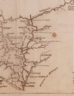
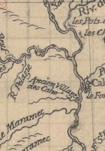
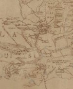
We have a copy of a book from the French archives that has dozens if not hundreds of maps and entries from the Jesuit priests. We had some of these translated back in the 90s. Many of the entries and maps explain the americas as they have come to know them. I’ll see if I can get it scanned into an electronic format and share it. Here is one of their maps that explains the route they would travel.
1733575755849.png
 

We have a copy of a book from the French archives that has dozens if not hundreds of maps and entries from the Jesuit priests. We had some of these translated back in the 90s. Many of the entries and maps explain the americas as they have come to know them. I’ll see if I can get it scanned into an electronic format and share it. Here is one of their maps that explains the route they would travel. View attachment 2182268
Thank you very much for sharing your map.

I recognize many of the features and I wonder if it was created during the late 1700's. That section of the Mississippi that defines the eastern border of Iowa is more accurate than anything I've seen, from earlier dates. At the bottom of the semi circle that forms the Iowa border, is the Iowa River West of that is the Missouri River. There's a little line across the Missouri River and I think it says Les Panis. I believe that line is at north latitude 41 deg. 28'. Here is some information that I posted on the site of one of my facebook friends.

During the spring of 1673, the two French explorers, Marquette and Joliet, began their exploration of the Mississippi River. Their mission was to extend the Kingdom of Jesus Christ and to seek a passage to the Sea of China, by the river that discharges into the Vermillion or California Sea. (the Colorado River) and to verify the existence of the kingdoms of Teguayo and Quivira where there are many mines of gold. Teguayo and Quivira were two mythical kingdoms that had lured colonial Spanish explorers into the country that is now northern Utah.
I have noted this expedition because of an entry Jesuit Father Marquette made in his journal at some time between the 17th and the 25th of June. He recorded the latitude of 41deg 28', with no comment about why. The latitude 41deg 28' matches the latitude at a Spanish river camp, close to the Mississippi River and at a trail marker location 12 miles west of the river camp.
There is a method of navigation that was used during colonial times called "latitude sailing" or "running down your easting (or westing)". Longitude could not be accurately determined but latitude could be easily calculated. In order for latitude sailing to work. there had to be a target latitude, or the latitude of the desired destination. The navigator would travel either north or south to the target latitude and then go either due east or west to the final destination.
Was it just coincidence that Father Marquette entered this latitude into his journal or was he recording a target latitude. It might have been coincidence but there were two other latitudes that he recorded during the same period, between the 17th and 25th of June. These latitudes were 41deg and 40deg and some minutes.
During the 1920s, O. A. Garretson of Salem, Iowa wrote an article titled Iowa and the Spanish Pioneers. In his article he claims that a battle was fought between colonial Spaniards and Indians at a place called Cedar Bluffs along the Skunk River in what is now Jefferson County. He describes artifacts and structures as evidence that the battle took place. He believed the Spaniards withdrew to the south to the mouth of Big Cedar Creek and followed that creek west for a few miles where they were again attacked by the Indians. Again, Garretson describes artifacts found in the area, as evidence that the battle took place. The battle of Cedar Bluffs was probably close to coordinates 41deg 02' 38" N and 91deg 43' 52" W. The mouth of Big Cedar Creek at the Skunk River is at coordinates 40deg 58' 17" N and 91deg 40' 28" W.
Another artifact found by the early settlers of Jefferson County was an iron cross fastened to a steep bluff high above Cedar Creek. If the cross was fastened high on the cliff, it was probably meant to be seen from a short distance and could have been used to mark a trail. From what evidence I have, I believe the cross was located at the coordinates 40deg 59' 51" N and 92deg 02' 02" W.
The latitudes of these three places in Jefferson County are very close to the latitude of 41deg recorded by Father Marquette, the cross is almost right on it Perhaps 41deg was another target latitude defining a trail to the Mississippi River.
This information could benefit trail searchers in the northern Rockies. Indications, on the trail and at the river camp, are that precious metals were being moved east to the Mississippi River. There are no gold or silver deposits in Iowa, so anything of value, coming from the west, would probably be coming from the northern Rockies. If somebody were to backtrack that trail, they might be able to find out where the metals originated. Knowing the latitudes should be helpful, but knowing the symbols used on the trail could also be a benefit.
When I go into the field, I always take a cloth measuring tape, 5 feet long. Measuring helps me identify the carvings that are relevant to the trail. Common measurements are in inches, 7, 13, 15.5, 17.5, 33. The measurements 15.5, 17.5 and 33 are usually found together and are associated with OR, the French word for gold. It's rare that a number is carved out, almost always, the numbers are in the measurements. One side of a heart could measure 15.5" and the other side will measure 17.5". The number 13 could be represented by a carved V, 8" on one side and 5" on the other. Another way that I've seen the V used is, one side measures 19" and the other side measures 21", if you add the single digits up, you get 13.
Figures used are the heart, the owl, V carvings, animal profiles, some letters, the eye and some shadow art. A lot of the carvings you can see in my previous posts.
I hope this information will be helpful.
 

Treasure Mountain, CO - Lost Frenchmen's Gold

Hoping someone on the forum can help me solve a small mystery, while at the same time generating some interest in and old story that isn't quite as well known as many. I will provide all of the detail I can scrape together and hopefully someone will be able to answer the one question I have:

Where does this story originally come from?


Allegedly posted in a Colorado newspaper in the early 1900s, I can find plenty of references to the article but no conformation that the article in fact exists r a specific bibliographic clue to point me to the original article. The story has been retold for nearly a century, but the original story eludes me. Can anyone help?
The Story sounds somewhat feasible. I don't know though, if you were being chased by a bunch of pissed off Indians out for your scalp, would you spend the time to bury gold? From the story it sounds like the Indians were right on top of them 3 out of the 4 were killed?

Probably came from a Journalist with aspirations of being a novelist, with the added bebefit of improving newspaper viewership.
But who knows?
 

Thank you very much for sharing your map.

I recognize many of the features and I wonder if it was created during the late 1700's. That section of the Mississippi that defines the eastern border of Iowa is more accurate than anything I've seen, from earlier dates. At the bottom of the semi circle that forms the Iowa border, is the Iowa River West of that is the Missouri River. There's a little line across the Missouri River and I think it says Les Panis. I believe that line is at north latitude 41 deg. 28'. Here is some information that I posted on the site of one of my facebook friends.

During the spring of 1673, the two French explorers, Marquette and Joliet, began their exploration of the Mississippi River. Their mission was to extend the Kingdom of Jesus Christ and to seek a passage to the Sea of China, by the river that discharges into the Vermillion or California Sea. (the Colorado River) and to verify the existence of the kingdoms of Teguayo and Quivira where there are many mines of gold. Teguayo and Quivira were two mythical kingdoms that had lured colonial Spanish explorers into the country that is now northern Utah.
I have noted this expedition because of an entry Jesuit Father Marquette made in his journal at some time between the 17th and the 25th of June. He recorded the latitude of 41deg 28', with no comment about why. The latitude 41deg 28' matches the latitude at a Spanish river camp, close to the Mississippi River and at a trail marker location 12 miles west of the river camp.
There is a method of navigation that was used during colonial times called "latitude sailing" or "running down your easting (or westing)". Longitude could not be accurately determined but latitude could be easily calculated. In order for latitude sailing to work. there had to be a target latitude, or the latitude of the desired destination. The navigator would travel either north or south to the target latitude and then go either due east or west to the final destination.
Was it just coincidence that Father Marquette entered this latitude into his journal or was he recording a target latitude. It might have been coincidence but there were two other latitudes that he recorded during the same period, between the 17th and 25th of June. These latitudes were 41deg and 40deg and some minutes.
During the 1920s, O. A. Garretson of Salem, Iowa wrote an article titled Iowa and the Spanish Pioneers. In his article he claims that a battle was fought between colonial Spaniards and Indians at a place called Cedar Bluffs along the Skunk River in what is now Jefferson County. He describes artifacts and structures as evidence that the battle took place. He believed the Spaniards withdrew to the south to the mouth of Big Cedar Creek and followed that creek west for a few miles where they were again attacked by the Indians. Again, Garretson describes artifacts found in the area, as evidence that the battle took place. The battle of Cedar Bluffs was probably close to coordinates 41deg 02' 38" N and 91deg 43' 52" W. The mouth of Big Cedar Creek at the Skunk River is at coordinates 40deg 58' 17" N and 91deg 40' 28" W.
Another artifact found by the early settlers of Jefferson County was an iron cross fastened to a steep bluff high above Cedar Creek. If the cross was fastened high on the cliff, it was probably meant to be seen from a short distance and could have been used to mark a trail. From what evidence I have, I believe the cross was located at the coordinates 40deg 59' 51" N and 92deg 02' 02" W.
The latitudes of these three places in Jefferson County are very close to the latitude of 41deg recorded by Father Marquette, the cross is almost right on it Perhaps 41deg was another target latitude defining a trail to the Mississippi River.
This information could benefit trail searchers in the northern Rockies. Indications, on the trail and at the river camp, are that precious metals were being moved east to the Mississippi River. There are no gold or silver deposits in Iowa, so anything of value, coming from the west, would probably be coming from the northern Rockies. If somebody were to backtrack that trail, they might be able to find out where the metals originated. Knowing the latitudes should be helpful, but knowing the symbols used on the trail could also be a benefit.
When I go into the field, I always take a cloth measuring tape, 5 feet long. Measuring helps me identify the carvings that are relevant to the trail. Common measurements are in inches, 7, 13, 15.5, 17.5, 33. The measurements 15.5, 17.5 and 33 are usually found together and are associated with OR, the French word for gold. It's rare that a number is carved out, almost always, the numbers are in the measurements. One side of a heart could measure 15.5" and the other side will measure 17.5". The number 13 could be represented by a carved V, 8" on one side and 5" on the other. Another way that I've seen the V used is, one side measures 19" and the other side measures 21", if you add the single digits up, you get 13.
Figures used are the heart, the owl, V carvings, animal profiles, some letters, the eye and some shadow art. A lot of the carvings you can see in my previous posts.
I hope this information will be helpful.
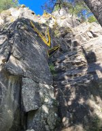
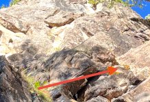
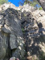
The correlation of the degrees is very interesting and something I will certainly look into when time permits. Carvings are indeed very important in finding “The Yard” as modern treasure hunters call it and what the French and Spanish called “The Bottle” I have also seen them refer to it as “The Boot”. Here is a remarkable photo from the Central Cache, look how many turtles and rabbits there are. If you look close you can see a sighting rock with an eye painted on it. There is also a rock with 3-5vs carved midway up the cliff face.
 

Attachments

  • IMG_4414.jpeg
    IMG_4414.jpeg
    565.8 KB · Views: 20
  • IMG_4417.jpeg
    IMG_4417.jpeg
    610.8 KB · Views: 21
  • IMG_4418.jpeg
    IMG_4418.jpeg
    195.1 KB · Views: 21
  • IMG_4420.jpeg
    IMG_4420.jpeg
    233.5 KB · Views: 21
  • IMG_4421.jpeg
    IMG_4421.jpeg
    152.7 KB · Views: 20
We have a copy of a book from the French archives that has dozens if not hundreds of maps and entries from the Jesuit priests. We had some of these translated back in the 90s. Many of the entries and maps explain the americas as they have come to know them. I’ll see if I can get it scanned into an electronic format and share it. Here is one of their maps that explains the route they would travel. View attachment 2182268
Maybe you can help me with something.

Muscatine, Iowa is located at the southern point of the semi circle formed by the Mississippi River on Iowa's eastern border. When the American settlers started moving into the area, they found the ruins of a French mission town. I've only seen one mention of that mission, and that's it. If you see a map that shows a mission at this point on the Mississippi River, I would really like to see it.

The river camp I mentioned is on the west side of the Mississippi River. On the east side of the river is the Rock River and the west end of the Sauk Trail. It's a prehistoric road that goes east to the Detroit, Michigan area. From there, it's a boat ride to Quebec and Montreal. I always thought this would be the best route from the northern Rockies to Quebec.
 

The correlation of the degrees is very interesting and something I will certainly look into when time permits. Carvings are indeed very important in finding “The Yard” as modern treasure hunters call it and what the French and Spanish called “The Bottle” I have also seen them refer to it as “The Boot”. Here is a remarkable photo from the Central Cache, look how many turtles and rabbits there are. If you look close you can see a sighting rock with an eye painted on it. There is also a rock with 3-5vs carved midway up the cliff face.
Cool pictures. Thank you. I like the rabbit ears sticking out over the top of the bluff.

Here are a couple of pictures from the river camp I mentioned. This one shows a turtle head with a closed eye.

turtle eye.jpg


When the Sun is right, the eye turns into this.

turtle 7.jpg


Shadow 7, it even has a little flair to it.

The shell of the turtle is a mound of rock and dirt, about 40 feet high. At the top of the mound is this.

rock heart 2 500 crop 2 800.jpg


It shows a two toned heart laying on it's side. Just to the right of the point of the heart is a fanged creature facing the heart The heart and the creature line up to point the way to the plugged hole, at the bottom right of the picture. Everything was too easy, at this place. I'm guessing there's a poisoned tunnel or vault behind the plug.
 

Maybe you can help me with something.

Muscatine, Iowa is located at the southern point of the semi circle formed by the Mississippi River on Iowa's eastern border. When the American settlers started moving into the area, they found the ruins of a French mission town. I've only seen one mention of that mission, and that's it. If you see a map that shows a mission at this point on the Mississippi River, I would really like to see it.

The river camp I mentioned is on the west side of the Mississippi River. On the east side of the river is the Rock River and the west end of the Sauk Trail. It's a prehistoric road that goes east to the Detroit, Michigan area. From there, it's a boat ride to Quebec and Montreal. I always thought this would be the best route from the northern Rockies to Quebec.
IMG_4429.jpeg
 

Attachments

  • IMG_4431.jpeg
    IMG_4431.jpeg
    144.9 KB · Views: 18
  • IMG_4432.jpeg
    IMG_4432.jpeg
    166.2 KB · Views: 14
  • IMG_4427.jpeg
    IMG_4427.jpeg
    145.4 KB · Views: 15
Thank you for posting these maps. This map that shows LAC DES ILI NOIS in the upper right. I can't make out the word on the left side of the map, just NE of the capital A. Can you make it out. It's in my target area. Thanks again.
That is just a few maps I pulled out of the French Archives of the area I thought you were talking about. I think the word is “cododaches”: You can access the archives online and search hundreds of maps that have never been published or that we Americans have seen. Go to this website:


Type what you want to search for, in your case “Mississippi” is a good basic word to search. “Nouvelle-France" is also a good search. You can hit “refine” and select “maps”, that will make it so you are only seeing all the maps and not the other documents.

You should find what you are looking for, let me know if you need more help.
 

Last edited:
That is just a few maps I pulled out of the French Archives of the area I thought you were talking about. I think the word is “cododaches”: You can access the archives online and search hundreds of maps that have never been published or that we Americans have seen. Go to this website:


Type what you want to search for, in your case “Mississippi” is a good basic word to search. “Nouvelle-France" is also a good search. You can hit “refine” and select “maps”, that will make it so you are only seeing all the maps and not the other documents.

You should find what you are looking for, let me know if you need more help.
Thank you, again.
 

knowing the value of gold coming from this area, why would Napoleon sell it for a mere $15mil? the Louisiana Purchase was one of the most confusing exchanges of treaties I have read. but France would have known it to be worth more than the Spanish. France gave it up multiple times in various treaties. That much gold should have created a defensive posture to the area.

Mallet's journal was lost but here is a quote from the gov summary about Spanish troops in Santa Fe 1740: "there are only 80 soldiers, a bad gang and poorly armed" (ref). says mines were abandoned. all of this looked anything but intimidating to a country like France earning so much from gold mining vaults. imho France would have built forts and a road system considering the strategic value and knowing how little Spain had invested in the area.
In the publication, “The Semi-Centennial History of Colorado”, published in 1913, Napoleon is interviewed about the Louisiana Purchase. He makes the statement that he knew of the vast mineral resources in the territory he sold, according to Napoleon, Captain Villemont had informed him of what was there prior to the sell.

It’s clear Napoleon wanted to establish his French presence in the new world, his issue was he over extended himself. Also, if you study the events surrounding the Louisiana Purchase you can understand his point. There had been a French blockade put in place by a rouge governor, this angered the newly formed United States and they were threatening war with France. There was pressure all around for the French to pull out of America and consolidate its resources.
 

The correlation of the degrees is very interesting and something I will certainly look into when time permits. Carvings are indeed very important in finding “The Yard” as modern treasure hunters call it and what the French and Spanish called “The Bottle” I have also seen them refer to it as “The Boot”. Here is a remarkable photo from the Central Cache, look how many turtles and rabbits there are. If you look close you can see a sighting rock with an eye painted on it. There is also a rock with 3-5vs carved midway up the cliff face.
Questions for you. If there is a document that mentions a map being in a "bottle" or "boot" does it mean that the carved signs and symbols in the area of the cache are the map that will lead you to the cache?

Also, I'm looking for similarities between the Mississippi River camp and places in the Rockies. I find a lot of 7's and 13's in measurements of symbols and monuments. I also have found a couple of rocks with two owls on them, one obvious and the other hidden. From what I can guess, there was a shipment of two caches, shipped together, but kept separate. Have you seen anything similar?
 

Top Member Reactions

Users who are viewing this thread

Back
Top