Thermal City NC

Jun 9, 2013
13
2
Primary Interest:
All Treasure Hunting
Hey guys I was wondering what part of the creek any of you have had success with. I’m taking my new 4 inch over there later this month. I’ve only seen people dredging in the creek between the panning troughs and the highbanker “beach”.

Has anyone been north of the bridge in the creek? It looks like a real pita to get a Dredge down to that area which is why I thought it might be better. I will try to sample as much area as possible but my time is kinda limited. Just looking for past experiences. Thanks!
 

Problem is that they have designated areas you can dredge. You will have to check with the owners on the boundaries. Also they will be closed for the season the first of November.
 

ive spent alot of time north of the bridge with my 4" from 2010 to 2016 ( i would camp there for 3 weeks to a month each year) , up at the campsite area (2nd pulloff above bridge , its the wide open area with the big rock at the trail by pulloff) from just below the small waterfall (the center of the creek there is 6 1/2 to 8ft to bedrock and its all big car sized rocks, found some nice 1/4" to 3/8" nuggets there) dont bother checking around the huge rock downstream from falls , i went to 10ft and never hit bedrock on the mid stream side(had a 15ft wide hole and also went all around the rock) i can take some pics of my notes and post them

and all the way up to the northern boundry (there is a sign, at least it was still there in 2016, last time i was there, its a steep trail down, i spent over a week there in 2012 and went from bank to bank) . its shallow from 2 1/2ft to 4ft to bedrock , found salt and pepper gold but no decent nuggets

a spot you might wanna checkout, standing on the bridge looking downstream about 100 ft , you can see a pile of rocks sticking up (the bedrock rises there and they catch there) is a spot i would get some decent gold when i checked every other year starting in 2008, once you get below the bridge at the first right bend, you start finding pockets of a grey clay like material in the dry stream wash that goes straight . its under a false bedrock layer thats 4 to 6 ft deep (the grey is a mercury rich layer from the Lucky strike processing plant when the long toms washed out during a flood) and you also get a fair amount of free mercury ( small balls sitting in the riffles) in that stretch

ETA: ill post some pics of the areas
 

Last edited:
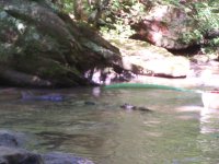
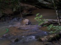
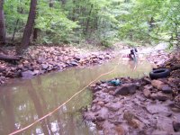
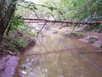
this is the farthest north section, above the big rock is off limits as its above the sign, from 2010
nc dredge .JPG
nc dredge1 .JPGnc dredge2 .JPG this is looking up stream
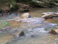
nc dredge3 .JPGnc dredge4 .JPGview from the road next to pulloff
nc dredge5 .JPGnc dredge6 .JPGsome better pics of the area
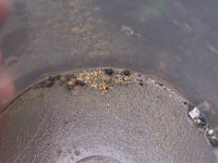
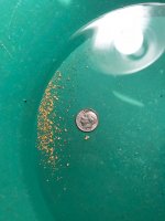
nc dredge22 .JPGone of the cleanups from there, with garnets
 

Last edited:
this is looking down from the road at the 2nd pulloff area in 2011 (camp site), this area is about 6ft to bedrock and varies from that to 8ft in this stretch
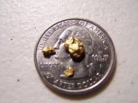
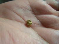
View attachment 1644167View attachment 1644168View attachment 1644171the big long flat rock is abt 2ft thick and sitting on another rock underneath it. this section has lots of car sized rocks sitting on the bedrock, i have to try and find some of the pics when i cleaned out from the falls to this hole the following year in 2013, the first rock i dredged down to was so big, i laid down flat on it and couldnt touch the edges with my arms or feet in length or width, i cleaned it off till i found a hole between the rocks, sucked down to the bedrock and them did a 360 with the nozzle pushing it abt 3ft in all directions ( i was holding it abt 1 1/2ft down on the hose behind the nozzle and pushing it under) , thats where the nugget in my hand below came from


nc dredge7 .JPGnc dredge14 .JPGnc dredge13 .JPGone of the clean ups from that stretch


nc dredge18 .JPGpic of the flat area, the huge rock would be to the left in this pic
 

Attachments

  • nc dredge23 .JPG
    nc dredge23 .JPG
    349.9 KB · Views: 207
  • nc dredge9 .JPG
    nc dredge9 .JPG
    813.6 KB · Views: 173
  • nc dredge10 .JPG
    nc dredge10 .JPG
    1.1 MB · Views: 172
Last edited:
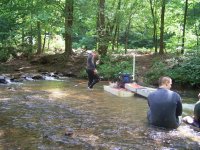
below the bridge area in the 1st pull off on right above the little concrete bridge by the back entrance to thermal city on polly spout rd, this is the dry wash channel area in middle of the channel where the river splits left and goes along the rock cliff and the close channel thats by the parking spot when it had water in it in 2012-2013. this is where i said theres a gray layer of mercury mixed material under the false bedrock layer at 4 to 6ft depth.
looking downstream towards where the two channels that split join back together north of the camping area

looking upstream towards where the two channels split. the left side is the sandbar where you can park and launch your dredge, the right side is tough to get to with a bigger dredge as its pretty shallow and you have to drag it for a good distance, you could also drive down the trail along the hill base right after the bridge on right side, follow that all the way back abt 1/4 mile to the cliff base where the back channel turns south. i had my 3" back there and wasnt impressed with what i found, so only spent a few days back there
 

Last edited:
NJ, great info! Unfortunately I just got it a little too late. I prob did 25 test pans north of the bridge esp around the “big rock” area at the first pulloff. As best I could tell, no one had been in this area since hurricane Michael a few weeks ago. I decided to just stay down near the TC headquarters. ImageUploadedByTreasureNet.com1540424280.201621.jpg

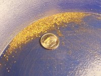
This was my take, about 5 hours with a 4 inch down near cabin 2, north of the beach.
 

yeah its too bad i didnt see the thread till the 20th

thats a decent haul for the lower end where you stayed, to get the decent gold, you need to go north of the camp at least to the bend below where the river splits around the island. the over burden by the camp is pretty deep except for the areas that get pounded by everyone with the smaller dredges, Crystal Jim (guy that used to work there till him and llyod had a falling out in 2014) said its 8 to 12 ft in most spots. most guys with the 3 inchers and smaller give up after about 3ft , by experience ive found you have to go to at least 5ft to get to ground that hasnt been hammered hard

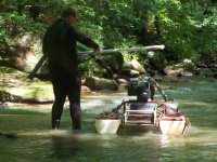
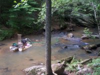
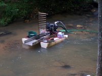
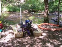
in the pics of the far north area above with the red framed dredge(my first 3in with a briggs 3.5hp that didnt have air), so in 2011 i brought my first 4 inch with the big homemade pontoons with the 6.5hp honda and left that up above the bridge and used the 3in with one of my portable air compressors to hit the middle channel of the island for a couple days, you can see the air hose coming downstream from the beach to the dredge so i could have air there

in 2012, there was a hurricane that came thru there the day before we got there and the river came up to within a foot of coming over the bank by cabin 3 (where we stayed), after the water went down, i hit a couple spots that had deep potholes and crevices i cleaned out in 2011 that i could long arm untill it cleared up enough to see but didnt find much replenishment gold

by the way, dont bother with the big rock unless you want to invest alot of time, i went down to 10ft and never hit bedrock on the mid stream side(had a 15ft wide hole and the sand kept sliding in and also went all around the rock down to 6ft plus trying to see what its sitting on, (by the way, its sitting on another big rock) gave up as i was running out of vacation days left

i have seen as many as 4 dredges above the bridge some days, and the scattering of highbanker dredges that bomb crater the sides near the banks
 

Last edited:
Wow nice color for a place that has been hit as hard as that sounds!
 

NJ sounds like you’ve worn that place out! I’ve wondered how hard that place has been hit, and where the guys that live there actually go. I was just long arming but did hit bedrock, I’d say down about 3 feet and just started following it. Down by cabin 4 there used to be a sign that said no dredging beyond this point, but it’s not there now.

I walked down beyond cabin 4 and there were some nice holes punched out, and a 4 inch sitting on the beach area. Not sure you know, but there are new owners, maybe they extended the area.
 

I spent the day there about 5 years ago.

I was a complete beginner, so I panned at the trough they provided first trying to develop some skill. I found zero gold in the trough. But then I went into the creek and did manage to capture a little color.

I still have the t-shirt :occasion14:
 

I really love it there. I don’t go to get rich, the people are always great and it’s quiet and relaxing. This was the first time I’ve ever taken a dredge. NJ or anybody else, do you have any experience at the other mine, vein mountain? They just don’t seem quite as hospitable.
 

Johnny,

yes i know there are new owners, a husband and wife, the husband got killed in August when something fell and crushed him i think it was in a highreach lift, dont remember the particulars.

i have a buddy that has a season spot there (that might have been his 4 inch on the beach). there was something like 20 acres below that sign that Llyod didnt let anyone on except the guys that worked there and where he had the "mine" that he dug the paydirt from across the river, there was some really nice looking bottom and crevices down there, but was never let in to dredge

when i was still going there, there would be 1 or 2 during the week and 4 to 6 dredges above the bridge on saturday, then less on sunday as everyone that stayed the week was packing up and heading home. sometimes you would have the whole creek from camp all the way to the north end all to yourselves. all it takes is a small patch someone missed to find a good pocket.

are you talking about carolina gold and gem? Donnys place? the one below lucky strike?
 

No I was talking about the lucky strike area. The people up there just don’t seem as friendly, to me anyway. I saw 3 guys there once all running 5 inchers in front of the diner. I’ve never seen anyone else there in the creek. What I understand they have other locations, but if I heard right, it’s $100 a month for access? They do have good burgers though, I always go for one when I stay at TC. The LDMA camp is back that way also. I found it accidentally one day, but it was closed due to flooding.
 

i dont go there anymore , there used to be lots of guys in that whole stretch in front of the diner and down to the waterfall dam and up to the crane. back when i started going there in 2007 and 2008, it was almost standing room only in that strecth. Lucky strike bought another mile of river to the north , it starts above the current lucky strike and goes up past the bridge further up polly spout that crosses over and goes up the steep hill. lucky strike also has a landlocked mining claim up by the LDMA camp, its called Brackettown

the LDMA camp is thru the one lane tunnel (vein mountain road)that goes under the railroad tracks across from carolina gold and gem (donnys place), its a couple miles on the left. its very picked over
 

Enamel, are you local? When did you hear this?id be curious to know what they are asking for it.
 

Top Member Reactions

Users who are viewing this thread

Back
Top