eagle_scout
Tenderfoot
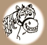
I ve spent alot of time studying this horse map and the priest map at the museum out in apache junction and i think they are real. if they arent copies of the real thing. ive noticed a lot of information on them that others have failed to mention. Most of the theories ive seen about them are close but here is my take on them. First of all, the horse map. what does it really say? the O's are O's and the A's are A's, so the word COBOLLO is not horse. horse is spelled CABALLO. I think the B is not a b but an old school G. the word then spells Cogollo. which means paydirt. and the horse? did anyone here go to college? first of all lets consider the location of the superstition mountains. they are on the 33rd parallel! (que spooky music now). In the old days, when the spanish were sailing in the pacific, they came to a zone where the winds were so calm that they drifted for months at a time and ran out of water and food. their livestock died. the dead horses had to be thrown overboard. they refered to these areas as the horse latitudes. here is a wiki link that better explains it: Horse latitudes - Wikipedia, the free encyclopedia
anyway, here is where that comical horse on the stone comes in. the stone is a star chart that tells you to go as far north as the horse lattitude. to properly read this stone, you would hold it over your head and look up at it.
anyway, here is where that comical horse on the stone comes in. the stone is a star chart that tells you to go as far north as the horse lattitude. to properly read this stone, you would hold it over your head and look up at it.


