signumops
Hero Member
- Feb 28, 2007
- 756
- 230
- Detector(s) used
- Garrett, Minelab, Aqua-Pulse
- Primary Interest:
- All Treasure Hunting
I have waited till after the Fisher Contractor meeting held last weekend to post this message. The meeting itself had nothing to do with this posting beyond the fact that the C-8 boat had found a particular cannon during the first week of October and we wanted to report its position before I made any public remarks about it. Actually, I have nothing in particular to say about the cannon, but I do have something interesting to say about a method of locating it. You can see pictures of the cannon at:
www.pixlbndr.com/wrecker/Travis where there is a simple directory listing of some JPG’s… nothing fancy, but available.
Now, you can get to this cannon if you have the fix, or, you can find it with a magnetometer, I’m sure, and I am confident that there are a number of salvors in recent years who were aware of its location (but Art McKee seemed to have missed it somehow!!!). Cal Johnson and Bill Haynie showed me another way to find it, using this device they have. I took them to the area: they located it. But, that is the most recent location they have shown me. I have been dragging them up and down the coast for more than a month, testing this “thing” they have to see how it works. Its very odd, but, to a certain extent, pretty reliable. In fact, it is much easier to use in a vehicle where you can cover some ground in any direction to triangulate your bearings… a boat is an ideal vehicle in this regard. I have taken them to the shore and out to sea with the intent of testing targets that I know of, some of which are probably only known to myself and a few others. So now, as a favor to Cal and Bill, I am dropping this dime on the Treasurenet Shipwreck forum.
Some months back I made a posting about a slew of waypoints that had fallen into my hands that noted locations where a shrimper had hung nets.
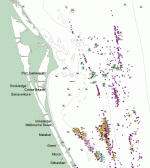
Here is a screen snapshot of a portion of the ArcGIS map hosting those positions. Bill and Cal picked up on this and gave me a buzz. They wanted to show me their new type of “magnetometer” (Bill’s wording). I’m only in this business to find things, so I don’t pass up an opportunity to check out a new technology, especially since it is only provided as a service, rather than an off-the-shelf expense. That’s right, you can’t buy this thing, and you can’t rent it. You have to hire Cal or Bill to run the service for you. Bear in mind that I did not hire them… I just ran them all over the place to see this device operate.
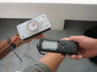
To look at it, you’ll swear that it seems too simple. Small box with battery inputs and a compass needle, and a common compass at that! Carumba! it’s a Boy Scout orienteering compass you can buy at Walmart! Cal has built a number of models and Bill has one of his own. I’ve seen both of them working, and both working in tandem with identical results. Basically, you use it by sweeping it in an arc and the needle will dwell on a bearing. You note your bearing, then move to another triangulation point. Note your bearing from the second point, and a third, fourth, and so on. This methodology requires that you have some way of plotting your bearings to see where they cross, and Bill has been using a mapping program on his laptop to do this, however, his map-ware uses charts of such a small scale that it can be difficult to determine, within dozens of feet the potential point of interest. However, when these bearings are coupled with well-defined datum points (in other words, X and Y fixes to the typical thousandths of a minute of distance we are required to report for the Fisher contracts), they can be plotted more precisely. I have been using my own software to do this, but, you could actually pull it off using Google Earth in many cases.
There are some caveats:
1. you can not approach north to south
2. larger man-made objects must only occupy a field dead-opposite of the sweeping arc, otherwise, the needle will dwell on them instead of other unidentified targets
3. the needle will spin when you are in the immediate influence of the object located, therefore, when you cross over it, you will lose the dwell of the needle and must move off some distance to re-acquire the object’s influence
4. there are no metrics for the device, in other words, you can not be certain what distance away from the object you are until you approach it, and, you have no way of knowing exactly what the object may be, nor if it is being affected by other surrounding objects
5. object size is not necessarily a denominator in the function of an object’s attractive attributes (at least this is not currently known to Cal or Bill)
6. object’s metallic composition can not be determined in advance… ferrous or non-ferrous is unknown
So, at this point, you ask “What’s the secret and where did these guys come up with it?”
You have to ask them: I won’t say how they came by the idea, and frankly, I’m not real sure, under the circumstances that they can really tell you much more. They never agreed to fill me in on exact details, but, have made themselves completely available for testing and disclosure of as much info as they can comfortably provide.
My own evidence:
I have to tell you that I have had no previous contact with Cal or Bill, but we certainly have a great deal in common, both in working history and in residential history. We also know many of the same people, have known many of the same people, and, therefore can come up with many common opinions based on similar experiences. Age does have its own grace. We also like the same beer.
At this point, I would like to hear from any of you out there who had dealings with Frank Brawley. I knew him well enough and worked with him in the oil fields of Louisiana as well as in Brevard County’s near-shore waters.
Anyway, Bill and Cal have no serious experience with any of the 1715 wrecks, nor were they aware of any other interesting wreck locations south of Cape Canaveral (do not take this to mean that they have no interests elsewhere along the Florida East Coast). The first test was a demonstration of the device locating a silver bar that Cal rescued from a 17th century wreck in a faraway land (don’t ask me, ask him). Yep, damn thing would dwell on it from about 50 feet away, and I intentionally had him demonstrate this at a beach where Indian Harbour Beach and Satellite Beach share their common boundary. There’s supposedly a wreck there that fetches cobs, so I hoped they might get a hit, but, when we arrived there, there was a dive boat near shore, divers in the water, and a set of buoys strung out. I don’t know who they were… probably some DNR types from a college doing some sort of marine life survey, but I don’t know for sure.
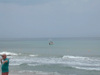
They also took me to Melbourne Beach where they tried to impress me with a fix and a bearing they thought lined up with a wreck symbol in their computer’s mapping software. I assessed this particular chart and immediately determined that they really needed somebody to take them to some locations NOT published on common software mapping data sets. I can certainly do that, but on this first introductory excursion, I only had a good cigar in my pocket and enough change to buy a round of draft beer. It was pretty hot, and I had a lot of questions, so we retired to a shady nook and had a round. End of first test.
Second test… I took them to a beach location where I suspect a wreckpile to lay. Worked this one over from A1A as well as along the beach. Bingo! Pointed to the spot from several hundred feet away. Also pointed to some other spots in the dunes, which we would have had to bulldoze to get to. This is not much of a test as I am only taking them to a location where I SUSPECT something could be found.
Third test… I took Bill and Cal to Wabasso and walked them a good way up the beach toward the “Spring of Whitby” location. This time I had my GPS with me and have many waypoints in the area, particularly two huge anchors lying about 1400 feet offshore along with some other mag’d targets that have yet to be excavated… very strong targets.
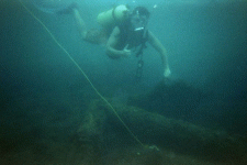
If you are familiar with this location you know that there are large houses along the beach fortified by very serious seawalls. As far as I know they are sheet piles made of steel, so this would be a test of Caveat 2.
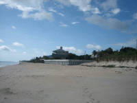
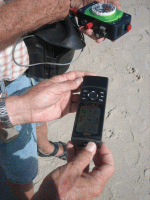
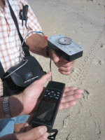
Cal tried several models of the device and immediately dwelled upon the location of the anchors. The anchors are about 100 feet apart and we were about 1400 feet away from them, so given the coarseness of the compass and the graphics of my GPS display at that distance, you have to be satisfied with the results. We began walking south, and, once again, the device acquired a bearing on my mag targets. Very impressive! They also found another hit, which we computed to be around 600 feet out. As we approached the parking lot at the end of 510, the devices definitely picked up the San Martin.
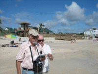
The attraction was irresistible. End of test three.
Fourth test… Bill came by an original chart, vis a vis Frank Brawley, vis a vis, Bill Andrews, vis a vis Mel Fisher. It is a pretty precise location of two mid-1800 to late 1800 vessels as they can be triangulated from the old Coast Guard Station in the area of Floridana Beach. The place is a roadhouse now and recently the watch tower was taken down, but, for you old-timers, it is a landmark and can be found on any USGS chart dating from the 1949 editions of the charts of the Grant Quad, or maybe the Sebastian NW Quad (I don’t have them on screen at the moment). Bill and I walked the baseline and had absolutely no trouble pinning down these two wrecks from shore. Bear in mind that Bill had no real idea where he was, but I did. These wrecks have already been worked over, and, once again they are about 1000 feet offshore. This test is definitely one that would be repeatable and I have the computations and rectified charts available for examination. End of test four.
Fortunately, the first week of October (2009) was a superb week for diving. Flat seas, clear water in the Wabasso area and sunshine. Water was warm from top to bottom. Seems that every other contractor had put their toys away for the year and we were the only boat on station. We worked a week and during that week found the cannon I mentioned early on. The last day of the week, when we knew our dockage bill was about to run out, and the seas were going to pick up, we took Bill and Cal out on the C-8 boat to test their locator devices. Leaving Sebastian Inlet and heading south past the Cabin Wreck, I had Travis run inshore of some mag hits recorded in the late 60’s. The targets are not generally known to most salvors, and they have yet to be verified. Cal’s needle homed in on them. Amazing! Next we swung by the Roberts. Big attraction there, for some distance moving southward it stayed on focus for about 2500 feet or so.
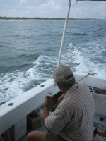
Next target were the big anchors at the Spring of Whitby. Picked them up from about 100 yards, but had some error when in the immediate area.
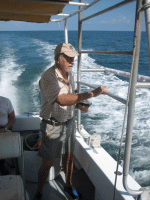
There must be a lot of stuff in that vicinity. We could not get a good dwell and the water was murky so we could not see the anchors from the surface. We moved on toward the San Martin. Big attraction there and the needle stayed focused upon that spot until we approached the cannon in our designated work zone. We passed shoreward of it and hove to. Bingo! Both Cal and Bill picked it up in tandem from a distance of about 50 feet. Very strong attraction. So then we moved out some distance and began a pattern when we got some hits and crossed over them to spin the needles… we took MOB fixes and dropped anchor about 100 feet inshore of the location. Water was about 20 feet deep here and the vis was about 30 feet, so Travis and I swam it for a while and could find nothing except coral/limestone ridges between beds of sand. End of test five.
So, there you have it so far. Now, the question is “How does it work?”
Induced Polarity…. Not in the traditional sense.
Magneto Telluric…. Close but no cigar.
Magneto metric…. Certainly similar, but, this finds any kind of metal.
Ley lines… That’s in the realm of fairy dust and I can’t draw a parallel on the subject.
Telepathy… I wore my aluminum “cone of silence” dunce cap the whole time (well what did you expect?)
I think, at the moment, that the thing works by sensing gravitational disturbances through the use of an induced polarity acting upon the compass needle which, in turn, temporarily neutralizes the real magnetic attributes of the needle. Part of this assumption is based upon the fact that it will not work while traveling along a polar line, and upon the ‘fact’ that it can apparently sense where large objects, like automobiles had PREVIOUSLY been located. I would have to really test this last feature under serious control to make sense of it. That’s about all I have to say about this at the moment. You heard it here first.
www.pixlbndr.com/wrecker/Travis where there is a simple directory listing of some JPG’s… nothing fancy, but available.
Now, you can get to this cannon if you have the fix, or, you can find it with a magnetometer, I’m sure, and I am confident that there are a number of salvors in recent years who were aware of its location (but Art McKee seemed to have missed it somehow!!!). Cal Johnson and Bill Haynie showed me another way to find it, using this device they have. I took them to the area: they located it. But, that is the most recent location they have shown me. I have been dragging them up and down the coast for more than a month, testing this “thing” they have to see how it works. Its very odd, but, to a certain extent, pretty reliable. In fact, it is much easier to use in a vehicle where you can cover some ground in any direction to triangulate your bearings… a boat is an ideal vehicle in this regard. I have taken them to the shore and out to sea with the intent of testing targets that I know of, some of which are probably only known to myself and a few others. So now, as a favor to Cal and Bill, I am dropping this dime on the Treasurenet Shipwreck forum.
Some months back I made a posting about a slew of waypoints that had fallen into my hands that noted locations where a shrimper had hung nets.

Here is a screen snapshot of a portion of the ArcGIS map hosting those positions. Bill and Cal picked up on this and gave me a buzz. They wanted to show me their new type of “magnetometer” (Bill’s wording). I’m only in this business to find things, so I don’t pass up an opportunity to check out a new technology, especially since it is only provided as a service, rather than an off-the-shelf expense. That’s right, you can’t buy this thing, and you can’t rent it. You have to hire Cal or Bill to run the service for you. Bear in mind that I did not hire them… I just ran them all over the place to see this device operate.
To look at it, you’ll swear that it seems too simple. Small box with battery inputs and a compass needle, and a common compass at that! Carumba! it’s a Boy Scout orienteering compass you can buy at Walmart! Cal has built a number of models and Bill has one of his own. I’ve seen both of them working, and both working in tandem with identical results. Basically, you use it by sweeping it in an arc and the needle will dwell on a bearing. You note your bearing, then move to another triangulation point. Note your bearing from the second point, and a third, fourth, and so on. This methodology requires that you have some way of plotting your bearings to see where they cross, and Bill has been using a mapping program on his laptop to do this, however, his map-ware uses charts of such a small scale that it can be difficult to determine, within dozens of feet the potential point of interest. However, when these bearings are coupled with well-defined datum points (in other words, X and Y fixes to the typical thousandths of a minute of distance we are required to report for the Fisher contracts), they can be plotted more precisely. I have been using my own software to do this, but, you could actually pull it off using Google Earth in many cases.
There are some caveats:
1. you can not approach north to south
2. larger man-made objects must only occupy a field dead-opposite of the sweeping arc, otherwise, the needle will dwell on them instead of other unidentified targets
3. the needle will spin when you are in the immediate influence of the object located, therefore, when you cross over it, you will lose the dwell of the needle and must move off some distance to re-acquire the object’s influence
4. there are no metrics for the device, in other words, you can not be certain what distance away from the object you are until you approach it, and, you have no way of knowing exactly what the object may be, nor if it is being affected by other surrounding objects
5. object size is not necessarily a denominator in the function of an object’s attractive attributes (at least this is not currently known to Cal or Bill)
6. object’s metallic composition can not be determined in advance… ferrous or non-ferrous is unknown
So, at this point, you ask “What’s the secret and where did these guys come up with it?”
You have to ask them: I won’t say how they came by the idea, and frankly, I’m not real sure, under the circumstances that they can really tell you much more. They never agreed to fill me in on exact details, but, have made themselves completely available for testing and disclosure of as much info as they can comfortably provide.
My own evidence:
I have to tell you that I have had no previous contact with Cal or Bill, but we certainly have a great deal in common, both in working history and in residential history. We also know many of the same people, have known many of the same people, and, therefore can come up with many common opinions based on similar experiences. Age does have its own grace. We also like the same beer.
At this point, I would like to hear from any of you out there who had dealings with Frank Brawley. I knew him well enough and worked with him in the oil fields of Louisiana as well as in Brevard County’s near-shore waters.
Anyway, Bill and Cal have no serious experience with any of the 1715 wrecks, nor were they aware of any other interesting wreck locations south of Cape Canaveral (do not take this to mean that they have no interests elsewhere along the Florida East Coast). The first test was a demonstration of the device locating a silver bar that Cal rescued from a 17th century wreck in a faraway land (don’t ask me, ask him). Yep, damn thing would dwell on it from about 50 feet away, and I intentionally had him demonstrate this at a beach where Indian Harbour Beach and Satellite Beach share their common boundary. There’s supposedly a wreck there that fetches cobs, so I hoped they might get a hit, but, when we arrived there, there was a dive boat near shore, divers in the water, and a set of buoys strung out. I don’t know who they were… probably some DNR types from a college doing some sort of marine life survey, but I don’t know for sure.

They also took me to Melbourne Beach where they tried to impress me with a fix and a bearing they thought lined up with a wreck symbol in their computer’s mapping software. I assessed this particular chart and immediately determined that they really needed somebody to take them to some locations NOT published on common software mapping data sets. I can certainly do that, but on this first introductory excursion, I only had a good cigar in my pocket and enough change to buy a round of draft beer. It was pretty hot, and I had a lot of questions, so we retired to a shady nook and had a round. End of first test.
Second test… I took them to a beach location where I suspect a wreckpile to lay. Worked this one over from A1A as well as along the beach. Bingo! Pointed to the spot from several hundred feet away. Also pointed to some other spots in the dunes, which we would have had to bulldoze to get to. This is not much of a test as I am only taking them to a location where I SUSPECT something could be found.
Third test… I took Bill and Cal to Wabasso and walked them a good way up the beach toward the “Spring of Whitby” location. This time I had my GPS with me and have many waypoints in the area, particularly two huge anchors lying about 1400 feet offshore along with some other mag’d targets that have yet to be excavated… very strong targets.

If you are familiar with this location you know that there are large houses along the beach fortified by very serious seawalls. As far as I know they are sheet piles made of steel, so this would be a test of Caveat 2.


Cal tried several models of the device and immediately dwelled upon the location of the anchors. The anchors are about 100 feet apart and we were about 1400 feet away from them, so given the coarseness of the compass and the graphics of my GPS display at that distance, you have to be satisfied with the results. We began walking south, and, once again, the device acquired a bearing on my mag targets. Very impressive! They also found another hit, which we computed to be around 600 feet out. As we approached the parking lot at the end of 510, the devices definitely picked up the San Martin.

The attraction was irresistible. End of test three.
Fourth test… Bill came by an original chart, vis a vis Frank Brawley, vis a vis, Bill Andrews, vis a vis Mel Fisher. It is a pretty precise location of two mid-1800 to late 1800 vessels as they can be triangulated from the old Coast Guard Station in the area of Floridana Beach. The place is a roadhouse now and recently the watch tower was taken down, but, for you old-timers, it is a landmark and can be found on any USGS chart dating from the 1949 editions of the charts of the Grant Quad, or maybe the Sebastian NW Quad (I don’t have them on screen at the moment). Bill and I walked the baseline and had absolutely no trouble pinning down these two wrecks from shore. Bear in mind that Bill had no real idea where he was, but I did. These wrecks have already been worked over, and, once again they are about 1000 feet offshore. This test is definitely one that would be repeatable and I have the computations and rectified charts available for examination. End of test four.
Fortunately, the first week of October (2009) was a superb week for diving. Flat seas, clear water in the Wabasso area and sunshine. Water was warm from top to bottom. Seems that every other contractor had put their toys away for the year and we were the only boat on station. We worked a week and during that week found the cannon I mentioned early on. The last day of the week, when we knew our dockage bill was about to run out, and the seas were going to pick up, we took Bill and Cal out on the C-8 boat to test their locator devices. Leaving Sebastian Inlet and heading south past the Cabin Wreck, I had Travis run inshore of some mag hits recorded in the late 60’s. The targets are not generally known to most salvors, and they have yet to be verified. Cal’s needle homed in on them. Amazing! Next we swung by the Roberts. Big attraction there, for some distance moving southward it stayed on focus for about 2500 feet or so.

Next target were the big anchors at the Spring of Whitby. Picked them up from about 100 yards, but had some error when in the immediate area.

There must be a lot of stuff in that vicinity. We could not get a good dwell and the water was murky so we could not see the anchors from the surface. We moved on toward the San Martin. Big attraction there and the needle stayed focused upon that spot until we approached the cannon in our designated work zone. We passed shoreward of it and hove to. Bingo! Both Cal and Bill picked it up in tandem from a distance of about 50 feet. Very strong attraction. So then we moved out some distance and began a pattern when we got some hits and crossed over them to spin the needles… we took MOB fixes and dropped anchor about 100 feet inshore of the location. Water was about 20 feet deep here and the vis was about 30 feet, so Travis and I swam it for a while and could find nothing except coral/limestone ridges between beds of sand. End of test five.
So, there you have it so far. Now, the question is “How does it work?”
Induced Polarity…. Not in the traditional sense.
Magneto Telluric…. Close but no cigar.
Magneto metric…. Certainly similar, but, this finds any kind of metal.
Ley lines… That’s in the realm of fairy dust and I can’t draw a parallel on the subject.
Telepathy… I wore my aluminum “cone of silence” dunce cap the whole time (well what did you expect?)
I think, at the moment, that the thing works by sensing gravitational disturbances through the use of an induced polarity acting upon the compass needle which, in turn, temporarily neutralizes the real magnetic attributes of the needle. Part of this assumption is based upon the fact that it will not work while traveling along a polar line, and upon the ‘fact’ that it can apparently sense where large objects, like automobiles had PREVIOUSLY been located. I would have to really test this last feature under serious control to make sense of it. That’s about all I have to say about this at the moment. You heard it here first.


 Tom
Tom


