SoCalBeachScanner
Hero Member
- Aug 17, 2013
- 601
- 547
- 🏆 Honorable Mentions:
- 4
- Detector(s) used
- Garrett ATX, AT Pro, ProPointer, and a weirdly good sense of direction
- Primary Interest:
- All Treasure Hunting
-
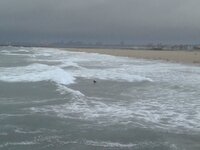
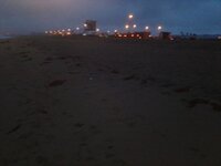
This morning at 5AM, I headed to Seal Beach to check out the beach erosion situation. When I arrived, there was already three media vans in the parking lot just waiting for the worst to happen. The problem is, the high surf has not come in yet. The surf was the same (3-5ft) as yesterday afternoon, but with a 20 knot wind this morning. I talked to one of the media vans and told them the high surf has not arrived, so not much to film. We both agreed that the media was there because it makes good TV weather reporting being this storm is SoCal's biggest storm in several years, along with the drought situation. I told them, the best chance of any minor flooding would be at tonight's high tide if very high swells arrives today.
At 5AM this morning it was three hours before high tide, so in between rain cells, I made a quick pass scanning down the beach mid-slope and on the way back I hit higher up at the high tide/cut mark. I was looking for areas of concentrations of targets that might have eroded out from last nights high tide. Only found scatter coins in the half hour I was out. Not much change from last nights high tide from when I was out there scanning yesterday afternoon at low tide.
After I made the quick pass scanning at Seal Beach this morning, I went to Huntington Beach to check out the erosion situation there. The Huntington Beach photo was while it was still dark out, but you can see the current high tide mark vs the erosion cut 30ft higher up from the high surf we had a couple weeks ago. So hopefully by tomorrow and Sunday, some new erosion will take place when the high swell arrives. I went back to Seal Beach to take some photos when it lighten up some.
Here are some photos and a video from this morning......
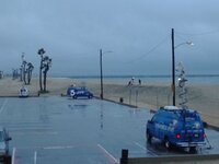 --
--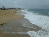 --
--
Video of Surrounding Area -This is my first attempt to add a cell phone video>>>> MD Select - YouTube
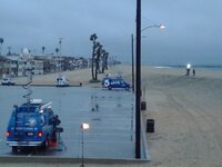 --
--
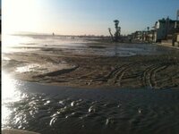
This picture is from several years ago went storm surge went around the sand berm. The city builds a sand berm every year in the Fall and removes it in early Spring. You can see the sand berm in the photos from this morning to the right of the media vans.
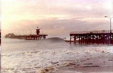
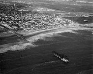
The last two pictures are from March 4th, 1983, when a very strong storm, with a higher than normal high tide, with a monster swell from the west, took out the Seal Beach pier.
This morning at 5AM, I headed to Seal Beach to check out the beach erosion situation. When I arrived, there was already three media vans in the parking lot just waiting for the worst to happen. The problem is, the high surf has not come in yet. The surf was the same (3-5ft) as yesterday afternoon, but with a 20 knot wind this morning. I talked to one of the media vans and told them the high surf has not arrived, so not much to film. We both agreed that the media was there because it makes good TV weather reporting being this storm is SoCal's biggest storm in several years, along with the drought situation. I told them, the best chance of any minor flooding would be at tonight's high tide if very high swells arrives today.
At 5AM this morning it was three hours before high tide, so in between rain cells, I made a quick pass scanning down the beach mid-slope and on the way back I hit higher up at the high tide/cut mark. I was looking for areas of concentrations of targets that might have eroded out from last nights high tide. Only found scatter coins in the half hour I was out. Not much change from last nights high tide from when I was out there scanning yesterday afternoon at low tide.
After I made the quick pass scanning at Seal Beach this morning, I went to Huntington Beach to check out the erosion situation there. The Huntington Beach photo was while it was still dark out, but you can see the current high tide mark vs the erosion cut 30ft higher up from the high surf we had a couple weeks ago. So hopefully by tomorrow and Sunday, some new erosion will take place when the high swell arrives. I went back to Seal Beach to take some photos when it lighten up some.
Here are some photos and a video from this morning......
 --
-- --
--
Video of Surrounding Area -This is my first attempt to add a cell phone video>>>> MD Select - YouTube
 --
--
This picture is from several years ago went storm surge went around the sand berm. The city builds a sand berm every year in the Fall and removes it in early Spring. You can see the sand berm in the photos from this morning to the right of the media vans.

The last two pictures are from March 4th, 1983, when a very strong storm, with a higher than normal high tide, with a monster swell from the west, took out the Seal Beach pier.


Amazon Forum Fav 👍
Last edited:
Upvote
0


