DanB
Hero Member
- Oct 23, 2007
- 624
- 143
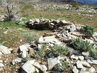
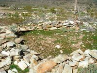
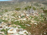
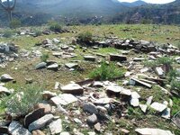
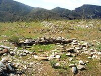
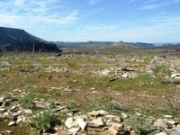
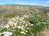
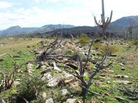
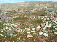
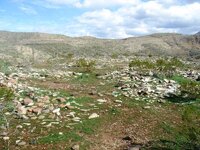
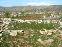
Here are some ruins just off of Table mesa rd to the east.....don't know much about who, how old or why....it covers about 6 acres...and most of it had a stone wall all around the perimeter...as seen from Google earth..any info would be nice..
the ruins are intersected by the strait line trail with gully's on either side.....
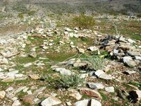
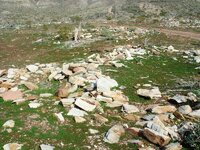
most of the stones on the site are not from this area....as if they were brought in...I first noticed it when out four wheeling...the rocks just seamed out of place....not the same consistency with what is found around the surrounding area. Then after a brush fire....the whole sight was reviled.....so here are some up close pictures...
db
the ruins are intersected by the strait line trail with gully's on either side.....
most of the stones on the site are not from this area....as if they were brought in...I first noticed it when out four wheeling...the rocks just seamed out of place....not the same consistency with what is found around the surrounding area. Then after a brush fire....the whole sight was reviled.....so here are some up close pictures...
db


Attachments
-
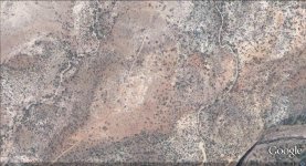 table mesa ruins map google.jpg186.7 KB · Views: 540
 -
 Las Vegas and Slate creek 228.jpg158.3 KB · Views: 544
 -
 Las Vegas and Slate creek 229.jpg144.1 KB · Views: 555
 -
 Las Vegas and Slate creek 230.jpg162.4 KB · Views: 533
 -
 Las Vegas and Slate creek 231.jpg139.9 KB · Views: 536
 -
 Las Vegas and Slate creek 232.jpg154.4 KB · Views: 536
 -
 Las Vegas and Slate creek 234.jpg171.5 KB · Views: 520
 -
 Las Vegas and Slate creek 233.jpg161.2 KB · Views: 535