Ragnor

Ragnor

Sr. Member
Dec 7, 2015
445
422
Primary Interest:
All Treasure Hunting
Well I was waiting to start this thread untill next summer, but tonight I made a discovery which I believe warrants the opening of this thread.
I have discovered a previously undocumented ore body of what appears to be gold and silver in carbonaceous rocks which lie outside the boundaries of a known mining district. I know of no mines in the immediate area which have exploited this material.

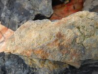
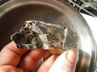
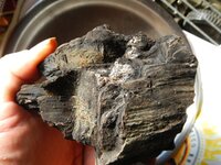
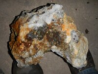
Here is the stuff
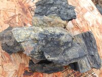
carbon1.jpg

carbon2.jpg

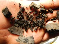
Ugly black rocks that I collected and dismissed as worthless coal. I collected them whilst traveling through the GPNF on an exploritory mission. I don't actually remember what I was up to. I may have been hunting at the time. I do not remember exactly where I collected the samples either. I know the general area and I recall it was a coal like seam in a sandstone slope above the road cut. The sulphide staining is what really caught my attention, but as I recall the black vein running through the hillside was somthing I had never seen before. I was hoping it was magnetite, as I have been looking for the source of the large hunks of magnetite I occasinally find for some years now.
I don't recall exactly when this occured, but I know it was prior to 2007. Since then the rocks have sunk into the ground and then been dug back up and left lying behind the barn for years. Untill today, when on a whim I crushed them and panned them.

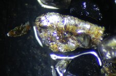
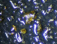
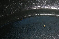
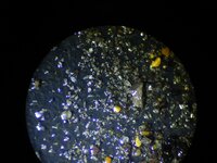
Here is the results.
microsilver.jpg

microgold.jpg

I apoligize for the poor picture quality, I am photoing them through a binocular metalurgical microscope with a nikon AW100

So that is my first official discovery of a previously unknown ore body.
It's a real sense of acomplishment for me. It's not even about any potential value. Just that I found somthing that no one else had ever discovered.
I suppose I will have to conduct some form of assay and hopefully relocate that seam some day.
I suspect it is primarily a silver deposit with trace gold.

I would have liked to start with a little autobiography. But I couldnt pass this one by. I'll get to the rest of it and what I'm about and my previous experiences in another post.
 

Found some more good ones hiding in the pan.

nice.jpg
 

Ragnor , from now on you should try to plot the samples you pick up on a map and maybe use a GPS for the locations . The rock in the pictures almost looks like it has some granite in it . I would also say you may have some iron staining too . Some of the fracturing does look similar to the way granite fractures . I was wondering just how hard this material is , and how it fractured as you crushed it .
 

Ragnor , from now on you should try to plot the samples you pick up on a map and maybe use a GPS for the locations . The rock in the pictures almost looks like it has some granite in it . I would also say you may have some iron staining too . Some of the fracturing does look similar to the way granite fractures . I was wondering just how hard this material is , and how it fractured as you crushed it .
Mapping and GPS are definately going to come into play from here on out. I was much younger and totally inexperienced when I started this project that was roughly 20 years ago. GPS and cell phones where not even in common use at that point. My brother and I plan to get serious about it from here on out. dividing our time between working our(my) placer and hunting down a good rich lode source. We plan to stockpile ore and process that when the snow is too deep to get to the placer.

As far as the materials we are working in there is really no granite in our area. The predominate features are diorites, andesites, basalts, breccias and tuffs. I've seen the granites around Moses Lake and into the Idaho pan handle. We don't have that here and the granite north of us is of the Mt Ranier variety, but we only see that as glacial till.
Here is a partial decription of the area this material was located.

" Bedded conglomerate, sandstone, siltstone, and
lithic diamictite containing volcanic-derived
clasts, as well as lithic- and lesser pumice-lapilli
tuff and fine-grained tuff. Typically brown to
buff, with the tuffaceous rocks generally green
and locally white or mauve. Different rock types
are interbedded at all scales, and attempts to
map them separately proved unworkable."

"Typically plagioclase-phyric, with
minor clinopyroxene; no hornblende and rare
quartz. Lithic clasts are sparse to abundant and
generally andesite or dacite in composition.
Fragments of charred wood are abundant in
many lapilli tuffs."


The material basically shatters into smaller pieces that look just like the larger pieces.
I dont know would that be splintery?

P3.jpg
P2.jpg
p1.jpg
 

Last edited:
Ok granite generally crushes sharp and triangluar , it looks like the stuff you are crushing resembles the original fischers , I was just wondering . It appears that the material you are crushing remain simlar in grain that it started from , Have you discovered the total mineral content . I was just wondering if there was any Silver or Platinum in it as they are also valuable .
 

I have not determined quantity or quality at this point. I'm hand crushing so that will take a while. I'm going to crush down what I have saving an orginal sample and then run some tests on the concentrate. I won't be able to return to the collection area till late spring if in fact any roads into the area are still passable at all. If not, well it will be another year before the horses are ready. We had a big blow out this fall. All of the roads from this side got wiped out. I don't know if I can get to it from the south or east till the snow melts. The forest services decided it was too much effort to keep track of road conditions within they're district. Kind of falls into the 'you had one job' category in my opinion. I put it on they're survey each year, but they don't really care about those things. It was the only reason I use they're web site, lol.
So that's where I'm at on this lead.
Aren't you from Washington.are you finding this on the west or east side.i have seen some stuff like this where I have some hardrock claims on the east side maybe I should check it out more closely
 

Assessing the claim, first trip of the year

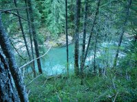
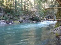
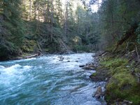
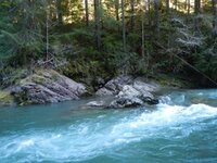
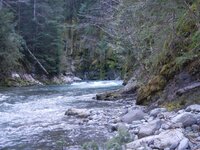
Well i got my econo-car rolling. I been up in the woods the last two days. First day was checking corners and recon. Had a dandy flood last December, best one since 1996 when I first found her. The scour mark was almost twice as high that year.

I'll give yah a little peak.

DSCN0946.JPGDSCN0940.JPG
DSCN0878.JPGDSCN0904.jpg
DSCN0895.JPGDSCN0912.JPG

I wasn't really there to get gold, but I just couldn't help but check it out a little.
It took me 3 pans to find what I was looking for.
DSCN0933.JPG

The current water level is 2000 cf/s it will be between 400 and 500 after the snow melts. Max flow in december was over 22,000. This is barely showing the surface.

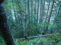
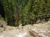
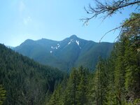
The second day I decided to look for some of the old mines, mostly I failed. Those hills are so freakin' big!
aDSCN0991.jpgaDSCN0994.jpg
I thought I was way up there, when I got home and looked at the map I wasn't even 1/3 of the way up.
I did find a nice piece of float that came down from an active mine in the flood though.
My metal detector really likes it.

DSCN1023.JPG

So, that's my journal update. Hope I ain't being too free with the information.
 

4-16-16

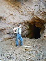
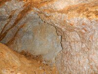
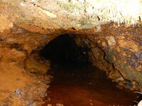
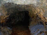
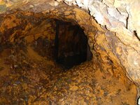
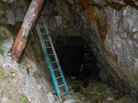
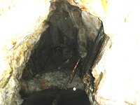
Made it up to most of the old mines on camp creek. Same story with most of them. They dead wall at around 20-30 feet, all are flooded. Most seam to have a flooded verticle shaft at the end. I didnt have a poking stick and I didnt want my boots and feet soaking in acid water all day so i didn't do much looking around.
Looks like the new claimants at the lucky strike are kind of whack jobs, they have nice equipment, but the mine entrance looks like a garbage dump and by the amount of signage and shell casings they think they own the mountain. They have a target range set up that fires down on the roads leading up the hill and beer cans and bottles and food wrappers laying everywhere. Looks more like a meth lab than a mine camp. City people been watching too much alaska gold show..... Also looks like some wildcatting has been done in recent years up there.

a wildcat mine, camp creek mine, rust adit, jim mine, blacksmith adit
saw a few other small prospects and a colapsed tunnel that is not on the maps could be traced for around 50 feet
Still no sign of the mine that was buried in a landslide with the miners inside in the 30's, but I think I found the area.
aDSCN1150.jpgaDSCN1154.jpg
aDSCN1160.jpgaDSCN1165.jpg
aDSCN1181.jpg
aDSCN1194.jpgaDSCN1195.jpg

The new guys are messing around in the blacksmith adit, they dont look to have made any effort to pump out the flooded shaft. I wonder if they have any idea how deep that hole goes.

Anyway, that was my expedition to the top of the mountain. The wall materials in the old mines was not what I was expecting. Though being as every one of them heads strait down I suspect i was not seeing the real workings.
 

Well, my summer was mostly a bust. We put allot of time in we dredged for 13 days strait and all we did was break even. Did better working on a club claim on a different creek up stream.I was pretty disappointed. took me this long to talk about it. lol. On the up side I got allot of hands on experience dredging and a lot of experience hand winching boulders. Also learned that being deep under water with shody gear is a tad bit scary. I also got a reminder that surfacing too fast at depth will rupture your ear drums. I forgot why I quit diving. I remember now. lol It's strange, the gold deposit I found as a kid was still there. We got 6 grams in a day in that spot, but it was just the one spot and just that one day. The rest of the time was real scarce pickings. So that was a learning experience. I also learned that big boulders don't always mean gold. We spent two days yarding huge boulders and dredging up into some real good looking material. It turned out to be barren. Appearantly the flood that deposited that material was from a non gold bearing tributary. I never would have believed it if I hadn't experienced it myself. I did get allot of copper/silver clinkers and they may have some gold in them. But I havn't gotten around to making the nitric to test them nor have a gotten around to roasting the half a coffee can of heavy sulphides that came out of our cleanups from dredging below the mines. I did get to see some real pretty crystaline gold though and I think that is pretty neat. I havn't given up though. I'm doing my research and planning to go back at it next year and now my partner has his first year under his belt too. He is all excited to get back to it again after the snow melts. So that's my journal entry for summer of 2016.
 

Top Member Reactions

Users who are viewing this thread

Back
Top