pegleglooker
Bronze Member
- Jun 9, 2006
- 1,857
- 238
- Detector(s) used
- ace 250
- Primary Interest:
- All Treasure Hunting
Hello everyone,
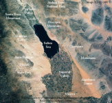
I have a question about salt conditions, diving and sonar. I live in Southern California and we have a inland sea called the Salton Sea.

It is said to be more salty than the ocean ( Because the Sea has no outlet, water is lost only through evaporation , leaving dissolved salts behind and gradually raising salinity. The Sea's salinity has now reached 44 parts per thousand (ppt), about 25% higher than ocean water.). Is it possible to use some sort of sonar to locate a lost ship at the bottom ( apprx 51 at it's deepest and 31 ft average ). This ship would have been lost between 400-500 yrs ago. It's important to know that this sea was not underwater for the whole time. It completely dried out many times. In 1905 the Colorado River overflowed and refilled the area. It took 2 yrs to fill. Here is a link if you need more info:
http://www.sci.sdsu.edu/salton/SaltonSeaHomePage.html
My questions are, can I use some sort of device to locate the wreck on the bottom and can one dive to recover any items I'm more of a landlock person and am not sure about these things. Please let me know if anyone can shed any light on this I would TOTALLY appreciate it.
Thankx in advance
PLL
I have a question about salt conditions, diving and sonar. I live in Southern California and we have a inland sea called the Salton Sea.

It is said to be more salty than the ocean ( Because the Sea has no outlet, water is lost only through evaporation , leaving dissolved salts behind and gradually raising salinity. The Sea's salinity has now reached 44 parts per thousand (ppt), about 25% higher than ocean water.). Is it possible to use some sort of sonar to locate a lost ship at the bottom ( apprx 51 at it's deepest and 31 ft average ). This ship would have been lost between 400-500 yrs ago. It's important to know that this sea was not underwater for the whole time. It completely dried out many times. In 1905 the Colorado River overflowed and refilled the area. It took 2 yrs to fill. Here is a link if you need more info:
http://www.sci.sdsu.edu/salton/SaltonSeaHomePage.html
My questions are, can I use some sort of device to locate the wreck on the bottom and can one dive to recover any items
 I'm more of a landlock person and am not sure about these things. Please let me know if anyone can shed any light on this I would TOTALLY appreciate it.
 Thankx in advance
PLL


