Navigation
Install the app
How to install the app on iOS
Follow along with the video below to see how to install our site as a web app on your home screen.
Note: This feature may not be available in some browsers.
More options
You are using an out of date browser. It may not display this or other websites correctly.
You should upgrade or use an alternative browser.
You should upgrade or use an alternative browser.
Quartzville opinions.....
- Thread starter USTiger
- Start date
Use Google maps and follow Quartzville Dr. past Whitcomb Creek Park. You will see the Rocky Top Rd. bridge going across Quartzville Creek. From this bridge all the way upstream to the edge of the Willamette National Forest is all open. Ive had the best luck up by Yellowbottom.
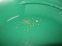
I dont have any pictures, but Ive gotten some decent gold there. Mostly fines and flakes with the occasional small picker.
I dont have any pictures, but Ive gotten some decent gold there. Mostly fines and flakes with the occasional small picker.
jog
Bronze Member
- Nov 28, 2008
- 1,364
- 682
- Detector(s) used
- Whites MXT / GMT
- Primary Interest:
- All Treasure Hunting
USTiger...
When are you going?
When you get to the spot where the lake turns into river you will go up a hill. After going back down to the river level there will be an area called Dogwood Recreation site on your right. Just up the Rd, ( could be half to a mile or more, don't remember how far)there will be Two camp sites on your right. They are right on the river and in some large trees. Just to the left of these camp sites between the river and the Rd, there is a large gravel bar from the 06 flood. Lots of large rocks and willow bushes to dig around( Water level permitting) i found some nice flakes there last year. Pretty big area. Good Luck!
jog
Bronze Member
- Nov 28, 2008
- 1,364
- 682
- Detector(s) used
- Whites MXT / GMT
- Primary Interest:
- All Treasure Hunting
Top Member Reactions
-
 3322
3322 -
 1927
1927 -
 1917
1917 -
 1201
1201 -
 1093
1093 -
 866
866 -
 820
820 -
 817
817 -
 810
810 -
 787
787 -
 775
775 -
 533
533 -
 499
499 -
 477
477 -
 425
425 -
 424
424 -
 419
419 -
E
417
-
 403
403 -
 395
395
Users who are viewing this thread
Total: 2 (members: 0, guests: 2)


